Ginza grid
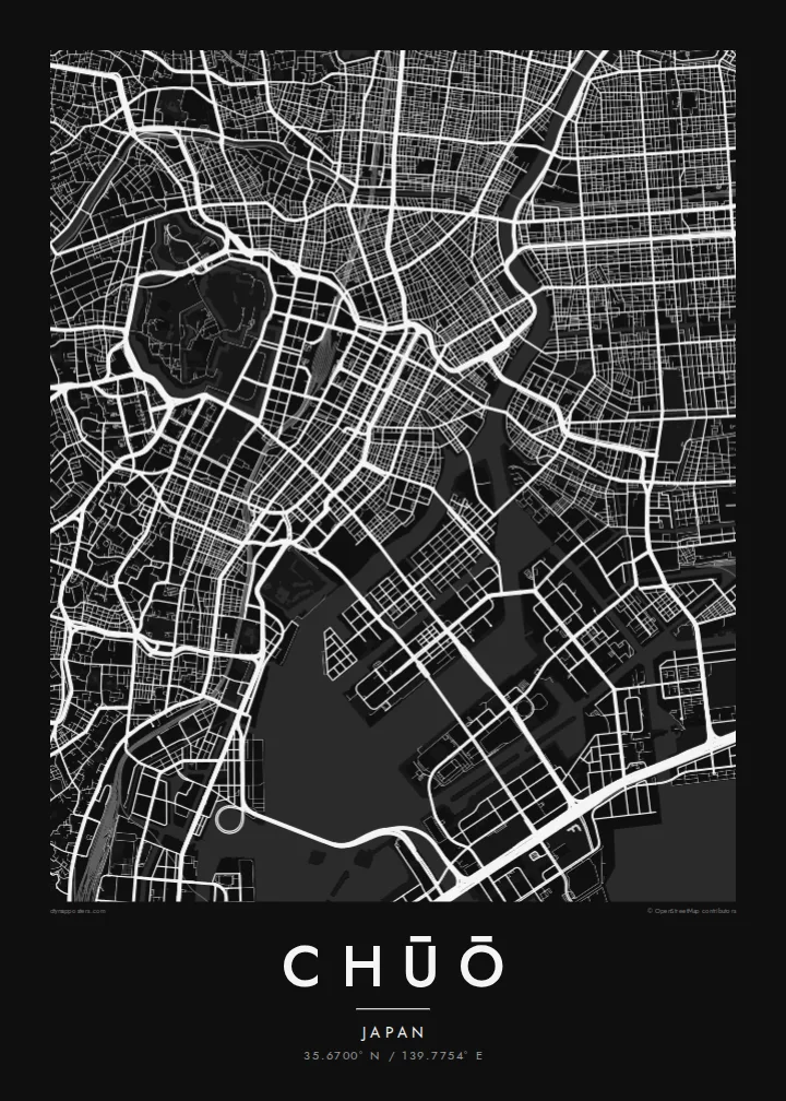
Ginza's regular blocks and main avenues form one of the most orderly street patterns in Tokyo. On the map it sits between former canal routes.
Qeeqabak kaartah poster · Japan
35.6700° N / 139.7754° E
Tokyo's historic commercial heart between the Imperial moats and the Sumida, extending onto reclaimed islands in the bay



Inki magaala, konoy gaba
Qande inkih tibbixeeh derre baguley table. Kulli qande missoowa caagid—daabbisimta, dirbaabu-le kaadu HD fayla akah.
 Cagalah pixels · 24 × 36″ daabbi fayla
Maxxaacah qeeqa
Tama usuk cagalah daabbi faylak 100% qambaala. Kulli poster — daabbisimta, dirbaabu-le kaadu download geytimta — ni-server-ittal 300 DPI-l ederimta, 7,200 × 10,800 pixels fanah, tokkel iyyi ellee catoy 24 × 36″ daabbi baxsi bahisak raaqu.
Gidarih


Kaarta
Chūō is one of Tokyo's central wards, lying between the area around the Imperial Palace and Tokyo Bay. It includes Nihonbashi, the old merchant district, and Ginza, famous for department stores and shopping. In the Edo period, the Nihonbashi bridge was the starting point of the main roads out of the city, and road distances in Japan are still measured from a marker there.
The ward's map is shaped by water. The Sumida River runs along its eastern side, and canals and old moats once surrounded the commercial districts. Some of these are now covered by expressways. To the southeast, the islands of Tsukishima, Kachidoki and Harumi were built on reclaimed land in the bay and are now filled with apartment towers.
A Chūō map poster shows the tight grid of Ginza and Nihonbashi, the wide Sumida, and the geometric outlines of the reclaimed islands. Few parts of Tokyo show so clearly how the city has grown out into the water. It makes a precise and detailed print for anyone who has worked, shopped or lived in the centre of Tokyo.
Ginza's regular blocks and main avenues form one of the most orderly street patterns in Tokyo. On the map it sits between former canal routes.
The old merchant district around the famous bridge, which served as the Edo-period starting point for the main roads leading out of the city.
Tsukishima, Kachidoki and Harumi extend into Tokyo Bay as angular blocks of reclaimed land, connected to the rest of the city by long bridges.
Kok tanim ab
Ayro, migaq hinnay kok tan xagar osis; gaba, ballaqa hinnay xiqa soorris.
Free preview qansarissi kee watermark-le. Daabbisimtaan kee HD fayla 300 DPI-l, 7,200 × 10,800 px fanah, watermark maleh ederimta.
Macah Chūō
For many people, Chūō is the part of Tokyo where they worked, stayed or walked on their first visit. The map puts Ginza, Nihonbashi and the Sumida together in one clear view.
You can personalise the title, subtitle and coordinates, for example with an office address or the year of a trip. Choose one of five styles: Classic black & white, Noir, Paper, Blueprint or Sand. Noir suits the dense grid especially well.
Chūō poster orme| Maxxaacah ballaqa | Qeeqa | Faylal |
|---|---|---|
| 30 × 40 cm (11.8 × 15.7″) | 3,543 × 4,724 px | PNG · PDF |
| 29.7 × 42 cm (A3, 11.7 × 16.5″) | 3,508 × 4,961 px | PNG · PDF |
| 42 × 59.4 cm (A2, 16.5 × 23.4″) | 4,961 × 7,016 px | PNG · PDF |
| 45.7 × 61 cm (18 × 24″) | 5,400 × 7,200 px | PNG · PDF |
| 50 × 70 cm (19.7 × 27.6″) | 5,906 × 8,268 px | PNG · PDF |
| 61 × 91.4 cm (24 × 36″) | 7,200 × 10,800 px | PNG · PDF |
Tabbaltah, limo-wayta xaqqa-le ablo 900 px ballaqa le, asta le, iskiriinih keh tan. HD faylal gexsoh inkih addal 8× fanah qeeqa le, poster ballaqa inkih addal meqeh maxxaacimta.
Baxxaqqa qari le qandiy dooriy, tohuk lakal Daabbisimtah Poster — kutuk kee, faxximek, dirbaabu — hinnay HD Digital Fayla dooru. Checkout inki wagitti geytima, kaadu ku-orme page keenih adissa akke waqdi caagoy kummite.
Usuk 200 gsm-le catam kutuk warqatal, lica katiy caagitte {printFrom}-ik hane ayta 30 × 40 cm-ik 24 × 36″ fanah, xaagu keenil warreeh.
Ee. Sarrah-le dirbaabu doori — bad, gudduc, oak-le hinnay bad-madabuy. Usuk finqisiimam ellee sange qarab-le kaadu qari umukku iyya keenih taagu. Dirbaabu-le poster {framedFrom}-ik hane, xaagu keenil warreeh.
Xaagu addunyal inkih cisab-le. Kulli poster 30+ ummattak ni-daabbi-mara mananih xayyoysa kaadu 3–7 caagu-ayróh fanah geeytima. Ku-orme kee xaagu tarikiy My Orders addal ablitta.
Geytimeek 14 ayróy addal foto naah rubbaay, cisab-le daabbisiynah hinnay ku-lacay gacisnaah.
Ee. Tama page-l edito addal, migaaq, subtitle kee coordinates sarrah faxxem fanah badal, kaadu qande kee katiy doori. Daabbisimtah, dirbaabu-le kaadu digital orme inkih ku-design cagalah yekkelen.
$9 bacisak 300 DPI PNG kee daabbisimtah adissime PDF fayla lica katiy inkih, watermark maleh, ayyi meki daabbisimtah geeytitta. Cisab makkoysemty ana? Awqak, watermark-le free preview download-eh.
Xayyo
