Cap de Creus
At the northern end is a knotted peninsula of bare rock, where the coastline splinters into tiny inlets around Cadaqués and Portlligat.
Qeeqabak kaartah poster · Spain
41.9254° N / 3.1496° E
A rocky, indented coast of coves and headlands running north from Blanes to the French border at Portbou


Inki magaala, konoy gaba
Qande inkih tibbixeeh derre baguley table. Kulli qande missoowa caagid—daabbisimta, dirbaabu-le kaadu HD fayla akah.
 Cagalah pixels · 24 × 36″ daabbi fayla
Maxxaacah qeeqa
Tama usuk cagalah daabbi faylak 100% qambaala. Kulli poster — daabbisimta, dirbaabu-le kaadu download geytimta — ni-server-ittal 300 DPI-l ederimta, 7,200 × 10,800 pixels fanah, tokkel iyyi ellee catoy 24 × 36″ daabbi baxsi bahisak raaqu.
Gidarih


Kaarta
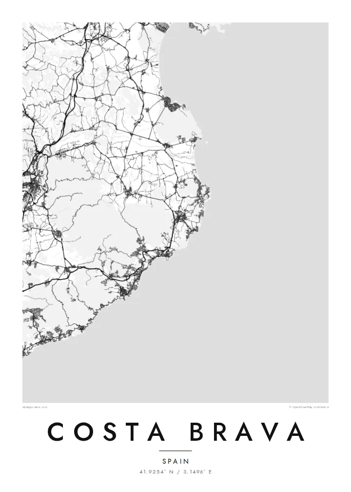
The Costa Brava is the coastline of the province of Girona in Catalonia, running from Blanes in the south to Portbou on the French border. The name means the rugged or wild coast, and it matches what the map shows: a shoreline broken into countless small coves and rocky points, with wider sandy bays, such as the Gulf of Roses, opening between the stretches of cliff.
At the northern end, the Cap de Creus peninsula is the easternmost point of the Iberian Peninsula. Salvador Dalí lived and worked in Portlligat, next to the whitewashed village of Cadaqués. Further south, Tossa de Mar keeps its medieval walled Vila Vella on a headland above the beach, one of the best-preserved fortified old towns on the Catalan coast.
A Costa Brava map poster covers the coast walked by the Camí de Ronda, an old patrol path that now links beaches and coves on foot. Between the resort towns, roads loop up and over the headlands. The wide Gulf of Roses interrupts the rocky shore with a long, gentle curve, backed by the flat wetlands of the Aiguamolls de l'Empordà.
At the northern end is a knotted peninsula of bare rock, where the coastline splinters into tiny inlets around Cadaqués and Portlligat.
A broad, smooth bay between Roses and L'Escala breaks the rocky rhythm of the coast, with the marina canals of Empuriabrava cut into the flat land behind it.
The Vila Vella sits on a small headland, and its enclosed lanes form a compact knot beside the newer, more regular streets of Tossa de Mar.
Kok tanim ab
Ayro, migaq hinnay kok tan xagar osis; gaba, ballaqa hinnay xiqa soorris.
Free preview qansarissi kee watermark-le. Daabbisimtaan kee HD fayla 300 DPI-l, 7,200 × 10,800 px fanah, watermark maleh ederimta.
Macah Costa Brava
For people who go back to the same cove every summer, or who walked the coast path from town to town, this map gives that memory a place on the wall. The title, subtitle and coordinates line can all be changed, so the poster can name a village, a house or a date.
Try Paper or Sand for a sun-warmed look, or Classic black & white, Noir and Blueprint for sharper contrast. The HD files cost $9 and include six print sizes, each as a 300 DPI PNG and a print-ready PDF without a watermark.
Costa Brava poster orme| Maxxaacah ballaqa | Qeeqa | Faylal |
|---|---|---|
| 30 × 40 cm11.8 × 15.7″ | 3,543 × 4,724 px | PNG · PDF |
| 29.7 × 42 cm (A3)11.7 × 16.5″ | 3,508 × 4,961 px | PNG · PDF |
| 42 × 59.4 cm (A2)16.5 × 23.4″ | 4,961 × 7,016 px | PNG · PDF |
| 45.7 × 61 cm18 × 24″ | 5,400 × 7,200 px | PNG · PDF |
| 50 × 70 cm19.7 × 27.6″ | 5,906 × 8,268 px | PNG · PDF |
| 61 × 91.4 cm24 × 36″ | 7,200 × 10,800 px | PNG · PDF |
Tabbaltah, limo-wayta xaqqa-le ablo 900 px ballaqa le, asta le, iskiriinih keh tan. HD faylal gexsoh inkih addal 8× fanah qeeqa le, poster ballaqa inkih addal meqeh maxxaacimta.
Baxxaqqa qari le qandiy dooriy, tohuk lakal Daabbisimtah Poster — kutuk kee, faxximek, dirbaabu — hinnay HD Digital Fayla dooru. Checkout inki wagitti geytima, kaadu ku-orme page keenih adissa akke waqdi caagoy kummite.
Usuk 200 gsm-le catam kutuk warqatal, lica katiy caagitte $39-ik hane ayta 30 × 40 cm-ik 24 × 36″ fanah, xaagu keenil warreeh.
Ee. Sarrah-le dirbaabu doori — bad, gudduc, oak-le hinnay bad-madabuy. Usuk finqisiimam ellee sange qarab-le kaadu qari umukku iyya keenih taagu. Dirbaabu-le poster $99-ik hane, xaagu keenil warreeh.
Dirsa 60+ baaxoh bilsa. Poster kasa 30+ baaxoh nel print kaadu yan kee dirgeh kaxxa kee tanah printa, kee 3–7 xaqu ayyaamah yaaxigeeh. Xaaloo kee tracking "Ac Order" gexsitam. Kaadu baaxo 2–5 isbuuc yaaxigeeh, nanu dirsi yanin baaxoh sajiitah site ku kalah tekkeh.
Geytimeek 14 ayróy addal foto naah rubbaay, cisab-le daabbisiynah hinnay ku-lacay gacisnaah.
Ee. Tama page-l edito addal, migaaq, subtitle kee coordinates sarrah faxxem fanah badal, kaadu qande kee katiy doori. Daabbisimtah, dirbaabu-le kaadu digital orme inkih ku-design cagalah yekkelen.
$9 bacisak 300 DPI PNG kee daabbisimtah adissime PDF fayla lica katiy inkih, watermark maleh, ayyi meki daabbisimtah geeytitta. Cisab makkoysemty ana? Awqak, watermark-le free preview download-eh.
