Hillside fortifications
The hills above the town hold the forts built after independence. On the poster the high ground behind the streets reads as a protective arc.
Qeeqabak kaartah poster · Haiti
19.2618° N / 72.5161° W
A compact inland town at the edge of the Artibonite plain, with its street grid pressed against a ring of forested hills



Inki magaala, konoy gaba
Qande inkih tibbixeeh derre baguley table. Kulli qande missoowa caagid—daabbisimta, dirbaabu-le kaadu HD fayla akah.
 Cagalah pixels · 24 × 36″ daabbi fayla
Maxxaacah qeeqa
Tama usuk cagalah daabbi faylak 100% qambaala. Kulli poster — daabbisimta, dirbaabu-le kaadu download geytimta — ni-server-ittal 300 DPI-l ederimta, 7,200 × 10,800 pixels fanah, tokkel iyyi ellee catoy 24 × 36″ daabbi baxsi bahisak raaqu.
Gidarih


Kaarta
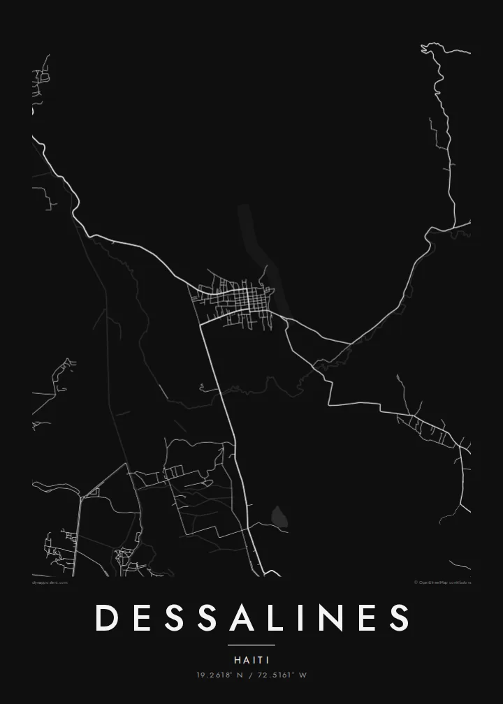
Dessalines sits where the flat, irrigated plain of the Artibonite starts to rise into the hills of central Haiti. From above, the town is a tight cluster of short blocks around a central core. Roads leave it in a few directions toward the lowland farms, and the higher ground to the east cuts the settlement off in a way you can see clearly.
The town carries the name of Jean-Jacques Dessalines, the leader of Haitian independence, who made it his seat in the first years after 1804. He had a series of forts built on the heights above it, meant as a defensive refuge inland. On a map, these strongpoints are part of the reason the town seems guarded by the terrain around it.
A Dessalines map poster shows this relationship between lowland and high ground in pure line work. You see the dense centre, the roads running out toward the rice fields of the Artibonite valley, and the blank, contoured space of the hills. It is a small place with a large place in the country's founding story, and the map keeps both of those things in view.
The hills above the town hold the forts built after independence. On the poster the high ground behind the streets reads as a protective arc.
West of the town the land flattens into the Artibonite valley, one of Haiti's main farming areas. There the road lines thin out and the landscape opens up.
The centre is a close weave of short streets. It gives the composition a dense focal point surrounded by open country.
Kok tanim ab
Ayro, migaq hinnay kok tan xagar osis; gaba, ballaqa hinnay xiqa soorris.
Free preview qansarissi kee watermark-le. Daabbisimtaan kee HD fayla 300 DPI-l, 7,200 × 10,800 px fanah, watermark maleh ederimta.
Macah Dessalines
For Haitian families and for anyone drawn to the country's history, Dessalines is a place of real symbolic weight. A quiet black-and-white map of it works as a reference to origins and independence without needing any imagery beyond the streets themselves.
You can personalise the title, subtitle and coordinates line, for example with a family name or a date that matters to you. Then choose from Classic black & white, Noir, Paper, Blueprint or Sand to suit the room where it will hang.
Dessalines poster orme| Maxxaacah ballaqa | Qeeqa | Faylal |
|---|---|---|
| 30 × 40 cm11.8 × 15.7″ | 3,543 × 4,724 px | PNG · PDF |
| 29.7 × 42 cm (A3)11.7 × 16.5″ | 3,508 × 4,961 px | PNG · PDF |
| 42 × 59.4 cm (A2)16.5 × 23.4″ | 4,961 × 7,016 px | PNG · PDF |
| 45.7 × 61 cm18 × 24″ | 5,400 × 7,200 px | PNG · PDF |
| 50 × 70 cm19.7 × 27.6″ | 5,906 × 8,268 px | PNG · PDF |
| 61 × 91.4 cm24 × 36″ | 7,200 × 10,800 px | PNG · PDF |
Tabbaltah, limo-wayta xaqqa-le ablo 900 px ballaqa le, asta le, iskiriinih keh tan. HD faylal gexsoh inkih addal 8× fanah qeeqa le, poster ballaqa inkih addal meqeh maxxaacimta.
Baxxaqqa qari le qandiy dooriy, tohuk lakal Daabbisimtah Poster — kutuk kee, faxximek, dirbaabu — hinnay HD Digital Fayla dooru. Checkout inki wagitti geytima, kaadu ku-orme page keenih adissa akke waqdi caagoy kummite.
Usuk 200 gsm-le catam kutuk warqatal, lica katiy caagitte $39-ik hane ayta 30 × 40 cm-ik 24 × 36″ fanah, xaagu keenil warreeh.
Ee. Sarrah-le dirbaabu doori — bad, gudduc, oak-le hinnay bad-madabuy. Usuk finqisiimam ellee sange qarab-le kaadu qari umukku iyya keenih taagu. Dirbaabu-le poster $99-ik hane, xaagu keenil warreeh.
Dirsa 60+ baaxoh bilsa. Poster kasa 30+ baaxoh nel print kaadu yan kee dirgeh kaxxa kee tanah printa, kee 3–7 xaqu ayyaamah yaaxigeeh. Xaaloo kee tracking "Ac Order" gexsitam. Kaadu baaxo 2–5 isbuuc yaaxigeeh, nanu dirsi yanin baaxoh sajiitah site ku kalah tekkeh.
Geytimeek 14 ayróy addal foto naah rubbaay, cisab-le daabbisiynah hinnay ku-lacay gacisnaah.
Ee. Tama page-l edito addal, migaaq, subtitle kee coordinates sarrah faxxem fanah badal, kaadu qande kee katiy doori. Daabbisimtah, dirbaabu-le kaadu digital orme inkih ku-design cagalah yekkelen.
$9 bacisak 300 DPI PNG kee daabbisimtah adissime PDF fayla lica katiy inkih, watermark maleh, ayyi meki daabbisimtah geeytitta. Cisab makkoysemty ana? Awqak, watermark-le free preview download-eh.
