The Düzce plain
A wide, nearly flat basin of farmland and orchards surrounds the city. On the map it appears as a calm field of small parcels and rural lanes, framing the urban centre from every side.
Qeeqabak kaartah poster · Türkiye
40.8389° N / 31.1639° E
A compact city on a broad, flat plain ringed by forested mountains, crossed by the main highway between Istanbul and Ankara.


Inki magaala, konoy gaba
Qande inkih tibbixeeh derre baguley table. Kulli qande missoowa caagid—daabbisimta, dirbaabu-le kaadu HD fayla akah.
 Cagalah pixels · 24 × 36″ daabbi fayla
Maxxaacah qeeqa
Tama usuk cagalah daabbi faylak 100% qambaala. Kulli poster — daabbisimta, dirbaabu-le kaadu download geytimta — ni-server-ittal 300 DPI-l ederimta, 7,200 × 10,800 pixels fanah, tokkel iyyi ellee catoy 24 × 36″ daabbi baxsi bahisak raaqu.
Gidarih


Kaarta
Düzce occupies the centre of a wide, level basin in north-western Turkey, a short distance inland from the Black Sea coast. From above, the city is a dense cluster of streets surrounded by an even patchwork of fields and hazelnut orchards, with wooded ridges closing in on every side. The flatness of the plain gives the map an unusual clarity, with roads radiating outward in long straight lines.
The city is inseparable from the earthquake of November 1999, which caused heavy damage and led to much of Düzce being rebuilt; the same year it became the capital of a new province. Today the O-4 motorway and the older D-100 highway run across the plain, carrying traffic between Istanbul and Ankara, and the university campus sits at the edge of town.
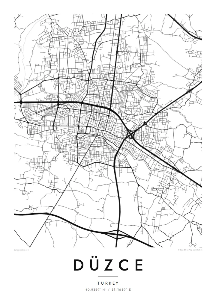
A Düzce map poster shows how a rebuilt city settled back into its landscape: newer blocks and wide avenues around an older core, the motorway sweeping along the plain, and streams draining the basin. In black and white, the contrast between the tight urban centre and the surrounding open land is particularly striking.
A wide, nearly flat basin of farmland and orchards surrounds the city. On the map it appears as a calm field of small parcels and rural lanes, framing the urban centre from every side.
The O-4 motorway and the D-100 highway cross the plain, drawn as long, confident lines. They are the reason Düzce has long been a stopping point between Turkey's two largest cities.
South-west of the city lies Efteni Lake, a shallow wetland known for its birdlife. It shows up on the map as an irregular pale shape set within the agricultural plain.
Kok tanim ab
Ayro, migaq hinnay kok tan xagar osis; gaba, ballaqa hinnay xiqa soorris.
Free preview qansarissi kee watermark-le. Daabbisimtaan kee HD fayla 300 DPI-l, 7,200 × 10,800 px fanah, watermark maleh ederimta.
Macah Düzce
Düzce carries a story of loss and recovery, and many residents mark their connection to it through the rebuilt city itself. A map is a quiet way to honour that, whether it hangs in a family home in the province or in a flat far from the Black Sea region.
Each poster can be personalised with a title, subtitle and coordinates line, perhaps a neighbourhood name or a meaningful date. Five styles are available: Classic black & white, Noir, Paper, Blueprint and Sand, each giving the plain and the surrounding hills a different mood.
Düzce poster orme| Maxxaacah ballaqa | Qeeqa | Faylal |
|---|---|---|
| 30 × 40 cm (11.8 × 15.7″) | 3,543 × 4,724 px | PNG · PDF |
| 29.7 × 42 cm (A3, 11.7 × 16.5″) | 3,508 × 4,961 px | PNG · PDF |
| 42 × 59.4 cm (A2, 16.5 × 23.4″) | 4,961 × 7,016 px | PNG · PDF |
| 45.7 × 61 cm (18 × 24″) | 5,400 × 7,200 px | PNG · PDF |
| 50 × 70 cm (19.7 × 27.6″) | 5,906 × 8,268 px | PNG · PDF |
| 61 × 91.4 cm (24 × 36″) | 7,200 × 10,800 px | PNG · PDF |
Tabbaltah, limo-wayta xaqqa-le ablo 900 px ballaqa le, asta le, iskiriinih keh tan. HD faylal gexsoh inkih addal 8× fanah qeeqa le, poster ballaqa inkih addal meqeh maxxaacimta.
Baxxaqqa qari le qandiy dooriy, tohuk lakal Daabbisimtah Poster — kutuk kee, faxximek, dirbaabu — hinnay HD Digital Fayla dooru. Checkout inki wagitti geytima, kaadu ku-orme page keenih adissa akke waqdi caagoy kummite.
Usuk 200 gsm-le catam kutuk warqatal, lica katiy caagitte {printFrom}-ik hane ayta 30 × 40 cm-ik 24 × 36″ fanah, xaagu keenil warreeh.
Ee. Sarrah-le dirbaabu doori — bad, gudduc, oak-le hinnay bad-madabuy. Usuk finqisiimam ellee sange qarab-le kaadu qari umukku iyya keenih taagu. Dirbaabu-le poster {framedFrom}-ik hane, xaagu keenil warreeh.
Xaagu addunyal inkih cisab-le. Kulli poster 30+ ummattak ni-daabbi-mara mananih xayyoysa kaadu 3–7 caagu-ayróh fanah geeytima. Ku-orme kee xaagu tarikiy My Orders addal ablitta.
Geytimeek 14 ayróy addal foto naah rubbaay, cisab-le daabbisiynah hinnay ku-lacay gacisnaah.
Ee. Tama page-l edito addal, migaaq, subtitle kee coordinates sarrah faxxem fanah badal, kaadu qande kee katiy doori. Daabbisimtah, dirbaabu-le kaadu digital orme inkih ku-design cagalah yekkelen.
$9 bacisak 300 DPI PNG kee daabbisimtah adissime PDF fayla lica katiy inkih, watermark maleh, ayyi meki daabbisimtah geeytitta. Cisab makkoysemty ana? Awqak, watermark-le free preview download-eh.
