Downtown street grid
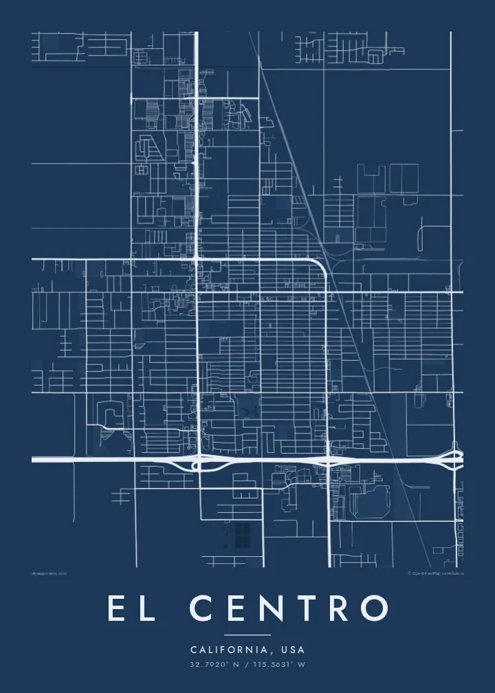
The centre of El Centro is a tidy grid of straight north–south and east–west streets, laid out on flat ground with no hills or rivers to bend it.
Qeeqabak kaartah poster · United States
32.7920° N / 115.5631° W
A desert grid below sea level, ringed by a patchwork of irrigated fields stretching toward the Mexican border



Inki magaala, konoy gaba
Qande inkih tibbixeeh derre baguley table. Kulli qande missoowa caagid—daabbisimta, dirbaabu-le kaadu HD fayla akah.
 Cagalah pixels · 24 × 36″ daabbi fayla
Maxxaacah qeeqa
Tama usuk cagalah daabbi faylak 100% qambaala. Kulli poster — daabbisimta, dirbaabu-le kaadu download geytimta — ni-server-ittal 300 DPI-l ederimta, 7,200 × 10,800 pixels fanah, tokkel iyyi ellee catoy 24 × 36″ daabbi baxsi bahisak raaqu.
Gidarih


Kaarta
El Centro lies in the Imperial Valley of southern California, a basin that sits below sea level and was turned from desert into farmland by irrigation. The city itself is laid out on a regular grid of straight streets, and the surrounding countryside repeats that logic at a larger scale, with square and rectangular fields divided by canals and section-line roads.
It is the seat of Imperial County and among the largest American cities located below sea level. Interstate 8 runs along its southern side on the way between San Diego and Arizona, and the border towns of Calexico and Mexicali lie a short drive to the south. The flat terrain means almost nothing interrupts the rectilinear pattern.
An El Centro map poster is an exercise in geometry. Streets meet at right angles, irrigation channels run in long straight lines, and the edges of town dissolve into a checkerboard of agricultural plots. In black and white this becomes almost abstract, a study in order and repetition that works well in modern, minimal interiors.
The centre of El Centro is a tidy grid of straight north–south and east–west streets, laid out on flat ground with no hills or rivers to bend it.
Beyond the city limits, farmland divided by canals and section-line roads forms a regular checkerboard that gives the outer edges of the map a strong graphic rhythm.
The interstate cuts across the south side of the city in a long, clean line, a clear horizontal anchor through the otherwise uniform grid.
Kok tanim ab
Ayro, migaq hinnay kok tan xagar osis; gaba, ballaqa hinnay xiqa soorris.
Free preview qansarissi kee watermark-le. Daabbisimtaan kee HD fayla 300 DPI-l, 7,200 × 10,800 px fanah, watermark maleh ederimta.
Macah El Centro
El Centro suits anyone who grew up in the Imperial Valley, served at the nearby naval air facility or simply likes the purity of a desert grid. The map reads as both a place and a pattern.
Personalise the title, subtitle and coordinates line and pick one of five styles: Classic black & white, Noir, Paper, Blueprint or Sand. Blueprint and Sand both suit the desert setting. Choose $9 HD files in six sizes or a printed poster shipped from a local partner.
El Centro poster orme| Maxxaacah ballaqa | Qeeqa | Faylal |
|---|---|---|
| 30 × 40 cm11.8 × 15.7″ | 3,543 × 4,724 px | PNG · PDF |
| 29.7 × 42 cm (A3)11.7 × 16.5″ | 3,508 × 4,961 px | PNG · PDF |
| 42 × 59.4 cm (A2)16.5 × 23.4″ | 4,961 × 7,016 px | PNG · PDF |
| 45.7 × 61 cm18 × 24″ | 5,400 × 7,200 px | PNG · PDF |
| 50 × 70 cm19.7 × 27.6″ | 5,906 × 8,268 px | PNG · PDF |
| 61 × 91.4 cm24 × 36″ | 7,200 × 10,800 px | PNG · PDF |
Tabbaltah, limo-wayta xaqqa-le ablo 900 px ballaqa le, asta le, iskiriinih keh tan. HD faylal gexsoh inkih addal 8× fanah qeeqa le, poster ballaqa inkih addal meqeh maxxaacimta.
Baxxaqqa qari le qandiy dooriy, tohuk lakal Daabbisimtah Poster — kutuk kee, faxximek, dirbaabu — hinnay HD Digital Fayla dooru. Checkout inki wagitti geytima, kaadu ku-orme page keenih adissa akke waqdi caagoy kummite.
Usuk 200 gsm-le catam kutuk warqatal, lica katiy caagitte $39-ik hane ayta 30 × 40 cm-ik 24 × 36″ fanah, xaagu keenil warreeh.
Ee. Sarrah-le dirbaabu doori — bad, gudduc, oak-le hinnay bad-madabuy. Usuk finqisiimam ellee sange qarab-le kaadu qari umukku iyya keenih taagu. Dirbaabu-le poster $99-ik hane, xaagu keenil warreeh.
Dirsa 60+ baaxoh bilsa. Poster kasa 30+ baaxoh nel print kaadu yan kee dirgeh kaxxa kee tanah printa, kee 3–7 xaqu ayyaamah yaaxigeeh. Xaaloo kee tracking "Ac Order" gexsitam. Kaadu baaxo 2–5 isbuuc yaaxigeeh, nanu dirsi yanin baaxoh sajiitah site ku kalah tekkeh.
Geytimeek 14 ayróy addal foto naah rubbaay, cisab-le daabbisiynah hinnay ku-lacay gacisnaah.
Ee. Tama page-l edito addal, migaaq, subtitle kee coordinates sarrah faxxem fanah badal, kaadu qande kee katiy doori. Daabbisimtah, dirbaabu-le kaadu digital orme inkih ku-design cagalah yekkelen.
$9 bacisak 300 DPI PNG kee daabbisimtah adissime PDF fayla lica katiy inkih, watermark maleh, ayyi meki daabbisimtah geeytitta. Cisab makkoysemty ana? Awqak, watermark-le free preview download-eh.
