The Arno bridges
A row of bridges crosses the river in close succession, with Ponte Vecchio in the middle. Together they stitch the historic centre to the Oltrarno across one clear line of water.
Qeeqabak kaartah poster · Italy
43.7792° N / 11.2463° E
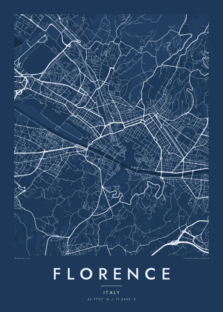
A Renaissance city spread along the Arno, its ring of avenues tracing the old walls and hills rising to the south



Inki magaala, konoy gaba
Qande inkih tibbixeeh derre baguley table. Kulli qande missoowa caagid—daabbisimta, dirbaabu-le kaadu HD fayla akah.
 Cagalah pixels · 24 × 36″ daabbi fayla
Maxxaacah qeeqa
Tama usuk cagalah daabbi faylak 100% qambaala. Kulli poster — daabbisimta, dirbaabu-le kaadu download geytimta — ni-server-ittal 300 DPI-l ederimta, 7,200 × 10,800 pixels fanah, tokkel iyyi ellee catoy 24 × 36″ daabbi baxsi bahisak raaqu.
Gidarih


Kaarta
The Arno crosses Florence from east to west in a gentle curve, and its bridges link the two halves of the city. Ponte Vecchio, lined with shops, is the best known. North of the river the dense historic centre is packed around the cathedral. The Oltrarno on the south bank is a quieter tangle of workshops and small squares leading up to the hills.
The Roman grid still shows near Piazza della Repubblica, where the streets meet at right angles. The city walls were largely taken down in the nineteenth century and replaced by the viali, a ring of broad tree-lined avenues. On the map they form a curving frame around the old centre.
A Florence map poster also shows the green shapes south of the river. The Boboli Gardens spread behind Palazzo Pitti, and the road climbs to Piazzale Michelangelo and San Miniato. From those slopes the whole city lies below, and the poster gives the same overhead view in ink.
A row of bridges crosses the river in close succession, with Ponte Vecchio in the middle. Together they stitch the historic centre to the Oltrarno across one clear line of water.
Wide avenues follow the route of the demolished medieval walls. Their curve clearly frames the old city and separates it from the later neighbourhoods outside.
A large formal garden behind Palazzo Pitti, with axial paths and terraces. It is one of the biggest open spaces on the map, sitting right against the dense Oltrarno streets.
Kok tanim ab
Ayro, migaq hinnay kok tan xagar osis; gaba, ballaqa hinnay xiqa soorris.
Free preview qansarissi kee watermark-le. Daabbisimtaan kee HD fayla 300 DPI-l, 7,200 × 10,800 px fanah, watermark maleh ederimta.
Macah Florence
Florence is where many people studied art, took their first trip abroad or got engaged overlooking the river. The map is quieter than a photograph, so it hangs well in a study, hallway or living room for many years.
Mark the date of the trip, the street of a rented flat or the name of a course in the title and subtitle, and set exact coordinates. Paper and Sand bring out the city's warm tones, and Noir makes the river stand out.
Florence poster orme| Maxxaacah ballaqa | Qeeqa | Faylal |
|---|---|---|
| 30 × 40 cm (11.8 × 15.7″) | 3,543 × 4,724 px | PNG · PDF |
| 29.7 × 42 cm (A3, 11.7 × 16.5″) | 3,508 × 4,961 px | PNG · PDF |
| 42 × 59.4 cm (A2, 16.5 × 23.4″) | 4,961 × 7,016 px | PNG · PDF |
| 45.7 × 61 cm (18 × 24″) | 5,400 × 7,200 px | PNG · PDF |
| 50 × 70 cm (19.7 × 27.6″) | 5,906 × 8,268 px | PNG · PDF |
| 61 × 91.4 cm (24 × 36″) | 7,200 × 10,800 px | PNG · PDF |
Tabbaltah, limo-wayta xaqqa-le ablo 900 px ballaqa le, asta le, iskiriinih keh tan. HD faylal gexsoh inkih addal 8× fanah qeeqa le, poster ballaqa inkih addal meqeh maxxaacimta.
Baxxaqqa qari le qandiy dooriy, tohuk lakal Daabbisimtah Poster — kutuk kee, faxximek, dirbaabu — hinnay HD Digital Fayla dooru. Checkout inki wagitti geytima, kaadu ku-orme page keenih adissa akke waqdi caagoy kummite.
Usuk 200 gsm-le catam kutuk warqatal, lica katiy caagitte {printFrom}-ik hane ayta 30 × 40 cm-ik 24 × 36″ fanah, xaagu keenil warreeh.
Ee. Sarrah-le dirbaabu doori — bad, gudduc, oak-le hinnay bad-madabuy. Usuk finqisiimam ellee sange qarab-le kaadu qari umukku iyya keenih taagu. Dirbaabu-le poster {framedFrom}-ik hane, xaagu keenil warreeh.
Shipping is free worldwide. Each poster is printed by the nearest of our print partners in 30+ countries and usually arrives in 3–7 business days. You can follow the status and tracking under My Orders. A few countries take 2–5 weeks, and where we don't ship yet, the site tells you before you pay.
Geytimeek 14 ayróy addal foto naah rubbaay, cisab-le daabbisiynah hinnay ku-lacay gacisnaah.
Ee. Tama page-l edito addal, migaaq, subtitle kee coordinates sarrah faxxem fanah badal, kaadu qande kee katiy doori. Daabbisimtah, dirbaabu-le kaadu digital orme inkih ku-design cagalah yekkelen.
$9 bacisak 300 DPI PNG kee daabbisimtah adissime PDF fayla lica katiy inkih, watermark maleh, ayyi meki daabbisimtah geeytitta. Cisab makkoysemty ana? Awqak, watermark-le free preview download-eh.
