Shared urban area
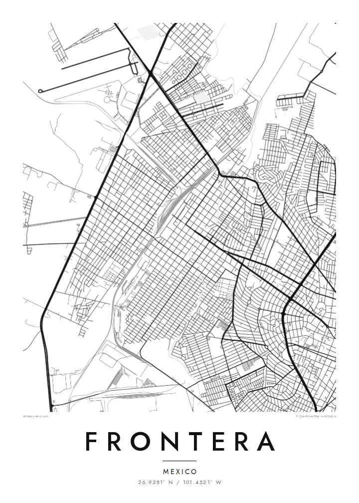
Frontera and Monclova have grown together into one continuous built-up area. On the map, the grid runs from one to the other without a visible break, so the two read as one city.
Qeeqabak kaartah poster · Mexico
26.9281° N / 101.4521° W
A desert-plain city grown into its neighbour Monclova, with river channels, rail lines and industrial blocks framed by bare sierras.


Inki magaala, konoy gaba
Qande inkih tibbixeeh derre baguley table. Kulli qande missoowa caagid—daabbisimta, dirbaabu-le kaadu HD fayla akah.
 Cagalah pixels · 24 × 36″ daabbi fayla
Maxxaacah qeeqa
Tama usuk cagalah daabbi faylak 100% qambaala. Kulli poster — daabbisimta, dirbaabu-le kaadu download geytimta — ni-server-ittal 300 DPI-l ederimta, 7,200 × 10,800 pixels fanah, tokkel iyyi ellee catoy 24 × 36″ daabbi baxsi bahisak raaqu.
Gidarih


Kaarta
Frontera sits on a broad, dry plain in central Coahuila, and from above it is hard to tell where it ends and Monclova begins. The two grew into one urban area, so the street grid runs straight across the municipal line. Long, straight avenues cut across smaller residential blocks. Pale mountain ridges rise on the horizon on almost every side.
Much of the map is shaped by work. Rail spurs, large industrial lots and wide roads for heavy traffic tie Frontera to the steel industry that defined the Monclova region in the twentieth century. Between them sit tight neighbourhoods of small parcels. On paper they look like fine texture set against the big, simple shapes of the plants and yards.
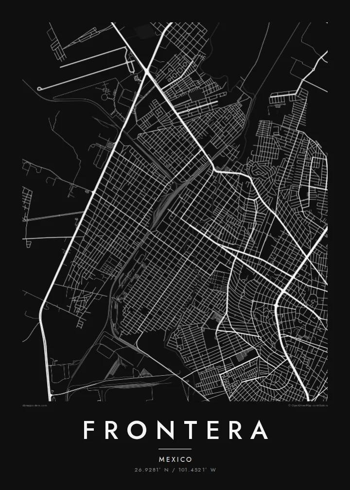
A Frontera map poster keeps this contrast clean: dense housing, large industrial footprints and the thin lines of the local watercourses, drawn in one weight of ink. Because the river channels are dry for much of the year, the city's shape comes mainly from roads and rails. That gives the poster a structured, almost diagrammatic look.
Frontera and Monclova have grown together into one continuous built-up area. On the map, the grid runs from one to the other without a visible break, so the two read as one city.
Large rectangular lots and rail spurs show the region's steel-making past. They form wide, calm shapes that sit apart from the fine grain of the residential streets around them.
Around the city, the lines thin out quickly into open ground. That emptiness is typical of Coahuila's dry plains, and it gives the street network a clear, sharp edge.
Kok tanim ab
Ayro, migaq hinnay kok tan xagar osis; gaba, ballaqa hinnay xiqa soorris.
Free preview qansarissi kee watermark-le. Daabbisimtaan kee HD fayla 300 DPI-l, 7,200 × 10,800 px fanah, watermark maleh ederimta.
Macah Frontera
For people from Frontera, this map shows home at the scale people actually live it: the avenue to work, the neighbourhood block, the edge where the city gives way to open land. It also suits anyone whose family history runs through northern Mexico's industrial towns.
You can set your own title, subtitle and coordinates line, for example a family name or a year you moved. Then pick Classic black & white, Noir, Paper, Blueprint or Sand. Blueprint suits the city's industrial geometry especially well.
Frontera poster orme| Maxxaacah ballaqa | Qeeqa | Faylal |
|---|---|---|
| 30 × 40 cm (11.8 × 15.7″) | 3,543 × 4,724 px | PNG · PDF |
| 29.7 × 42 cm (A3, 11.7 × 16.5″) | 3,508 × 4,961 px | PNG · PDF |
| 42 × 59.4 cm (A2, 16.5 × 23.4″) | 4,961 × 7,016 px | PNG · PDF |
| 45.7 × 61 cm (18 × 24″) | 5,400 × 7,200 px | PNG · PDF |
| 50 × 70 cm (19.7 × 27.6″) | 5,906 × 8,268 px | PNG · PDF |
| 61 × 91.4 cm (24 × 36″) | 7,200 × 10,800 px | PNG · PDF |
Tabbaltah, limo-wayta xaqqa-le ablo 900 px ballaqa le, asta le, iskiriinih keh tan. HD faylal gexsoh inkih addal 8× fanah qeeqa le, poster ballaqa inkih addal meqeh maxxaacimta.
Baxxaqqa qari le qandiy dooriy, tohuk lakal Daabbisimtah Poster — kutuk kee, faxximek, dirbaabu — hinnay HD Digital Fayla dooru. Checkout inki wagitti geytima, kaadu ku-orme page keenih adissa akke waqdi caagoy kummite.
Usuk 200 gsm-le catam kutuk warqatal, lica katiy caagitte {printFrom}-ik hane ayta 30 × 40 cm-ik 24 × 36″ fanah, xaagu keenil warreeh.
Ee. Sarrah-le dirbaabu doori — bad, gudduc, oak-le hinnay bad-madabuy. Usuk finqisiimam ellee sange qarab-le kaadu qari umukku iyya keenih taagu. Dirbaabu-le poster {framedFrom}-ik hane, xaagu keenil warreeh.
Xaagu addunyal inkih cisab-le. Kulli poster 30+ ummattak ni-daabbi-mara mananih xayyoysa kaadu 3–7 caagu-ayróh fanah geeytima. Ku-orme kee xaagu tarikiy My Orders addal ablitta.
Geytimeek 14 ayróy addal foto naah rubbaay, cisab-le daabbisiynah hinnay ku-lacay gacisnaah.
Ee. Tama page-l edito addal, migaaq, subtitle kee coordinates sarrah faxxem fanah badal, kaadu qande kee katiy doori. Daabbisimtah, dirbaabu-le kaadu digital orme inkih ku-design cagalah yekkelen.
$9 bacisak 300 DPI PNG kee daabbisimtah adissime PDF fayla lica katiy inkih, watermark maleh, ayyi meki daabbisimtah geeytitta. Cisab makkoysemty ana? Awqak, watermark-le free preview download-eh.
Xayyo
