The Muur climb
The cobbled road up the Oudenberg to its hilltop chapel is one of the best-known climbs in cycling, and it shows on the map as a winding street heading into green space.
Qeeqabak kaartah poster · Belgium
50.7734° N / 3.8822° E
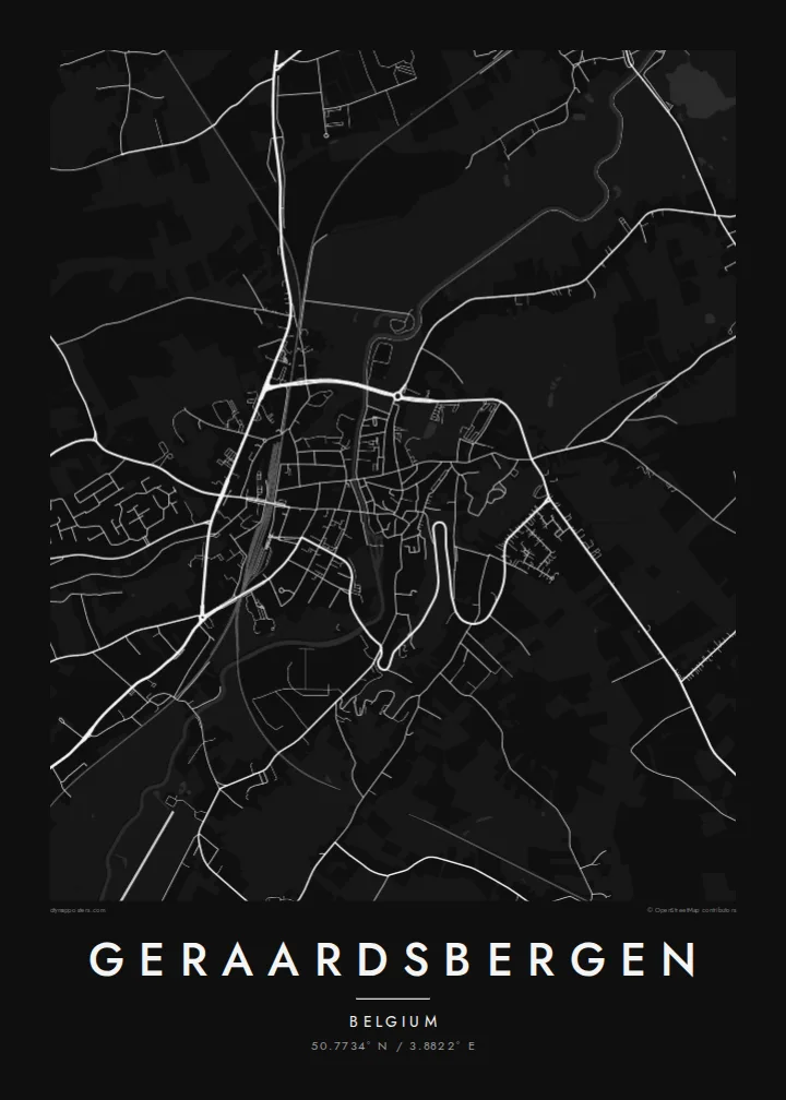
A Flemish town climbing from the Dender valley up the steep Oudenberg, with the famous cobbled Muur at its crown



Inki magaala, konoy gaba
Qande inkih tibbixeeh derre baguley table. Kulli qande missoowa caagid—daabbisimta, dirbaabu-le kaadu HD fayla akah.
 Cagalah pixels · 24 × 36″ daabbi fayla
Maxxaacah qeeqa
Tama usuk cagalah daabbi faylak 100% qambaala. Kulli poster — daabbisimta, dirbaabu-le kaadu download geytimta — ni-server-ittal 300 DPI-l ederimta, 7,200 × 10,800 pixels fanah, tokkel iyyi ellee catoy 24 × 36″ daabbi baxsi bahisak raaqu.
Gidarih


Kaarta
Geraardsbergen lies in the south of East Flanders, on the River Dender, and it is one of the few towns in Flanders with real relief. The old centre sits on the slope between the river and the Oudenberg hill, so its streets wind upward rather than following a grid, while the Dender and the railway run along the lower ground of the valley.
The town is well known to cycling fans for the Muur van Geraardsbergen, a steep cobbled climb up the Oudenberg to the chapel at the top, long associated with the Tour of Flanders. Geraardsbergen also claims its own Manneken Pis, said to be older than the one in Brussels, and is known for its mattentaart pastry.
A Geraardsbergen map poster reveals how the land shaped the town. Streets curve up the hillside toward the green summit of the Oudenberg, the market square sits at the centre of the old core, and the Dender marks the lower edge. It is a map with movement in it, suited to cyclists and to anyone with roots in the Flemish Ardennes.
The cobbled road up the Oudenberg to its hilltop chapel is one of the best-known climbs in cycling, and it shows on the map as a winding street heading into green space.
The Dender runs through the lower part of the town, defining the valley floor and providing a clear line beneath the streets rising up the slope.
The historic centre and market square sit on sloping ground, so streets bend and twist as they climb, creating a lively, organic pattern on the poster.
Kok tanim ab
Ayro, migaq hinnay kok tan xagar osis; gaba, ballaqa hinnay xiqa soorris.
Free preview qansarissi kee watermark-le. Daabbisimtaan kee HD fayla 300 DPI-l, 7,200 × 10,800 px fanah, watermark maleh ederimta.
Macah Geraardsbergen
Cyclists hang this map to remember riding or watching the Muur, while locals see the streets they walk every day, from the market square to the river. It combines sporting history and home in one frame.
Personalise the title, subtitle and coordinates line, perhaps with a race date or a family name, and choose Classic black and white, Noir, Paper, Blueprint or Sand.
Geraardsbergen poster orme| Maxxaacah ballaqa | Qeeqa | Faylal |
|---|---|---|
| 30 × 40 cm11.8 × 15.7″ | 3,543 × 4,724 px | PNG · PDF |
| 29.7 × 42 cm (A3)11.7 × 16.5″ | 3,508 × 4,961 px | PNG · PDF |
| 42 × 59.4 cm (A2)16.5 × 23.4″ | 4,961 × 7,016 px | PNG · PDF |
| 45.7 × 61 cm18 × 24″ | 5,400 × 7,200 px | PNG · PDF |
| 50 × 70 cm19.7 × 27.6″ | 5,906 × 8,268 px | PNG · PDF |
| 61 × 91.4 cm24 × 36″ | 7,200 × 10,800 px | PNG · PDF |
Tabbaltah, limo-wayta xaqqa-le ablo 900 px ballaqa le, asta le, iskiriinih keh tan. HD faylal gexsoh inkih addal 8× fanah qeeqa le, poster ballaqa inkih addal meqeh maxxaacimta.
Baxxaqqa qari le qandiy dooriy, tohuk lakal Daabbisimtah Poster — kutuk kee, faxximek, dirbaabu — hinnay HD Digital Fayla dooru. Checkout inki wagitti geytima, kaadu ku-orme page keenih adissa akke waqdi caagoy kummite.
Usuk 200 gsm-le catam kutuk warqatal, lica katiy caagitte $39-ik hane ayta 30 × 40 cm-ik 24 × 36″ fanah, xaagu keenil warreeh.
Ee. Sarrah-le dirbaabu doori — bad, gudduc, oak-le hinnay bad-madabuy. Usuk finqisiimam ellee sange qarab-le kaadu qari umukku iyya keenih taagu. Dirbaabu-le poster $99-ik hane, xaagu keenil warreeh.
Dirsa 60+ baaxoh bilsa. Poster kasa 30+ baaxoh nel print kaadu yan kee dirgeh kaxxa kee tanah printa, kee 3–7 xaqu ayyaamah yaaxigeeh. Xaaloo kee tracking "Ac Order" gexsitam. Kaadu baaxo 2–5 isbuuc yaaxigeeh, nanu dirsi yanin baaxoh sajiitah site ku kalah tekkeh.
Geytimeek 14 ayróy addal foto naah rubbaay, cisab-le daabbisiynah hinnay ku-lacay gacisnaah.
Ee. Tama page-l edito addal, migaaq, subtitle kee coordinates sarrah faxxem fanah badal, kaadu qande kee katiy doori. Daabbisimtah, dirbaabu-le kaadu digital orme inkih ku-design cagalah yekkelen.
$9 bacisak 300 DPI PNG kee daabbisimtah adissime PDF fayla lica katiy inkih, watermark maleh, ayyi meki daabbisimtah geeytitta. Cisab makkoysemty ana? Awqak, watermark-le free preview download-eh.
Xayyo
