Hagåtña waist
The capital sits where the island narrows, its compact streets pressed between the bay and a limestone ridge. It marks the natural midpoint of the composition and holds the clearest urban texture on the map.
Qeeqabak kaartah poster · United States
13.4502° N / 144.7876° E
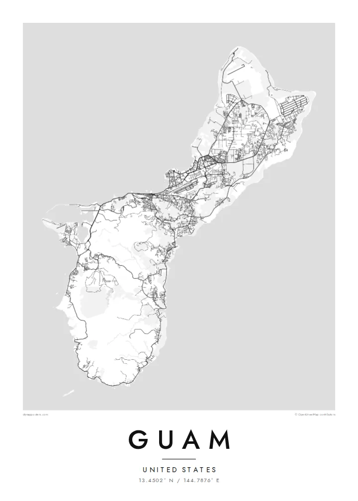
A long, pinched island with a flat limestone north, volcanic southern hills and a harbour carved into its western shore.


Inki magaala, konoy gaba
Qande inkih tibbixeeh derre baguley table. Kulli qande missoowa caagid—daabbisimta, dirbaabu-le kaadu HD fayla akah.
 Cagalah pixels · 24 × 36″ daabbi fayla
Maxxaacah qeeqa
Tama usuk cagalah daabbi faylak 100% qambaala. Kulli poster — daabbisimta, dirbaabu-le kaadu download geytimta — ni-server-ittal 300 DPI-l ederimta, 7,200 × 10,800 pixels fanah, tokkel iyyi ellee catoy 24 × 36″ daabbi baxsi bahisak raaqu.
Gidarih


Kaarta
Guam is the largest and southernmost of the Mariana Islands, a United States territory in the western Pacific. From above it reads as a narrow island about fifty kilometres long, drawn in at the middle where the capital, Hagåtña, sits on the western coast. North of that waist lies a raised limestone plateau with long straight roads and large cleared areas. To the south the land folds into ridges and river valleys.
On a Guam map poster the western shoreline carries most of the detail. Marine Corps Drive traces the coast past Tumon Bay, where hotels line a curved sandy beach, and continues south to Apra Harbor, a deep port sheltered by a breakwater and the Orote Peninsula. The eastern side faces the open ocean and is quieter on paper, with scattered villages and fewer roads between the cliffs and the reef.
Chamorro people settled the island thousands of years before European contact, and village names across the map still reflect that heritage. Not far offshore lies the Mariana Trench, whose Challenger Deep is the deepest known point of the ocean floor, though a poster shows only the reef edge and the coast. What remains is a clear portrait of a small island shaped by both volcanic rock and coral.
The capital sits where the island narrows, its compact streets pressed between the bay and a limestone ridge. It marks the natural midpoint of the composition and holds the clearest urban texture on the map.
A wide, sheltered anchorage on the west coast, framed by the Orote Peninsula and a long breakwater. Its hard-edged piers and basins give the southern half of the poster a strong graphic anchor.
Above the waist, the land becomes a flat limestone table crossed by long straight roads and the broad rectangles of airfields, a far more geometric pattern than the winding valleys of the south.
Kok tanim ab
Ayro, migaq hinnay kok tan xagar osis; gaba, ballaqa hinnay xiqa soorris.
Free preview qansarissi kee watermark-le. Daabbisimtaan kee HD fayla 300 DPI-l, 7,200 × 10,800 px fanah, watermark maleh ederimta.
Macah Guam
A Guam poster suits people who were stationed on the island, grew up in one of its villages or spent time along Tumon Bay. The outline is compact enough to show whole, so the print works as a complete portrait of the island rather than a cropped fragment of it.
You can change the title, add a subtitle such as a family name or a date, and edit the coordinates line. Choose from five styles, Classic black & white, Noir, Paper, Blueprint or Sand, then take the $9 HD files in six sizes or order a matte print, framed if you prefer.
Guam poster orme| Maxxaacah ballaqa | Qeeqa | Faylal |
|---|---|---|
| 30 × 40 cm (11.8 × 15.7″) | 3,543 × 4,724 px | PNG · PDF |
| 29.7 × 42 cm (A3, 11.7 × 16.5″) | 3,508 × 4,961 px | PNG · PDF |
| 42 × 59.4 cm (A2, 16.5 × 23.4″) | 4,961 × 7,016 px | PNG · PDF |
| 45.7 × 61 cm (18 × 24″) | 5,400 × 7,200 px | PNG · PDF |
| 50 × 70 cm (19.7 × 27.6″) | 5,906 × 8,268 px | PNG · PDF |
| 61 × 91.4 cm (24 × 36″) | 7,200 × 10,800 px | PNG · PDF |
Tabbaltah, limo-wayta xaqqa-le ablo 900 px ballaqa le, asta le, iskiriinih keh tan. HD faylal gexsoh inkih addal 8× fanah qeeqa le, poster ballaqa inkih addal meqeh maxxaacimta.
Baxxaqqa qari le qandiy dooriy, tohuk lakal Daabbisimtah Poster — kutuk kee, faxximek, dirbaabu — hinnay HD Digital Fayla dooru. Checkout inki wagitti geytima, kaadu ku-orme page keenih adissa akke waqdi caagoy kummite.
Usuk 200 gsm-le catam kutuk warqatal, lica katiy caagitte {printFrom}-ik hane ayta 30 × 40 cm-ik 24 × 36″ fanah, xaagu keenil warreeh.
Ee. Sarrah-le dirbaabu doori — bad, gudduc, oak-le hinnay bad-madabuy. Usuk finqisiimam ellee sange qarab-le kaadu qari umukku iyya keenih taagu. Dirbaabu-le poster {framedFrom}-ik hane, xaagu keenil warreeh.
Shipping is free worldwide. Each poster is printed by the nearest of our print partners in 30+ countries and usually arrives in 3–7 business days. You can follow the status and tracking under My Orders. A few countries take 2–5 weeks, and where we don't ship yet, the site tells you before you pay.
Geytimeek 14 ayróy addal foto naah rubbaay, cisab-le daabbisiynah hinnay ku-lacay gacisnaah.
Ee. Tama page-l edito addal, migaaq, subtitle kee coordinates sarrah faxxem fanah badal, kaadu qande kee katiy doori. Daabbisimtah, dirbaabu-le kaadu digital orme inkih ku-design cagalah yekkelen.
$9 bacisak 300 DPI PNG kee daabbisimtah adissime PDF fayla lica katiy inkih, watermark maleh, ayyi meki daabbisimtah geeytitta. Cisab makkoysemty ana? Awqak, watermark-le free preview download-eh.
