Ridge-following roads
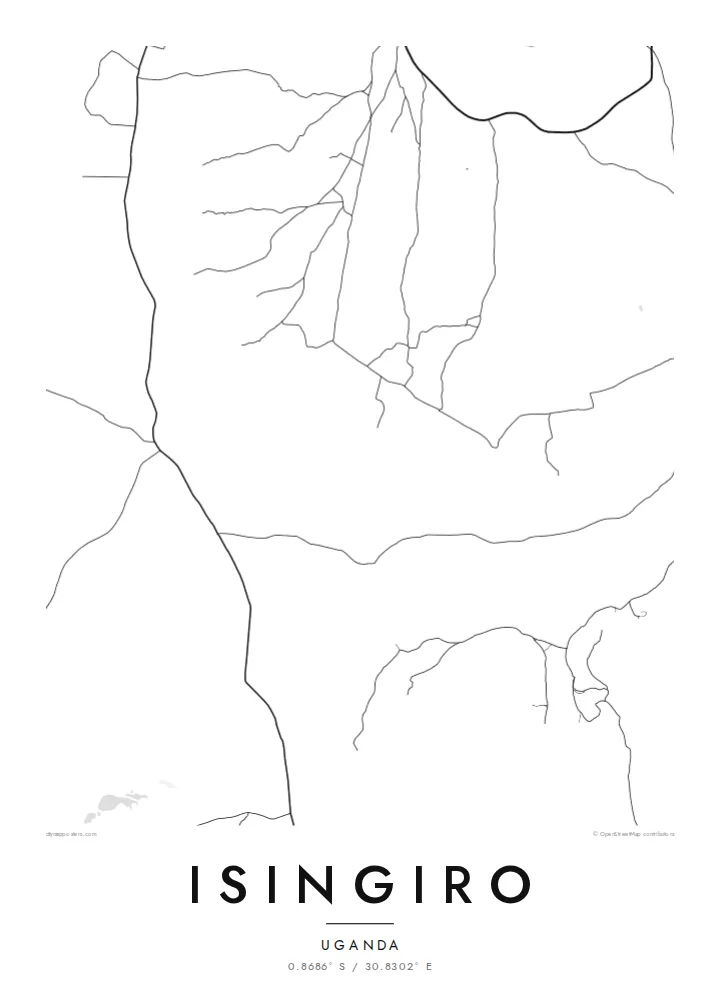
The main routes trace the higher ground and curve with the terrain, so the network looks organic, almost hand-drawn, rather than laid out on a drafting table.
Qeeqabak kaartah poster · Uganda
0.8686° S / 30.8302° E
A hill-country town in south-western Uganda, where winding roads follow ridges and valleys of banana farmland.


Inki magaala, konoy gaba
Qande inkih tibbixeeh derre baguley table. Kulli qande missoowa caagid—daabbisimta, dirbaabu-le kaadu HD fayla akah.
 Cagalah pixels · 24 × 36″ daabbi fayla
Maxxaacah qeeqa
Tama usuk cagalah daabbi faylak 100% qambaala. Kulli poster — daabbisimta, dirbaabu-le kaadu download geytimta — ni-server-ittal 300 DPI-l ederimta, 7,200 × 10,800 pixels fanah, tokkel iyyi ellee catoy 24 × 36″ daabbi baxsi bahisak raaqu.
Gidarih


Kaarta
Isingiro sits in the rolling uplands of Uganda's Western Region, south-east of Mbarara and within reach of the border with Tanzania. From above, the town reads as a loose cluster of streets gathered along a main road, with smaller tracks branching off toward farms and homesteads. There is no rigid grid here. The pattern follows the land, bending around slopes and settling into the gentler ground between them.
The surrounding district is known for its banana plantations, and matooke grown here travels to markets across the country. On a map, that farming character shows up as a wide, quiet field of scattered lanes rather than dense urban blocks. Isingiro District is also home to Nakivale, one of the oldest refugee settlements in Africa, a reminder that this rural area has long played a larger role than its size suggests.
An Isingiro map poster captures that restraint well. The thin lines of the roads, the open spaces between them and the way the town fades gradually into countryside make for a composition that feels spacious and calm. It records a highland place drawn without decoration, where the geography does the talking and every curve in the road has a reason behind it.
The main routes trace the higher ground and curve with the terrain, so the network looks organic, almost hand-drawn, rather than laid out on a drafting table.
Beyond the centre, narrow tracks spread out toward plantations and homesteads, producing a fine, scattered texture that fills the outer edges of the frame.
The town lies in the far south of the Western Region, not far from the Tanzanian frontier, in a landscape of low hills and broad, cultivated valleys.
Kok tanim ab
Ayro, migaq hinnay kok tan xagar osis; gaba, ballaqa hinnay xiqa soorris.
Free preview qansarissi kee watermark-le. Daabbisimtaan kee HD fayla 300 DPI-l, 7,200 × 10,800 px fanah, watermark maleh ederimta.
Macah Isingiro
For people with roots in Isingiro, or who have worked or volunteered in the district, this map keeps a specific corner of Uganda close. It suits a hallway or study where something personal but understated belongs, a line drawing rather than a photograph.
You can add your own title, a subtitle such as a family name or a date, and a coordinates line. Choose from five styles, Classic black & white, Noir, Paper, Blueprint or Sand, then download the HD files or order a printed poster.
Isingiro poster orme| Maxxaacah ballaqa | Qeeqa | Faylal |
|---|---|---|
| 30 × 40 cm (11.8 × 15.7″) | 3,543 × 4,724 px | PNG · PDF |
| 29.7 × 42 cm (A3, 11.7 × 16.5″) | 3,508 × 4,961 px | PNG · PDF |
| 42 × 59.4 cm (A2, 16.5 × 23.4″) | 4,961 × 7,016 px | PNG · PDF |
| 45.7 × 61 cm (18 × 24″) | 5,400 × 7,200 px | PNG · PDF |
| 50 × 70 cm (19.7 × 27.6″) | 5,906 × 8,268 px | PNG · PDF |
| 61 × 91.4 cm (24 × 36″) | 7,200 × 10,800 px | PNG · PDF |
Tabbaltah, limo-wayta xaqqa-le ablo 900 px ballaqa le, asta le, iskiriinih keh tan. HD faylal gexsoh inkih addal 8× fanah qeeqa le, poster ballaqa inkih addal meqeh maxxaacimta.
Baxxaqqa qari le qandiy dooriy, tohuk lakal Daabbisimtah Poster — kutuk kee, faxximek, dirbaabu — hinnay HD Digital Fayla dooru. Checkout inki wagitti geytima, kaadu ku-orme page keenih adissa akke waqdi caagoy kummite.
Usuk 200 gsm-le catam kutuk warqatal, lica katiy caagitte {printFrom}-ik hane ayta 30 × 40 cm-ik 24 × 36″ fanah, xaagu keenil warreeh.
Ee. Sarrah-le dirbaabu doori — bad, gudduc, oak-le hinnay bad-madabuy. Usuk finqisiimam ellee sange qarab-le kaadu qari umukku iyya keenih taagu. Dirbaabu-le poster {framedFrom}-ik hane, xaagu keenil warreeh.
Xaagu addunyal inkih cisab-le. Kulli poster 30+ ummattak ni-daabbi-mara mananih xayyoysa kaadu 3–7 caagu-ayróh fanah geeytima. Ku-orme kee xaagu tarikiy My Orders addal ablitta.
Geytimeek 14 ayróy addal foto naah rubbaay, cisab-le daabbisiynah hinnay ku-lacay gacisnaah.
Ee. Tama page-l edito addal, migaaq, subtitle kee coordinates sarrah faxxem fanah badal, kaadu qande kee katiy doori. Daabbisimtah, dirbaabu-le kaadu digital orme inkih ku-design cagalah yekkelen.
$9 bacisak 300 DPI PNG kee daabbisimtah adissime PDF fayla lica katiy inkih, watermark maleh, ayyi meki daabbisimtah geeytitta. Cisab makkoysemty ana? Awqak, watermark-le free preview download-eh.
Xayyo
