The ridge line
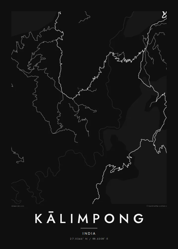
The core of the town follows a single hilltop spine, so the densest grid of streets forms a long, slightly bent band rather than a round centre.
Qeeqabak kaartah poster · India
27.0346° N / 88.6308° E
A ridge-top town strung along a saddle between two hills, with roads looping down toward the Teesta valley far below



Inki magaala, konoy gaba
Qande inkih tibbixeeh derre baguley table. Kulli qande missoowa caagid—daabbisimta, dirbaabu-le kaadu HD fayla akah.
 Cagalah pixels · 24 × 36″ daabbi fayla
Maxxaacah qeeqa
Tama usuk cagalah daabbi faylak 100% qambaala. Kulli poster — daabbisimta, dirbaabu-le kaadu download geytimta — ni-server-ittal 300 DPI-l ederimta, 7,200 × 10,800 pixels fanah, tokkel iyyi ellee catoy 24 × 36″ daabbi baxsi bahisak raaqu.
Gidarih


Kaarta
Kālimpong sits on a long ridge in the eastern Himalayan foothills of West Bengal, and from above the town reads as a narrow band of streets following the spine of the hill. Houses and lanes spill down both flanks, and the roads leave the ridge in tight hairpins, tracing the contour lines rather than cutting across them.
Below the town the land falls steeply toward the Teesta River, which makes a pale, curving line through the valley floor. On a Kālimpong map poster, that drop is felt in the way the street pattern thins out and breaks into scattered threads. The dense centre gives way to isolated roads that feel their way across the slopes.
For much of its history Kālimpong was a trading post on the route between India and Tibet, where wool and other goods changed hands. Today it is also known for its plant nurseries and its schools, several founded in the colonial era. The map carries little of this directly, but the ridge that made it a crossroads is plain to see.
The core of the town follows a single hilltop spine, so the densest grid of streets forms a long, slightly bent band rather than a round centre.
Roads leaving the ridge fold back on themselves again and again, drawing zigzag patterns that make the steepness of the terrain readable even without shading.
The river runs through the deep valley below the town, a curving line that anchors the lower edge of a wider frame and sets the scale of the hills.
Kok tanim ab
Ayro, migaq hinnay kok tan xagar osis; gaba, ballaqa hinnay xiqa soorris.
Free preview qansarissi kee watermark-le. Daabbisimtaan kee HD fayla 300 DPI-l, 7,200 × 10,800 px fanah, watermark maleh ederimta.
Macah Kālimpong
Kālimpong is a place people often carry with them after leaving, whether they studied in one of its schools, grew up on its slopes or passed through on the way to the mountains. A map of the ridge is a quiet way to keep that altitude on a wall at home.
The poster can be personalised with your own title, subtitle and coordinates line, for example a family name and the year you arrived. Choose from five styles, Classic black & white, Noir, Paper, Blueprint or Sand, and order a $9 HD download or a printed poster.
Kālimpong poster orme| Maxxaacah ballaqa | Qeeqa | Faylal |
|---|---|---|
| 30 × 40 cm11.8 × 15.7″ | 3,543 × 4,724 px | PNG · PDF |
| 29.7 × 42 cm (A3)11.7 × 16.5″ | 3,508 × 4,961 px | PNG · PDF |
| 42 × 59.4 cm (A2)16.5 × 23.4″ | 4,961 × 7,016 px | PNG · PDF |
| 45.7 × 61 cm18 × 24″ | 5,400 × 7,200 px | PNG · PDF |
| 50 × 70 cm19.7 × 27.6″ | 5,906 × 8,268 px | PNG · PDF |
| 61 × 91.4 cm24 × 36″ | 7,200 × 10,800 px | PNG · PDF |
Tabbaltah, limo-wayta xaqqa-le ablo 900 px ballaqa le, asta le, iskiriinih keh tan. HD faylal gexsoh inkih addal 8× fanah qeeqa le, poster ballaqa inkih addal meqeh maxxaacimta.
Baxxaqqa qari le qandiy dooriy, tohuk lakal Daabbisimtah Poster — kutuk kee, faxximek, dirbaabu — hinnay HD Digital Fayla dooru. Checkout inki wagitti geytima, kaadu ku-orme page keenih adissa akke waqdi caagoy kummite.
Usuk 200 gsm-le catam kutuk warqatal, lica katiy caagitte $39-ik hane ayta 30 × 40 cm-ik 24 × 36″ fanah, xaagu keenil warreeh.
Ee. Sarrah-le dirbaabu doori — bad, gudduc, oak-le hinnay bad-madabuy. Usuk finqisiimam ellee sange qarab-le kaadu qari umukku iyya keenih taagu. Dirbaabu-le poster $99-ik hane, xaagu keenil warreeh.
Dirsa 60+ baaxoh bilsa. Poster kasa 30+ baaxoh nel print kaadu yan kee dirgeh kaxxa kee tanah printa, kee 3–7 xaqu ayyaamah yaaxigeeh. Xaaloo kee tracking "Ac Order" gexsitam. Kaadu baaxo 2–5 isbuuc yaaxigeeh, nanu dirsi yanin baaxoh sajiitah site ku kalah tekkeh.
Geytimeek 14 ayróy addal foto naah rubbaay, cisab-le daabbisiynah hinnay ku-lacay gacisnaah.
Ee. Tama page-l edito addal, migaaq, subtitle kee coordinates sarrah faxxem fanah badal, kaadu qande kee katiy doori. Daabbisimtah, dirbaabu-le kaadu digital orme inkih ku-design cagalah yekkelen.
$9 bacisak 300 DPI PNG kee daabbisimtah adissime PDF fayla lica katiy inkih, watermark maleh, ayyi meki daabbisimtah geeytitta. Cisab makkoysemty ana? Awqak, watermark-le free preview download-eh.
Xayyo
