Coastal road
A road follows the shoreline around much of the island, drawing a near-continuous line just inside the coast that emphasises the island's rounded outline.
Qeeqabak kaartah poster · Iran
26.5578° N / 54.0194° E
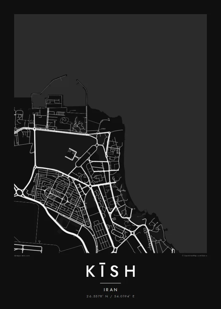
A rounded coral island in the Persian Gulf, traced by a coastal road, with planned streets across its flat interior.



Inki magaala, konoy gaba
Qande inkih tibbixeeh derre baguley table. Kulli qande missoowa caagid—daabbisimta, dirbaabu-le kaadu HD fayla akah.
 Cagalah pixels · 24 × 36″ daabbi fayla
Maxxaacah qeeqa
Tama usuk cagalah daabbi faylak 100% qambaala. Kulli poster — daabbisimta, dirbaabu-le kaadu download geytimta — ni-server-ittal 300 DPI-l ederimta, 7,200 × 10,800 pixels fanah, tokkel iyyi ellee catoy 24 × 36″ daabbi baxsi bahisak raaqu.
Gidarih


Kaarta
Kīsh is an island off the southern coast of Iran, in the Persian Gulf, and on a map it appears as a compact, rounded shape surrounded entirely by water. The land is low and flat, edged with coral reefs and beaches. A road runs close to the shore around much of the island. Most of the development, including hotels, shopping centres and residential districts, is concentrated in the northeast.
For several decades Kīsh has been a free trade zone, and much of its street plan is modern and planned, with broad boulevards, roundabouts and large landscaped plots. Two sights appear on almost every visitor's list. One is the Greek Ship, a cargo vessel stranded off the southwestern coast in 1966. The other is the old city of Harireh, whose excavated ruins lie in the north of the island.
A Kīsh map poster is one of the simplest and most graphic compositions possible: a single island, the sea around it and the fine pattern of roads inside. With generous water on every side of the frame, the outline itself becomes the image, and the coastal road traces the island like a drawn border.
A road follows the shoreline around much of the island, drawing a near-continuous line just inside the coast that emphasises the island's rounded outline.
On the southwestern shore, the wreck of a cargo ship that ran aground in 1966 has become the island's best-known sight and a favourite place to watch the sunset.
In the northeast, broad boulevards, roundabouts and large plots for hotels and malls form a spacious, modern street plan quite unlike that of older Iranian towns.
Kok tanim ab
Ayro, migaq hinnay kok tan xagar osis; gaba, ballaqa hinnay xiqa soorris.
Free preview qansarissi kee watermark-le. Daabbisimtaan kee HD fayla 300 DPI-l, 7,200 × 10,800 px fanah, watermark maleh ederimta.
Macah Kīsh
Many people know Kīsh from a holiday, a honeymoon or a business trip, and its island outline makes a memorable wall piece. Put your names and the dates of the trip in the title and subtitle, or keep the island's name and coordinates for a clean, geographic look.
In Blueprint and Noir the sea reads as a deep field around the island, while Sand gives it a sunlit, coastal feel. Classic black & white and Paper complete the five styles. The $9 download includes six sizes, and printed posters on matte paper ship from partners in more than 30 countries.
Kīsh poster orme| Maxxaacah ballaqa | Qeeqa | Faylal |
|---|---|---|
| 30 × 40 cm (11.8 × 15.7″) | 3,543 × 4,724 px | PNG · PDF |
| 29.7 × 42 cm (A3, 11.7 × 16.5″) | 3,508 × 4,961 px | PNG · PDF |
| 42 × 59.4 cm (A2, 16.5 × 23.4″) | 4,961 × 7,016 px | PNG · PDF |
| 45.7 × 61 cm (18 × 24″) | 5,400 × 7,200 px | PNG · PDF |
| 50 × 70 cm (19.7 × 27.6″) | 5,906 × 8,268 px | PNG · PDF |
| 61 × 91.4 cm (24 × 36″) | 7,200 × 10,800 px | PNG · PDF |
Tabbaltah, limo-wayta xaqqa-le ablo 900 px ballaqa le, asta le, iskiriinih keh tan. HD faylal gexsoh inkih addal 8× fanah qeeqa le, poster ballaqa inkih addal meqeh maxxaacimta.
Baxxaqqa qari le qandiy dooriy, tohuk lakal Daabbisimtah Poster — kutuk kee, faxximek, dirbaabu — hinnay HD Digital Fayla dooru. Checkout inki wagitti geytima, kaadu ku-orme page keenih adissa akke waqdi caagoy kummite.
Usuk 200 gsm-le catam kutuk warqatal, lica katiy caagitte $39-ik hane ayta 30 × 40 cm-ik 24 × 36″ fanah, xaagu keenil warreeh.
Ee. Sarrah-le dirbaabu doori — bad, gudduc, oak-le hinnay bad-madabuy. Usuk finqisiimam ellee sange qarab-le kaadu qari umukku iyya keenih taagu. Dirbaabu-le poster $99-ik hane, xaagu keenil warreeh.
Shipping is free worldwide. Each poster is printed by the nearest of our print partners in 30+ countries and usually arrives in 3–7 business days. You can follow the status and tracking under My Orders. A few countries take 2–5 weeks, and where we don't ship yet, the site tells you before you pay.
Geytimeek 14 ayróy addal foto naah rubbaay, cisab-le daabbisiynah hinnay ku-lacay gacisnaah.
Ee. Tama page-l edito addal, migaaq, subtitle kee coordinates sarrah faxxem fanah badal, kaadu qande kee katiy doori. Daabbisimtah, dirbaabu-le kaadu digital orme inkih ku-design cagalah yekkelen.
$9 bacisak 300 DPI PNG kee daabbisimtah adissime PDF fayla lica katiy inkih, watermark maleh, ayyi meki daabbisimtah geeytitta. Cisab makkoysemty ana? Awqak, watermark-le free preview download-eh.
