Port Island
A large artificial island south of the city centre, laid out in regular blocks and linked by bridge. Its straight edges contrast with the natural shoreline.
Qeeqabak kaartah poster · Japan
34.6913° N / 135.1830° E
A slim port city pressed between the Rokkō mountains and Osaka Bay, with two artificial islands offshore.


Inki magaala, konoy gaba
Qande inkih tibbixeeh derre baguley table. Kulli qande missoowa caagid—daabbisimta, dirbaabu-le kaadu HD fayla akah.
 Cagalah pixels · 24 × 36″ daabbi fayla
Maxxaacah qeeqa
Tama usuk cagalah daabbi faylak 100% qambaala. Kulli poster — daabbisimta, dirbaabu-le kaadu download geytimta — ni-server-ittal 300 DPI-l ederimta, 7,200 × 10,800 pixels fanah, tokkel iyyi ellee catoy 24 × 36″ daabbi baxsi bahisak raaqu.
Gidarih


Kaarta
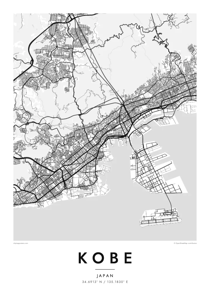
Kobe is a city of limited width. The Rokkō range rises steeply just behind the centre, so the streets are squeezed into a long band along the shore of Osaka Bay. Railway lines, expressways and main roads all run parallel to the water, while shorter streets climb north toward the slopes, giving the map a clear east–west grain.
The port has long been central to the city's identity. Port Island and Rokkō Island, two large reclaimed islands, extend into the bay as rectangular shapes connected by bridges. Much of the city was rebuilt after the 1995 Great Hanshin earthquake, and on its western edge the Akashi Kaikyō Bridge links Kobe to Awaji Island across the strait.
A Kobe map poster captures a rare composition: dense blocks along a strip of coast, the mountains as a quiet empty space above, and the crisp geometry of the islands below. The Kitano district, with its old foreign merchants' houses, and the harbour at Meriken Park sit within easy reach of one another, all on one sheet.
A large artificial island south of the city centre, laid out in regular blocks and linked by bridge. Its straight edges contrast with the natural shoreline.
The mountain range behind the city, where streets thin out and give way to wooded hills. On the poster it forms a calm upper border.
At the western end of the city, this suspension bridge spans the strait to Awaji Island and adds a slender line of connection across the water.
Kok tanim ab
Ayro, migaq hinnay kok tan xagar osis; gaba, ballaqa hinnay xiqa soorris.
Free preview qansarissi kee watermark-le. Daabbisimtaan kee HD fayla 300 DPI-l, 7,200 × 10,800 px fanah, watermark maleh ederimta.
Macah Kobe
Kobe is a city people remember by its slopes and its harbour, whether they grew up there, studied there or arrived by ship. Its narrow shape makes it especially readable as a poster, and it holds up well in both large and small formats.
Add a personal title and subtitle, keep or adjust the coordinates line, and pick from five styles; Noir makes the islands and coastline stand out sharply. Buy the digital files for $9 with no watermark, or order a matte print, framed if you like.
Kobe poster orme| Maxxaacah ballaqa | Qeeqa | Faylal |
|---|---|---|
| 30 × 40 cm (11.8 × 15.7″) | 3,543 × 4,724 px | PNG · PDF |
| 29.7 × 42 cm (A3, 11.7 × 16.5″) | 3,508 × 4,961 px | PNG · PDF |
| 42 × 59.4 cm (A2, 16.5 × 23.4″) | 4,961 × 7,016 px | PNG · PDF |
| 45.7 × 61 cm (18 × 24″) | 5,400 × 7,200 px | PNG · PDF |
| 50 × 70 cm (19.7 × 27.6″) | 5,906 × 8,268 px | PNG · PDF |
| 61 × 91.4 cm (24 × 36″) | 7,200 × 10,800 px | PNG · PDF |
Tabbaltah, limo-wayta xaqqa-le ablo 900 px ballaqa le, asta le, iskiriinih keh tan. HD faylal gexsoh inkih addal 8× fanah qeeqa le, poster ballaqa inkih addal meqeh maxxaacimta.
Baxxaqqa qari le qandiy dooriy, tohuk lakal Daabbisimtah Poster — kutuk kee, faxximek, dirbaabu — hinnay HD Digital Fayla dooru. Checkout inki wagitti geytima, kaadu ku-orme page keenih adissa akke waqdi caagoy kummite.
Usuk 200 gsm-le catam kutuk warqatal, lica katiy caagitte {printFrom}-ik hane ayta 30 × 40 cm-ik 24 × 36″ fanah, xaagu keenil warreeh.
Ee. Sarrah-le dirbaabu doori — bad, gudduc, oak-le hinnay bad-madabuy. Usuk finqisiimam ellee sange qarab-le kaadu qari umukku iyya keenih taagu. Dirbaabu-le poster {framedFrom}-ik hane, xaagu keenil warreeh.
Xaagu addunyal inkih cisab-le. Kulli poster 30+ ummattak ni-daabbi-mara mananih xayyoysa kaadu 3–7 caagu-ayróh fanah geeytima. Ku-orme kee xaagu tarikiy My Orders addal ablitta.
Geytimeek 14 ayróy addal foto naah rubbaay, cisab-le daabbisiynah hinnay ku-lacay gacisnaah.
Ee. Tama page-l edito addal, migaaq, subtitle kee coordinates sarrah faxxem fanah badal, kaadu qande kee katiy doori. Daabbisimtah, dirbaabu-le kaadu digital orme inkih ku-design cagalah yekkelen.
$9 bacisak 300 DPI PNG kee daabbisimtah adissime PDF fayla lica katiy inkih, watermark maleh, ayyi meki daabbisimtah geeytitta. Cisab makkoysemty ana? Awqak, watermark-le free preview download-eh.
Xayyo
