Prytanée grounds
The former Jesuit college founded under Henri IV forms a large rectangular complex of buildings, courtyards and gardens, one of the most distinctive shapes on the map.
Qeeqabak kaartah poster · France
47.6981° N / 0.0755° W
A Loir valley town of broad avenues and river channels, with the long rectangle of the Prytanée at its heart.



Inki magaala, konoy gaba
Qande inkih tibbixeeh derre baguley table. Kulli qande missoowa caagid—daabbisimta, dirbaabu-le kaadu HD fayla akah.
 Cagalah pixels · 24 × 36″ daabbi fayla
Maxxaacah qeeqa
Tama usuk cagalah daabbi faylak 100% qambaala. Kulli poster — daabbisimta, dirbaabu-le kaadu download geytimta — ni-server-ittal 300 DPI-l ederimta, 7,200 × 10,800 pixels fanah, tokkel iyyi ellee catoy 24 × 36″ daabbi baxsi bahisak raaqu.
Gidarih


Kaarta
La Flèche lies on the Loir in the Sarthe department, between Le Mans and Angers. Its best-known institution is the Prytanée national militaire, which was founded in 1604 as a Jesuit college under Henri IV. René Descartes was one of its pupils. Today it is a military school, and its large grounds still dominate the centre of town.
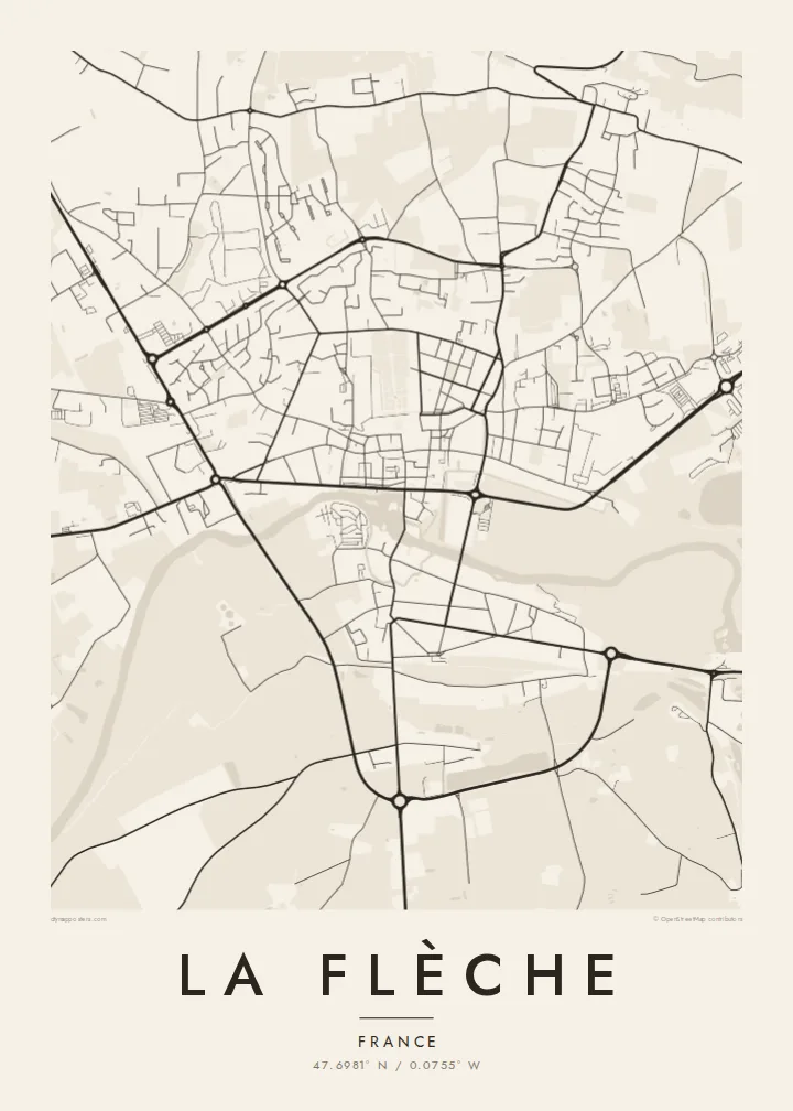
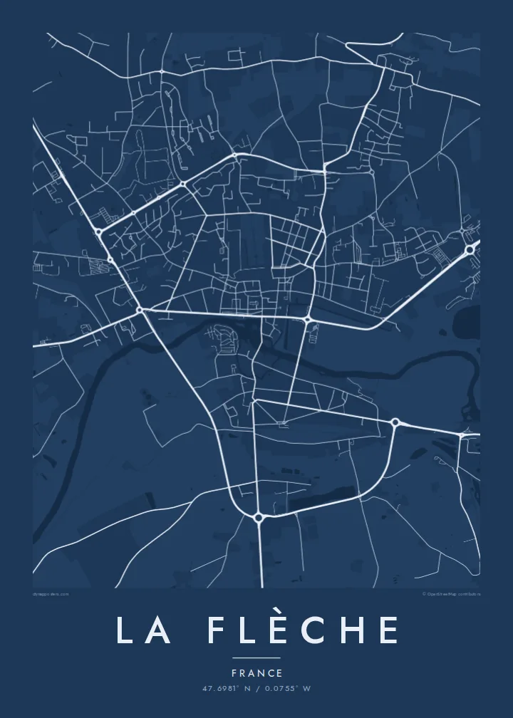
The town has a legible plan. The Loir and its side channels run past the centre, with a mill, quays and bridges. Straight streets and wide squares show a degree of planning unusual for a town of this size. Beyond the centre, residential districts spread onto the plateau, and the surroundings include woodland and the zoo that the town is also known for.
A La Flèche map poster puts the river and the Prytanée in dialogue. The water curves along one side of the old town, while the school's grounds form a large, calm geometric block. Streets radiate outward to the ring of newer districts, giving the print a balanced, readable structure.
The former Jesuit college founded under Henri IV forms a large rectangular complex of buildings, courtyards and gardens, one of the most distinctive shapes on the map.
The Loir passes the old town in several arms, with bridges and quays, drawing soft curves along the southern side of the centre.
Wide, direct streets and squares link the centre's key points, a clear urban pattern that makes the heart of La Flèche easy to read from above.
Kok tanim ab
Ayro, migaq hinnay kok tan xagar osis; gaba, ballaqa hinnay xiqa soorris.
Free preview qansarissi kee watermark-le. Daabbisimtaan kee HD fayla 300 DPI-l, 7,200 × 10,800 px fanah, watermark maleh ederimta.
Macah La Flèche
La Flèche means a lot to former pupils of the Prytanée, their families, and anyone who knows the Loir valley. The poster captures that combination of river and school in a form that is quiet and easy to recognise.
You can personalise the title, subtitle and coordinates, for instance with a graduating year, and choose one of five styles. Digital files cost $9 in six sizes, including A2 and 50×70 cm. Framed or unframed prints are also available.
La Flèche poster orme| Maxxaacah ballaqa | Qeeqa | Faylal |
|---|---|---|
| 30 × 40 cm (11.8 × 15.7″) | 3,543 × 4,724 px | PNG · PDF |
| 29.7 × 42 cm (A3, 11.7 × 16.5″) | 3,508 × 4,961 px | PNG · PDF |
| 42 × 59.4 cm (A2, 16.5 × 23.4″) | 4,961 × 7,016 px | PNG · PDF |
| 45.7 × 61 cm (18 × 24″) | 5,400 × 7,200 px | PNG · PDF |
| 50 × 70 cm (19.7 × 27.6″) | 5,906 × 8,268 px | PNG · PDF |
| 61 × 91.4 cm (24 × 36″) | 7,200 × 10,800 px | PNG · PDF |
Tabbaltah, limo-wayta xaqqa-le ablo 900 px ballaqa le, asta le, iskiriinih keh tan. HD faylal gexsoh inkih addal 8× fanah qeeqa le, poster ballaqa inkih addal meqeh maxxaacimta.
Baxxaqqa qari le qandiy dooriy, tohuk lakal Daabbisimtah Poster — kutuk kee, faxximek, dirbaabu — hinnay HD Digital Fayla dooru. Checkout inki wagitti geytima, kaadu ku-orme page keenih adissa akke waqdi caagoy kummite.
Usuk 200 gsm-le catam kutuk warqatal, lica katiy caagitte {printFrom}-ik hane ayta 30 × 40 cm-ik 24 × 36″ fanah, xaagu keenil warreeh.
Ee. Sarrah-le dirbaabu doori — bad, gudduc, oak-le hinnay bad-madabuy. Usuk finqisiimam ellee sange qarab-le kaadu qari umukku iyya keenih taagu. Dirbaabu-le poster {framedFrom}-ik hane, xaagu keenil warreeh.
Shipping is free worldwide. Each poster is printed by the nearest of our print partners in 30+ countries and usually arrives in 3–7 business days. You can follow the status and tracking under My Orders. A few countries take 2–5 weeks, and where we don't ship yet, the site tells you before you pay.
Geytimeek 14 ayróy addal foto naah rubbaay, cisab-le daabbisiynah hinnay ku-lacay gacisnaah.
Ee. Tama page-l edito addal, migaaq, subtitle kee coordinates sarrah faxxem fanah badal, kaadu qande kee katiy doori. Daabbisimtah, dirbaabu-le kaadu digital orme inkih ku-design cagalah yekkelen.
$9 bacisak 300 DPI PNG kee daabbisimtah adissime PDF fayla lica katiy inkih, watermark maleh, ayyi meki daabbisimtah geeytitta. Cisab makkoysemty ana? Awqak, watermark-le free preview download-eh.
