Road through the valley
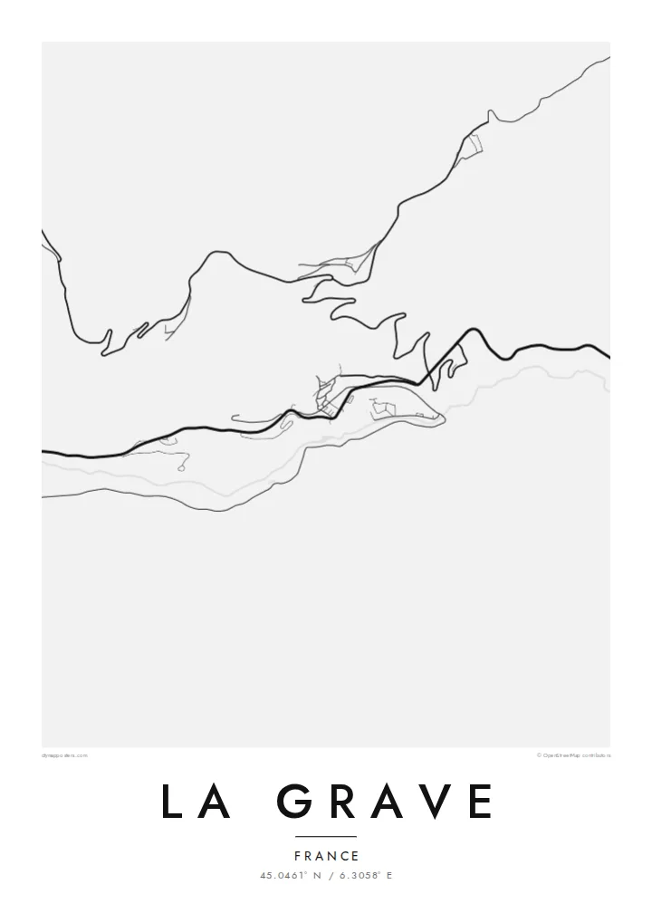
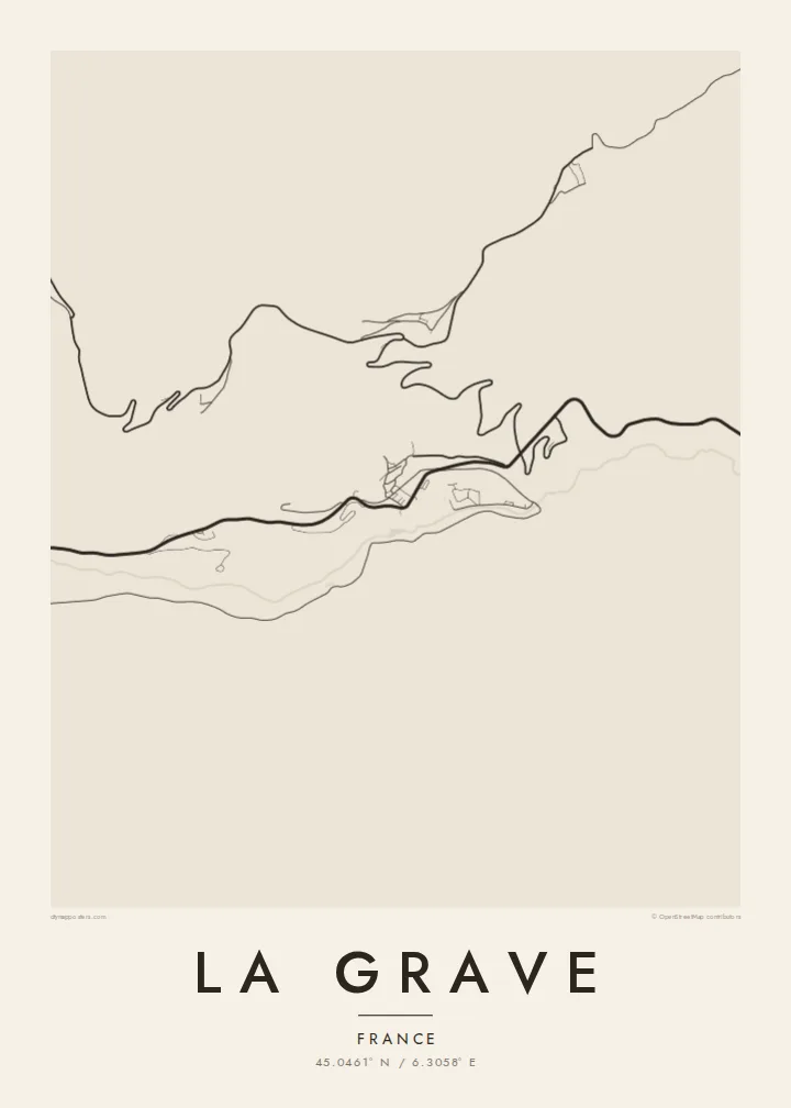
The main road from Grenoble to Briançon passes straight through La Grave. It bends along the valley side and forms the spine of the village on the map.
Qeeqabak kaartah poster · France
45.0461° N / 6.3058° E
A handful of houses on a steep shelf above the Romanche, facing the glaciers of La Meije across the valley.



Inki magaala, konoy gaba
Qande inkih tibbixeeh derre baguley table. Kulli qande missoowa caagid—daabbisimta, dirbaabu-le kaadu HD fayla akah.
 Cagalah pixels · 24 × 36″ daabbi fayla
Maxxaacah qeeqa
Tama usuk cagalah daabbi faylak 100% qambaala. Kulli poster — daabbisimta, dirbaabu-le kaadu download geytimta — ni-server-ittal 300 DPI-l ederimta, 7,200 × 10,800 pixels fanah, tokkel iyyi ellee catoy 24 × 36″ daabbi baxsi bahisak raaqu.
Gidarih


Kaarta
La Grave is small, and the map makes that obvious. The village clings to the sunny side of the Romanche valley along the road between Grenoble and Briançon. A few hamlets sit higher up on terraces. Across the river, the ground rises almost straight into the north face of La Meije and its glaciers.
The resort is known far beyond France for its cable car, which climbs toward the glaciers with almost no groomed pistes. That leaves the mountain to experienced off-piste skiers and their guides. La Meije, close to 4,000 metres high, was among the last major summits in the Alps to be climbed, in 1877.
A La Grave map poster is dominated by landscape, not streets. The road bends through the village, bridges cross the Romanche, and hamlets such as Les Terrasses and Le Chazelet sit on the slopes above. Everything else is steep ground, torrents and ice. The sheer scale of the valley presses the village into a narrow line.
The main road from Grenoble to Briançon passes straight through La Grave. It bends along the valley side and forms the spine of the village on the map.
The river runs below the village in its deep valley. It is a single line separating the houses from the mountain wall that rises on the other side.
The lift line climbs from the village toward the glaciers of La Meije. It is a straight stroke across open ground and marks the start of the area's famous off-piste terrain.
Kok tanim ab
Ayro, migaq hinnay kok tan xagar osis; gaba, ballaqa hinnay xiqa soorris.
Free preview qansarissi kee watermark-le. Daabbisimtaan kee HD fayla 300 DPI-l, 7,200 × 10,800 px fanah, watermark maleh ederimta.
Macah La Grave
La Grave draws people who think in couloirs and ropes. A map of the village, reduced to river, road and hamlets, is a fitting reminder of a place where the mountain matters more than the resort and a single lift leads into serious terrain.
Personalise the title, subtitle and coordinates line, perhaps with a route or the date of a descent, and choose one of five styles. Digital files come without a watermark in six sizes. Printed versions arrive on matte paper, with or without a wooden frame.
La Grave poster orme| Maxxaacah ballaqa | Qeeqa | Faylal |
|---|---|---|
| 30 × 40 cm (11.8 × 15.7″) | 3,543 × 4,724 px | PNG · PDF |
| 29.7 × 42 cm (A3, 11.7 × 16.5″) | 3,508 × 4,961 px | PNG · PDF |
| 42 × 59.4 cm (A2, 16.5 × 23.4″) | 4,961 × 7,016 px | PNG · PDF |
| 45.7 × 61 cm (18 × 24″) | 5,400 × 7,200 px | PNG · PDF |
| 50 × 70 cm (19.7 × 27.6″) | 5,906 × 8,268 px | PNG · PDF |
| 61 × 91.4 cm (24 × 36″) | 7,200 × 10,800 px | PNG · PDF |
Tabbaltah, limo-wayta xaqqa-le ablo 900 px ballaqa le, asta le, iskiriinih keh tan. HD faylal gexsoh inkih addal 8× fanah qeeqa le, poster ballaqa inkih addal meqeh maxxaacimta.
Baxxaqqa qari le qandiy dooriy, tohuk lakal Daabbisimtah Poster — kutuk kee, faxximek, dirbaabu — hinnay HD Digital Fayla dooru. Checkout inki wagitti geytima, kaadu ku-orme page keenih adissa akke waqdi caagoy kummite.
Usuk 200 gsm-le catam kutuk warqatal, lica katiy caagitte $39-ik hane ayta 30 × 40 cm-ik 24 × 36″ fanah, xaagu keenil warreeh.
Ee. Sarrah-le dirbaabu doori — bad, gudduc, oak-le hinnay bad-madabuy. Usuk finqisiimam ellee sange qarab-le kaadu qari umukku iyya keenih taagu. Dirbaabu-le poster $99-ik hane, xaagu keenil warreeh.
Shipping is free worldwide. Each poster is printed by the nearest of our print partners in 30+ countries and usually arrives in 3–7 business days. You can follow the status and tracking under My Orders. A few countries take 2–5 weeks, and where we don't ship yet, the site tells you before you pay.
Geytimeek 14 ayróy addal foto naah rubbaay, cisab-le daabbisiynah hinnay ku-lacay gacisnaah.
Ee. Tama page-l edito addal, migaaq, subtitle kee coordinates sarrah faxxem fanah badal, kaadu qande kee katiy doori. Daabbisimtah, dirbaabu-le kaadu digital orme inkih ku-design cagalah yekkelen.
$9 bacisak 300 DPI PNG kee daabbisimtah adissime PDF fayla lica katiy inkih, watermark maleh, ayyi meki daabbisimtah geeytitta. Cisab makkoysemty ana? Awqak, watermark-le free preview download-eh.
