Central square
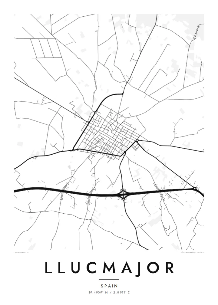
The old town gathers around its main square and parish church, where narrow streets meet and form the densest, most detailed part of the map.
Qeeqabak kaartah poster · Spain
39.4909° N / 2.8911° E
A Mallorcan inland town at the center of a vast municipality reaching from the Randa hills down to cliffs on the sea


Inki magaala, konoy gaba
Qande inkih tibbixeeh derre baguley table. Kulli qande missoowa caagid—daabbisimta, dirbaabu-le kaadu HD fayla akah.
 Cagalah pixels · 24 × 36″ daabbi fayla
Maxxaacah qeeqa
Tama usuk cagalah daabbi faylak 100% qambaala. Kulli poster — daabbisimta, dirbaabu-le kaadu download geytimta — ni-server-ittal 300 DPI-l ederimta, 7,200 × 10,800 pixels fanah, tokkel iyyi ellee catoy 24 × 36″ daabbi baxsi bahisak raaqu.
Gidarih


Kaarta
Llucmajor is the largest municipality in Mallorca by area, stretching from the hills of Randa in the north to a long coastline in the south and west. The town itself lies inland on the plain, a compact grid of old streets around its central square, surrounded by orchards, dry-stone walls and scattered farmhouses.
The coast within the municipality ranges from part of S'Arenal, on the Bay of Palma, to high limestone cliffs around Cap Blanc and its lighthouse. Near this shore lies Capocorb Vell, one of the island's best-known Talaiotic settlements, with prehistoric stone towers. Inland, the Puig de Randa rises with three sanctuaries associated with the medieval thinker Ramon Llull.
In 1349 the Battle of Llucmajor ended the independent Kingdom of Majorca when James III was killed near the town. A Llucmajor map poster centers on the town's close-knit streets while hinting at the wide, open countryside beyond, a quiet composition for a home connected to Mallorca.
The old town gathers around its main square and parish church, where narrow streets meet and form the densest, most detailed part of the map.
The hill north of the town rises from the plain with its three sanctuaries, reached by a winding road that stands out as a looping line on the map.
The municipality's southern shore is lined with limestone cliffs running toward Cap Blanc, a clean, sharp edge where the island meets the Mediterranean.
Kok tanim ab
Ayro, migaq hinnay kok tan xagar osis; gaba, ballaqa hinnay xiqa soorris.
Free preview qansarissi kee watermark-le. Daabbisimtaan kee HD fayla 300 DPI-l, 7,200 × 10,800 px fanah, watermark maleh ederimta.
Macah Llucmajor
Llucmajor is a place many visitors pass on the way to the beaches, but those who stay know its markets, country roads and quiet evenings in the square. A map of the town suits anyone with a finca nearby, family roots, or a favorite stretch of Mallorcan coast.
Personalise the title and subtitle, perhaps in Catalan or Spanish, add a date and adjust the coordinates line. Choose among Classic black & white, Noir, Paper, Blueprint and Sand; Sand and Paper suit the warm stone of the island.
Llucmajor poster orme| Maxxaacah ballaqa | Qeeqa | Faylal |
|---|---|---|
| 30 × 40 cm (11.8 × 15.7″) | 3,543 × 4,724 px | PNG · PDF |
| 29.7 × 42 cm (A3, 11.7 × 16.5″) | 3,508 × 4,961 px | PNG · PDF |
| 42 × 59.4 cm (A2, 16.5 × 23.4″) | 4,961 × 7,016 px | PNG · PDF |
| 45.7 × 61 cm (18 × 24″) | 5,400 × 7,200 px | PNG · PDF |
| 50 × 70 cm (19.7 × 27.6″) | 5,906 × 8,268 px | PNG · PDF |
| 61 × 91.4 cm (24 × 36″) | 7,200 × 10,800 px | PNG · PDF |
Tabbaltah, limo-wayta xaqqa-le ablo 900 px ballaqa le, asta le, iskiriinih keh tan. HD faylal gexsoh inkih addal 8× fanah qeeqa le, poster ballaqa inkih addal meqeh maxxaacimta.
Baxxaqqa qari le qandiy dooriy, tohuk lakal Daabbisimtah Poster — kutuk kee, faxximek, dirbaabu — hinnay HD Digital Fayla dooru. Checkout inki wagitti geytima, kaadu ku-orme page keenih adissa akke waqdi caagoy kummite.
Usuk 200 gsm-le catam kutuk warqatal, lica katiy caagitte $39-ik hane ayta 30 × 40 cm-ik 24 × 36″ fanah, xaagu keenil warreeh.
Ee. Sarrah-le dirbaabu doori — bad, gudduc, oak-le hinnay bad-madabuy. Usuk finqisiimam ellee sange qarab-le kaadu qari umukku iyya keenih taagu. Dirbaabu-le poster $99-ik hane, xaagu keenil warreeh.
Shipping is free worldwide. Each poster is printed by the nearest of our print partners in 30+ countries and usually arrives in 3–7 business days. You can follow the status and tracking under My Orders. A few countries take 2–5 weeks, and where we don't ship yet, the site tells you before you pay.
Geytimeek 14 ayróy addal foto naah rubbaay, cisab-le daabbisiynah hinnay ku-lacay gacisnaah.
Ee. Tama page-l edito addal, migaaq, subtitle kee coordinates sarrah faxxem fanah badal, kaadu qande kee katiy doori. Daabbisimtah, dirbaabu-le kaadu digital orme inkih ku-design cagalah yekkelen.
$9 bacisak 300 DPI PNG kee daabbisimtah adissime PDF fayla lica katiy inkih, watermark maleh, ayyi meki daabbisimtah geeytitta. Cisab makkoysemty ana? Awqak, watermark-le free preview download-eh.
