Santa Monica Mountains
A ridge of hills runs east to west through the city, separating the basin from the Valley, with Mulholland Drive winding along its crest.
Qeeqabak kaartah poster · United States
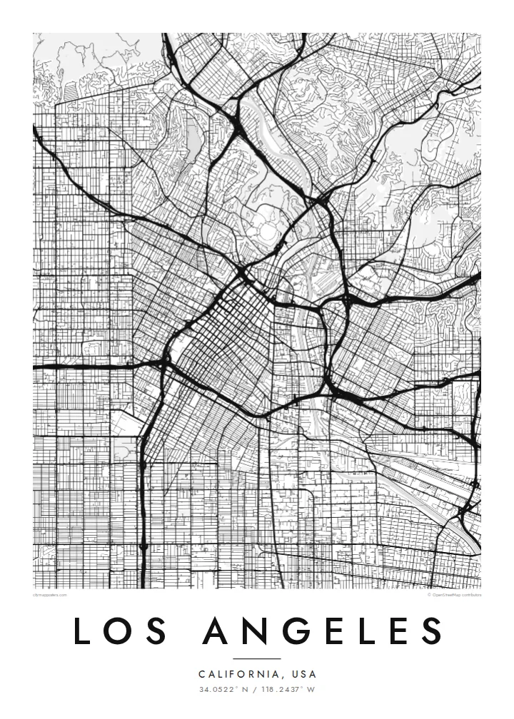
34.0522° N / 118.2437° W
An immense grid of boulevards and freeways across a coastal basin, split by mountains and bordered by the Pacific.


Inki magaala, konoy gaba
Qande inkih tibbixeeh derre baguley table. Kulli qande missoowa caagid—daabbisimta, dirbaabu-le kaadu HD fayla akah.
 Cagalah pixels · 24 × 36″ daabbi fayla
Maxxaacah qeeqa
Tama usuk cagalah daabbi faylak 100% qambaala. Kulli poster — daabbisimta, dirbaabu-le kaadu download geytimta — ni-server-ittal 300 DPI-l ederimta, 7,200 × 10,800 pixels fanah, tokkel iyyi ellee catoy 24 × 36″ daabbi baxsi bahisak raaqu.
Gidarih


Kaarta
Los Angeles covers a huge area, and from above it reads as one of the largest continuous street grids anywhere. Long boulevards such as Wilshire, Sunset and Venice run for many miles across the basin, and the freeways cut diagonals and curves through that pattern. The city boundary itself is irregular, weaving around independent cities like Santa Monica and Beverly Hills.
The Santa Monica Mountains divide the basin from the San Fernando Valley, and on the map their dark, winding ridge roads stand out against the regular blocks on either side. At the eastern end of the range, Griffith Park forms one of the largest urban parks in the country, while the Los Angeles River runs through the city in a long concrete channel.
A narrow strip of city land, often called the Shoestring, runs south to connect Los Angeles with its harbour at San Pedro. A Los Angeles map poster makes this unusual shape clear, along with the coastline from Venice to Pacific Palisades. It is a city many people know by car, and the map shows those routes in a way the windshield never does.
A ridge of hills runs east to west through the city, separating the basin from the Valley, with Mulholland Drive winding along its crest.
Long, straight streets like Wilshire and Sunset cross the basin for miles, forming a grid so large it fills the poster from edge to edge.
A narrow corridor of city land reaches south to the Port of Los Angeles at San Pedro, one of the strangest and most recognisable municipal boundaries in the country.
Kok tanim ab
Ayro, migaq hinnay kok tan xagar osis; gaba, ballaqa hinnay xiqa soorris.
Free preview qansarissi kee watermark-le. Daabbisimtaan kee HD fayla 300 DPI-l, 7,200 × 10,800 px fanah, watermark maleh ederimta.
Macah Los Angeles
Los Angeles is a city of neighbourhoods, and a map poster lets you mark your own: a first apartment in Silver Lake, a job in Hollywood, a house near the beach in Venice. The clean grid looks sharp in a home office or living room.
Write your own title and subtitle, add a date or coordinates, and choose Classic black & white, Noir, Paper, Blueprint or Sand. The $9 HD files include 18×24″ and 24×36″ sizes, and printed posters ship from partners in 30+ countries.
Los Angeles poster orme| Maxxaacah ballaqa | Qeeqa | Faylal |
|---|---|---|
| 30 × 40 cm11.8 × 15.7″ | 3,543 × 4,724 px | PNG · PDF |
| 29.7 × 42 cm (A3)11.7 × 16.5″ | 3,508 × 4,961 px | PNG · PDF |
| 42 × 59.4 cm (A2)16.5 × 23.4″ | 4,961 × 7,016 px | PNG · PDF |
| 45.7 × 61 cm18 × 24″ | 5,400 × 7,200 px | PNG · PDF |
| 50 × 70 cm19.7 × 27.6″ | 5,906 × 8,268 px | PNG · PDF |
| 61 × 91.4 cm24 × 36″ | 7,200 × 10,800 px | PNG · PDF |
Tabbaltah, limo-wayta xaqqa-le ablo 900 px ballaqa le, asta le, iskiriinih keh tan. HD faylal gexsoh inkih addal 8× fanah qeeqa le, poster ballaqa inkih addal meqeh maxxaacimta.
Baxxaqqa qari le qandiy dooriy, tohuk lakal Daabbisimtah Poster — kutuk kee, faxximek, dirbaabu — hinnay HD Digital Fayla dooru. Checkout inki wagitti geytima, kaadu ku-orme page keenih adissa akke waqdi caagoy kummite.
Usuk 200 gsm-le catam kutuk warqatal, lica katiy caagitte $39-ik hane ayta 30 × 40 cm-ik 24 × 36″ fanah, xaagu keenil warreeh.
Ee. Sarrah-le dirbaabu doori — bad, gudduc, oak-le hinnay bad-madabuy. Usuk finqisiimam ellee sange qarab-le kaadu qari umukku iyya keenih taagu. Dirbaabu-le poster $99-ik hane, xaagu keenil warreeh.
Dirsa 60+ baaxoh bilsa. Poster kasa 30+ baaxoh nel print kaadu yan kee dirgeh kaxxa kee tanah printa, kee 3–7 xaqu ayyaamah yaaxigeeh. Xaaloo kee tracking "Ac Order" gexsitam. Kaadu baaxo 2–5 isbuuc yaaxigeeh, nanu dirsi yanin baaxoh sajiitah site ku kalah tekkeh.
Geytimeek 14 ayróy addal foto naah rubbaay, cisab-le daabbisiynah hinnay ku-lacay gacisnaah.
Ee. Tama page-l edito addal, migaaq, subtitle kee coordinates sarrah faxxem fanah badal, kaadu qande kee katiy doori. Daabbisimtah, dirbaabu-le kaadu digital orme inkih ku-design cagalah yekkelen.
$9 bacisak 300 DPI PNG kee daabbisimtah adissime PDF fayla lica katiy inkih, watermark maleh, ayyi meki daabbisimtah geeytitta. Cisab makkoysemty ana? Awqak, watermark-le free preview download-eh.
Xayyo
