Köýtendag foothills
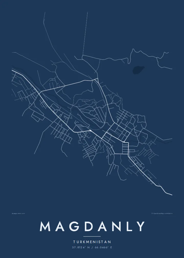
The town lies near the highest mountains in Turkmenistan, and the thinning road network toward the slopes suggests the rugged terrain beyond the edge of the plan.
Qeeqabak kaartah poster · Turkmenistan
37.8124° N / 66.0466° E
A remote Turkmen town near the Köýtendag range, where a compact street plan meets rail lines and dry, open land



Inki magaala, konoy gaba
Qande inkih tibbixeeh derre baguley table. Kulli qande missoowa caagid—daabbisimta, dirbaabu-le kaadu HD fayla akah.
 Cagalah pixels · 24 × 36″ daabbi fayla
Maxxaacah qeeqa
Tama usuk cagalah daabbi faylak 100% qambaala. Kulli poster — daabbisimta, dirbaabu-le kaadu download geytimta — ni-server-ittal 300 DPI-l ederimta, 7,200 × 10,800 pixels fanah, tokkel iyyi ellee catoy 24 × 36″ daabbi baxsi bahisak raaqu.
Gidarih


Kaarta
Magdanly lies in the far southeast of Turkmenistan, in Lebap Province, close to the border with Uzbekistan. Known for much of the twentieth century as Gaurdak, it sits near the Köýtendag mountains, the highest range in the country. From above, the town is a compact arrangement of streets and blocks surrounded by dry, open land, with roads and a railway line connecting it to the wider region.
The town grew around mineral resources, especially sulphur, which was mined and processed here in the Soviet period. Industrial areas therefore sit alongside residential districts, and their large, simple footprints are visible on a map. Toward the mountains the terrain becomes increasingly rugged, and the road network grows sparse as it approaches the foothills.
A Magdanly map poster offers a spare, graphic view of a place few maps show in detail. The town's streets, rail line and approach roads are drawn in black and white, with plenty of open space around them that reflects its setting. It makes a distinctive gift for anyone who lived or worked in this corner of Turkmenistan.
The town lies near the highest mountains in Turkmenistan, and the thinning road network toward the slopes suggests the rugged terrain beyond the edge of the plan.
A railway line serves the town and its industry, crossing the map as a long, steady line that links this remote place to the rest of the country.
Sites associated with the former sulphur industry appear as broad, simple shapes beside the residential blocks, a reminder of why the town was built here.
Kok tanim ab
Ayro, migaq hinnay kok tan xagar osis; gaba, ballaqa hinnay xiqa soorris.
Free preview qansarissi kee watermark-le. Daabbisimtaan kee HD fayla 300 DPI-l, 7,200 × 10,800 px fanah, watermark maleh ederimta.
Macah Magdanly
Magdanly rarely appears on posters or postcards, which makes a map of it all the more personal. It suits former residents, engineers and families with roots in Lebap who want an understated image of the town that works in any modern interior.
You can set the title in whichever name you prefer, Magdanly or Gaurdak, and add a subtitle and coordinates line. Pick from Classic black & white, Noir, Paper, Blueprint and Sand, and check the free 900 px watermarked preview before buying the HD files.
Magdanly poster orme| Maxxaacah ballaqa | Qeeqa | Faylal |
|---|---|---|
| 30 × 40 cm11.8 × 15.7″ | 3,543 × 4,724 px | PNG · PDF |
| 29.7 × 42 cm (A3)11.7 × 16.5″ | 3,508 × 4,961 px | PNG · PDF |
| 42 × 59.4 cm (A2)16.5 × 23.4″ | 4,961 × 7,016 px | PNG · PDF |
| 45.7 × 61 cm18 × 24″ | 5,400 × 7,200 px | PNG · PDF |
| 50 × 70 cm19.7 × 27.6″ | 5,906 × 8,268 px | PNG · PDF |
| 61 × 91.4 cm24 × 36″ | 7,200 × 10,800 px | PNG · PDF |
Tabbaltah, limo-wayta xaqqa-le ablo 900 px ballaqa le, asta le, iskiriinih keh tan. HD faylal gexsoh inkih addal 8× fanah qeeqa le, poster ballaqa inkih addal meqeh maxxaacimta.
Baxxaqqa qari le qandiy dooriy, tohuk lakal Daabbisimtah Poster — kutuk kee, faxximek, dirbaabu — hinnay HD Digital Fayla dooru. Checkout inki wagitti geytima, kaadu ku-orme page keenih adissa akke waqdi caagoy kummite.
Usuk 200 gsm-le catam kutuk warqatal, lica katiy caagitte $39-ik hane ayta 30 × 40 cm-ik 24 × 36″ fanah, xaagu keenil warreeh.
Ee. Sarrah-le dirbaabu doori — bad, gudduc, oak-le hinnay bad-madabuy. Usuk finqisiimam ellee sange qarab-le kaadu qari umukku iyya keenih taagu. Dirbaabu-le poster $99-ik hane, xaagu keenil warreeh.
Dirsa 60+ baaxoh bilsa. Poster kasa 30+ baaxoh nel print kaadu yan kee dirgeh kaxxa kee tanah printa, kee 3–7 xaqu ayyaamah yaaxigeeh. Xaaloo kee tracking "Ac Order" gexsitam. Kaadu baaxo 2–5 isbuuc yaaxigeeh, nanu dirsi yanin baaxoh sajiitah site ku kalah tekkeh.
Geytimeek 14 ayróy addal foto naah rubbaay, cisab-le daabbisiynah hinnay ku-lacay gacisnaah.
Ee. Tama page-l edito addal, migaaq, subtitle kee coordinates sarrah faxxem fanah badal, kaadu qande kee katiy doori. Daabbisimtah, dirbaabu-le kaadu digital orme inkih ku-design cagalah yekkelen.
$9 bacisak 300 DPI PNG kee daabbisimtah adissime PDF fayla lica katiy inkih, watermark maleh, ayyi meki daabbisimtah geeytitta. Cisab makkoysemty ana? Awqak, watermark-le free preview download-eh.
