Radiating regional roads
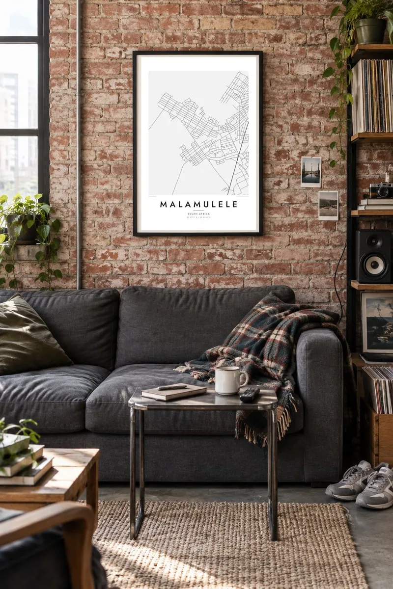
Several routes meet at Malamulele and head off toward neighbouring villages and towns. On the poster they form a clear star pattern that anchors the whole design.
Qeeqabak kaartah poster · South Africa
22.9711° S / 30.6736° E
A spread-out Limpopo town whose roads fan out across the bushveld toward surrounding villages and the edge of Kruger country.

Inki magaala, konoy gaba
Qande inkih tibbixeeh derre baguley table. Kulli qande missoowa caagid—daabbisimta, dirbaabu-le kaadu HD fayla akah.
 Cagalah pixels · 24 × 36″ daabbi fayla
Maxxaacah qeeqa
Tama usuk cagalah daabbi faylak 100% qambaala. Kulli poster — daabbisimta, dirbaabu-le kaadu download geytimta — ni-server-ittal 300 DPI-l ederimta, 7,200 × 10,800 pixels fanah, tokkel iyyi ellee catoy 24 × 36″ daabbi baxsi bahisak raaqu.
Gidarih


Kaarta
Malamulele lies in the far north-east of South Africa's Limpopo province, in lowveld country not far from the western boundary of Kruger National Park. From above it looks nothing like a tight grid. It is a loose, wide settlement where a central commercial area gives way to residential sections and then to villages scattered along the roads that cross the bushveld.
The town is a centre for the Xitsonga-speaking communities of the area. It is known for the local campaign that led to a municipality of its own: in 2016 it became part of the newly formed Collins Chabane Local Municipality. That civic role shows on the map in the roads, which lead to Malamulele from many directions.
A Malamulele map poster shows how that pattern holds together. Clusters of small plots, winding local roads and long regional routes fill the frame with fine texture. Dry riverbeds and open veld add gentle breaks between them. The result is a map of a place that grows outward rather than upward, and it still reads clearly from a distance.
Several routes meet at Malamulele and head off toward neighbouring villages and towns. On the poster they form a clear star pattern that anchors the whole design.
Around the centre, residential sections and nearby villages appear as patches of small plots and lanes. They spread the detail widely across the frame instead of packing it into one core.
Stretches of bush and farmland lie between the settlements and turn into calm white space. That space sets off the finer lines of the streets.
Kok tanim ab
Ayro, migaq hinnay kok tan xagar osis; gaba, ballaqa hinnay xiqa soorris.
Free preview qansarissi kee watermark-le. Daabbisimtaan kee HD fayla 300 DPI-l, 7,200 × 10,800 px fanah, watermark maleh ederimta.
Macah Malamulele
The map suits anyone with roots in Malamulele or the villages around it, and anyone who has passed through on the way to the northern part of Kruger. It records a place defined by its connections, where each road leads to somebody's home.
The title, subtitle and coordinates line can be personalised with a village name, a family surname or an important date. There are five styles to choose from: Classic black & white, Noir, Paper, Blueprint and Sand. Warmer tones such as Sand suit the lowveld setting well.
Malamulele poster orme| Maxxaacah ballaqa | Qeeqa | Faylal |
|---|---|---|
| 30 × 40 cm11.8 × 15.7″ | 3,543 × 4,724 px | PNG · PDF |
| 29.7 × 42 cm (A3)11.7 × 16.5″ | 3,508 × 4,961 px | PNG · PDF |
| 42 × 59.4 cm (A2)16.5 × 23.4″ | 4,961 × 7,016 px | PNG · PDF |
| 45.7 × 61 cm18 × 24″ | 5,400 × 7,200 px | PNG · PDF |
| 50 × 70 cm19.7 × 27.6″ | 5,906 × 8,268 px | PNG · PDF |
| 61 × 91.4 cm24 × 36″ | 7,200 × 10,800 px | PNG · PDF |
Tabbaltah, limo-wayta xaqqa-le ablo 900 px ballaqa le, asta le, iskiriinih keh tan. HD faylal gexsoh inkih addal 8× fanah qeeqa le, poster ballaqa inkih addal meqeh maxxaacimta.
Baxxaqqa qari le qandiy dooriy, tohuk lakal Daabbisimtah Poster — kutuk kee, faxximek, dirbaabu — hinnay HD Digital Fayla dooru. Checkout inki wagitti geytima, kaadu ku-orme page keenih adissa akke waqdi caagoy kummite.
Usuk 200 gsm-le catam kutuk warqatal, lica katiy caagitte $39-ik hane ayta 30 × 40 cm-ik 24 × 36″ fanah, xaagu keenil warreeh.
Ee. Sarrah-le dirbaabu doori — bad, gudduc, oak-le hinnay bad-madabuy. Usuk finqisiimam ellee sange qarab-le kaadu qari umukku iyya keenih taagu. Dirbaabu-le poster $99-ik hane, xaagu keenil warreeh.
Dirsa 60+ baaxoh bilsa. Poster kasa 30+ baaxoh nel print kaadu yan kee dirgeh kaxxa kee tanah printa, kee 3–7 xaqu ayyaamah yaaxigeeh. Xaaloo kee tracking "Ac Order" gexsitam. Kaadu baaxo 2–5 isbuuc yaaxigeeh, nanu dirsi yanin baaxoh sajiitah site ku kalah tekkeh.
Geytimeek 14 ayróy addal foto naah rubbaay, cisab-le daabbisiynah hinnay ku-lacay gacisnaah.
Ee. Tama page-l edito addal, migaaq, subtitle kee coordinates sarrah faxxem fanah badal, kaadu qande kee katiy doori. Daabbisimtah, dirbaabu-le kaadu digital orme inkih ku-design cagalah yekkelen.
$9 bacisak 300 DPI PNG kee daabbisimtah adissime PDF fayla lica katiy inkih, watermark maleh, ayyi meki daabbisimtah geeytitta. Cisab makkoysemty ana? Awqak, watermark-le free preview download-eh.
