The coastal road
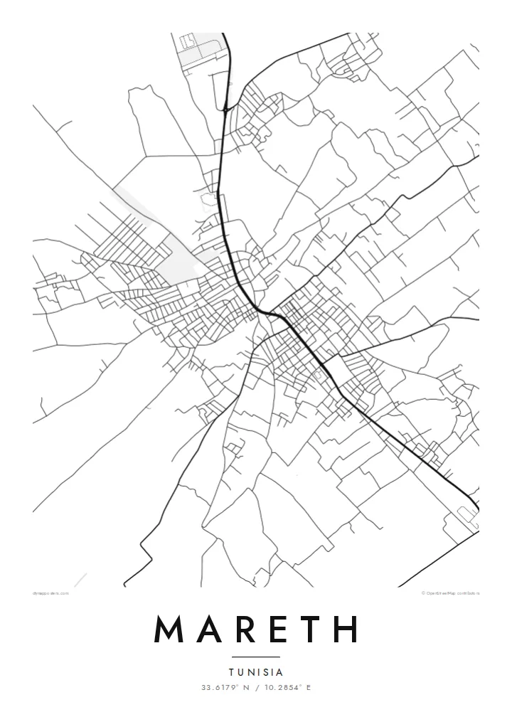
A main north–south route runs through Mareth, linking it to Gabès and the south. On the poster it becomes the strongest single line, and the rest of the town is arranged along it.
Qeeqabak kaartah poster · Tunisia
33.6179° N / 10.2854° E
A low oasis town on the coastal plain of southern Tunisia, its streets gathered between palm gardens, a dry riverbed and the open road north.



Inki magaala, konoy gaba
Qande inkih tibbixeeh derre baguley table. Kulli qande missoowa caagid—daabbisimta, dirbaabu-le kaadu HD fayla akah.
 Cagalah pixels · 24 × 36″ daabbi fayla
Maxxaacah qeeqa
Tama usuk cagalah daabbi faylak 100% qambaala. Kulli poster — daabbisimta, dirbaabu-le kaadu download geytimta — ni-server-ittal 300 DPI-l ederimta, 7,200 × 10,800 pixels fanah, tokkel iyyi ellee catoy 24 × 36″ daabbi baxsi bahisak raaqu.
Gidarih


Kaarta
Mareth sits a short distance inland from the Gulf of Gabès, on the flat strip of land between the sea and the Matmata hills. From above, the town is a loose cluster of streets set among cultivated plots and palm groves, with the main road running through it. Around the edge, the pattern thins into field boundaries and scattered buildings instead of stopping at a hard line.
The name is best known from the Second World War. Before the war, French engineers built the Mareth Line, a chain of fortifications running from the coast to the hills. In March 1943 it was the scene of heavy fighting between the British Eighth Army and Axis forces. The Wadi Zigzaou, a natural obstacle in that defensive line, still cuts across the landscape near the town.
A Mareth map poster turns this quiet geography into line work: the through-road, the tight grain of the older lanes and the looser pattern of streets and plots around them. Water shows up on a map here in a particular way. It follows seasonal wadis, not rivers, and the poster keeps those faint channels next to the denser street network.
A main north–south route runs through Mareth, linking it to Gabès and the south. On the poster it becomes the strongest single line, and the rest of the town is arranged along it.
This seasonal watercourse near the town was part of the Mareth Line's defences in 1943. On a map it reads as a thin, winding channel through otherwise flat ground.
Where the streets end, garden plots and palm groves take over. The grid loosens into irregular parcels, which gives the poster a soft, uneven border and no sharp city limit.
Kok tanim ab
Ayro, migaq hinnay kok tan xagar osis; gaba, ballaqa hinnay xiqa soorris.
Free preview qansarissi kee watermark-le. Daabbisimtaan kee HD fayla 300 DPI-l, 7,200 × 10,800 px fanah, watermark maleh ederimta.
Macah Mareth
For some people Mareth is home or a family town in the Gabès region. For others it is a name from military history they have read about or visited. A map of it is a plain, unsentimental way to keep that connection on the wall, drawn from the street pattern itself.
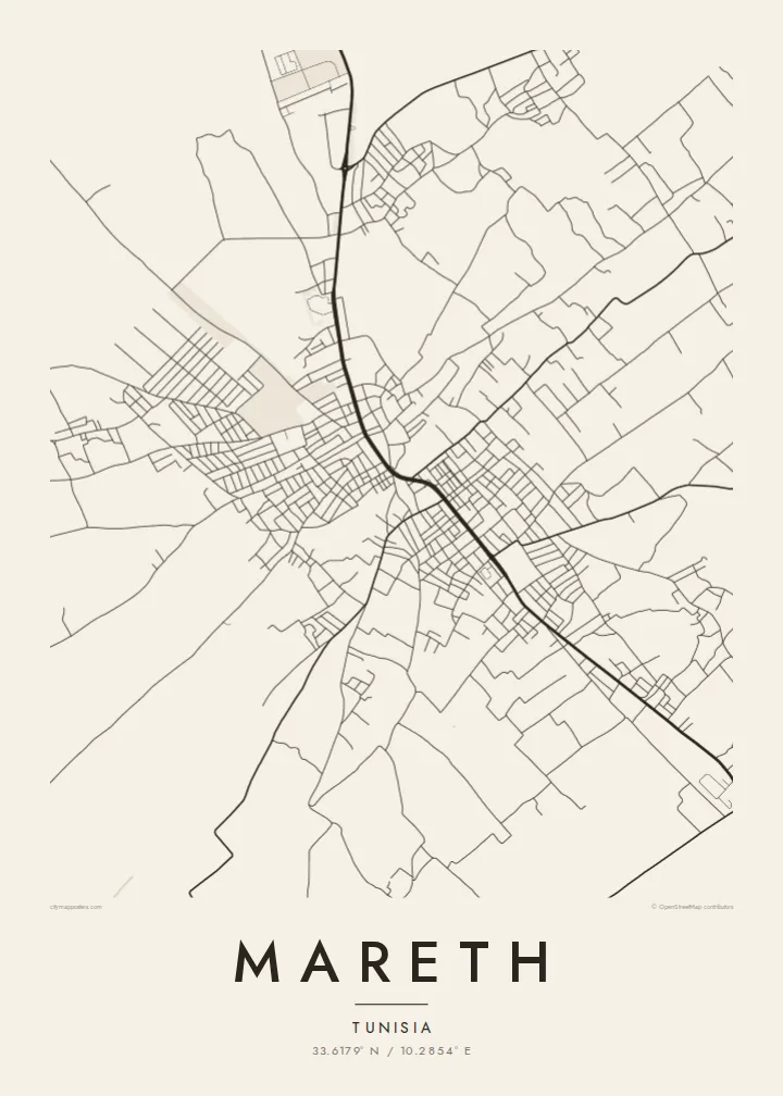
You can personalise the title, subtitle and coordinates line, for example with a family name or a year that matters. Choose from five styles: Classic black & white, Noir, Paper, Blueprint or Sand. Sand suits the southern Tunisian setting especially well.
Mareth poster orme| Maxxaacah ballaqa | Qeeqa | Faylal |
|---|---|---|
| 30 × 40 cm (11.8 × 15.7″) | 3,543 × 4,724 px | PNG · PDF |
| 29.7 × 42 cm (A3, 11.7 × 16.5″) | 3,508 × 4,961 px | PNG · PDF |
| 42 × 59.4 cm (A2, 16.5 × 23.4″) | 4,961 × 7,016 px | PNG · PDF |
| 45.7 × 61 cm (18 × 24″) | 5,400 × 7,200 px | PNG · PDF |
| 50 × 70 cm (19.7 × 27.6″) | 5,906 × 8,268 px | PNG · PDF |
| 61 × 91.4 cm (24 × 36″) | 7,200 × 10,800 px | PNG · PDF |
Tabbaltah, limo-wayta xaqqa-le ablo 900 px ballaqa le, asta le, iskiriinih keh tan. HD faylal gexsoh inkih addal 8× fanah qeeqa le, poster ballaqa inkih addal meqeh maxxaacimta.
Baxxaqqa qari le qandiy dooriy, tohuk lakal Daabbisimtah Poster — kutuk kee, faxximek, dirbaabu — hinnay HD Digital Fayla dooru. Checkout inki wagitti geytima, kaadu ku-orme page keenih adissa akke waqdi caagoy kummite.
Usuk 200 gsm-le catam kutuk warqatal, lica katiy caagitte {printFrom}-ik hane ayta 30 × 40 cm-ik 24 × 36″ fanah, xaagu keenil warreeh.
Ee. Sarrah-le dirbaabu doori — bad, gudduc, oak-le hinnay bad-madabuy. Usuk finqisiimam ellee sange qarab-le kaadu qari umukku iyya keenih taagu. Dirbaabu-le poster {framedFrom}-ik hane, xaagu keenil warreeh.
Xaagu addunyal inkih cisab-le. Kulli poster 30+ ummattak ni-daabbi-mara mananih xayyoysa kaadu 3–7 caagu-ayróh fanah geeytima. Ku-orme kee xaagu tarikiy My Orders addal ablitta.
Geytimeek 14 ayróy addal foto naah rubbaay, cisab-le daabbisiynah hinnay ku-lacay gacisnaah.
Ee. Tama page-l edito addal, migaaq, subtitle kee coordinates sarrah faxxem fanah badal, kaadu qande kee katiy doori. Daabbisimtah, dirbaabu-le kaadu digital orme inkih ku-design cagalah yekkelen.
$9 bacisak 300 DPI PNG kee daabbisimtah adissime PDF fayla lica katiy inkih, watermark maleh, ayyi meki daabbisimtah geeytitta. Cisab makkoysemty ana? Awqak, watermark-le free preview download-eh.
