Vieux-Port
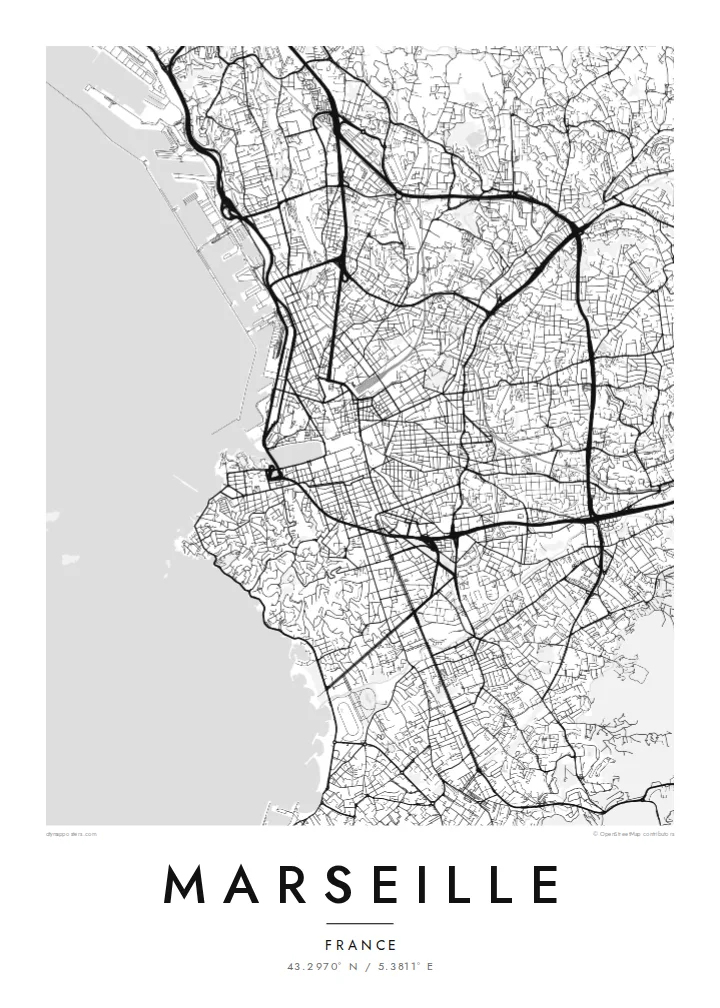
The ancient harbour forms a narrow rectangle of water reaching into the heart of the city. It is the natural centre of any composition, with streets converging on its quays.
Qeeqabak kaartah poster · France
43.2970° N / 5.3811° E
A rugged bowl of hills around a deep old harbour, open to the sea on the west and edged by limestone inlets.


Inki magaala, konoy gaba
Qande inkih tibbixeeh derre baguley table. Kulli qande missoowa caagid—daabbisimta, dirbaabu-le kaadu HD fayla akah.
 Cagalah pixels · 24 × 36″ daabbi fayla
Maxxaacah qeeqa
Tama usuk cagalah daabbi faylak 100% qambaala. Kulli poster — daabbisimta, dirbaabu-le kaadu download geytimta — ni-server-ittal 300 DPI-l ederimta, 7,200 × 10,800 pixels fanah, tokkel iyyi ellee catoy 24 × 36″ daabbi baxsi bahisak raaqu.
Gidarih


Kaarta
Marseille was founded around 600 BC by Greek sailors from Phocaea, who called it Massalia, and it is usually described as the oldest city in France. The original harbour, now the Vieux-Port, is a long rectangular inlet cutting deep into the city. La Canebière runs east from its head, the main axis of the centre.
The city fills a wide amphitheatre of hills that open towards the sea. On the tallest hill south of the port stands the basilica of Notre-Dame de la Garde, visible from almost everywhere. At the harbour entrance, Fort Saint-Jean and Fort Saint-Nicolas face each other, and the MuCEM museum is linked to the old fort by a footbridge.
Offshore lie the Frioul islands and the small island fortress of the Château d'If. To the north, modern port basins stretch along the coast, while to the southeast the city ends in the white limestone cliffs of the Calanques National Park. A Marseille map poster traces a coastline that changes character completely from one end to the other.
The ancient harbour forms a narrow rectangle of water reaching into the heart of the city. It is the natural centre of any composition, with streets converging on its quays.
The basilica sits on a limestone hill south of the port. Around it, the streets bend and switch back up the slope, a clear sign of the terrain in a flat drawing.
A small group of rocky islands sits just off the coast, with the Château d'If on the smallest of them. On the poster they appear as fine shapes floating in the open sea.
Kok tanim ab
Ayro, migaq hinnay kok tan xagar osis; gaba, ballaqa hinnay xiqa soorris.
Free preview qansarissi kee watermark-le. Daabbisimtaan kee HD fayla 300 DPI-l, 7,200 × 10,800 px fanah, watermark maleh ederimta.
Macah Marseille
Marseille inspires strong loyalty, and a map of its port, hills and coast suits both those who grew up there and those who fell for it on a visit. The harbour gives the poster a clear centre that works in any size.
Add your own title and a subtitle such as an arrondissement or a date, and adjust the coordinates line. Choose from Classic black & white, Noir, Paper, Blueprint and Sand. HD files cost $9, and printed posters come on matte paper with an optional wooden frame.
Marseille poster orme| Maxxaacah ballaqa | Qeeqa | Faylal |
|---|---|---|
| 30 × 40 cm (11.8 × 15.7″) | 3,543 × 4,724 px | PNG · PDF |
| 29.7 × 42 cm (A3, 11.7 × 16.5″) | 3,508 × 4,961 px | PNG · PDF |
| 42 × 59.4 cm (A2, 16.5 × 23.4″) | 4,961 × 7,016 px | PNG · PDF |
| 45.7 × 61 cm (18 × 24″) | 5,400 × 7,200 px | PNG · PDF |
| 50 × 70 cm (19.7 × 27.6″) | 5,906 × 8,268 px | PNG · PDF |
| 61 × 91.4 cm (24 × 36″) | 7,200 × 10,800 px | PNG · PDF |
Tabbaltah, limo-wayta xaqqa-le ablo 900 px ballaqa le, asta le, iskiriinih keh tan. HD faylal gexsoh inkih addal 8× fanah qeeqa le, poster ballaqa inkih addal meqeh maxxaacimta.
Baxxaqqa qari le qandiy dooriy, tohuk lakal Daabbisimtah Poster — kutuk kee, faxximek, dirbaabu — hinnay HD Digital Fayla dooru. Checkout inki wagitti geytima, kaadu ku-orme page keenih adissa akke waqdi caagoy kummite.
Usuk 200 gsm-le catam kutuk warqatal, lica katiy caagitte $39-ik hane ayta 30 × 40 cm-ik 24 × 36″ fanah, xaagu keenil warreeh.
Ee. Sarrah-le dirbaabu doori — bad, gudduc, oak-le hinnay bad-madabuy. Usuk finqisiimam ellee sange qarab-le kaadu qari umukku iyya keenih taagu. Dirbaabu-le poster $99-ik hane, xaagu keenil warreeh.
Shipping is free worldwide. Each poster is printed by the nearest of our print partners in 30+ countries and usually arrives in 3–7 business days. You can follow the status and tracking under My Orders. A few countries take 2–5 weeks, and where we don't ship yet, the site tells you before you pay.
Geytimeek 14 ayróy addal foto naah rubbaay, cisab-le daabbisiynah hinnay ku-lacay gacisnaah.
Ee. Tama page-l edito addal, migaaq, subtitle kee coordinates sarrah faxxem fanah badal, kaadu qande kee katiy doori. Daabbisimtah, dirbaabu-le kaadu digital orme inkih ku-design cagalah yekkelen.
$9 bacisak 300 DPI PNG kee daabbisimtah adissime PDF fayla lica katiy inkih, watermark maleh, ayyi meki daabbisimtah geeytitta. Cisab makkoysemty ana? Awqak, watermark-le free preview download-eh.
