Lake Senba
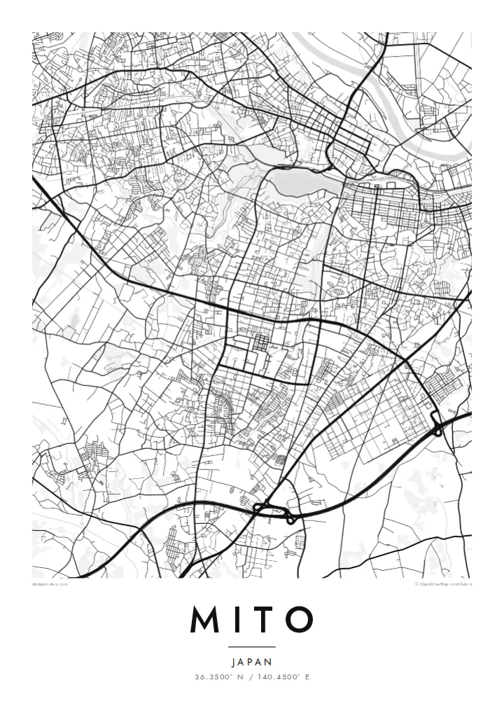
The lake forms a large, smooth oval on the southwest side of the centre. Its shores are lined with walking paths and connect directly to the green of Kairakuen.
Qeeqabak kaartah poster · Japan
36.3500° N / 140.4500° E
A castle town on a narrow plateau between a river and a lake, with a famous plum garden on its western edge.


Inki magaala, konoy gaba
Qande inkih tibbixeeh derre baguley table. Kulli qande missoowa caagid—daabbisimta, dirbaabu-le kaadu HD fayla akah.
 Cagalah pixels · 24 × 36″ daabbi fayla
Maxxaacah qeeqa
Tama usuk cagalah daabbi faylak 100% qambaala. Kulli poster — daabbisimta, dirbaabu-le kaadu download geytimta — ni-server-ittal 300 DPI-l ederimta, 7,200 × 10,800 pixels fanah, tokkel iyyi ellee catoy 24 × 36″ daabbi baxsi bahisak raaqu.
Gidarih


Kaarta
Mito, the capital of Ibaraki Prefecture, grew on a long, narrow plateau. The Naka River runs to the north and Lake Senba lies to the south and west. From above, that setting shapes the whole map. The old centre follows the ridge from east to west, with the river's floodplain on one side and the water and parkland of the lake on the other.
In the Edo period Mito was the seat of one of the three senior branches of the Tokugawa family. Its best-known landmark from that era is Kairakuen, a large garden created in the 1840s and counted among the three great gardens of Japan. It is especially famous for its thousands of plum trees, which bloom in late winter.
A Mito map poster shows the city's unusual long shape. The main streets run along the plateau, the rail lines follow the lowlands, and the broad oval of Lake Senba joins the green of Kairakuen to the west. Modern suburbs spread across the surrounding plains, but the old outline of the castle town is still easy to trace.
The lake forms a large, smooth oval on the southwest side of the centre. Its shores are lined with walking paths and connect directly to the green of Kairakuen.
The famous plum garden occupies a broad open area on the western edge of the old town, overlooking the lake. On the map it appears as a green gap in the streets.
The main streets of the historic centre run along a narrow ridge between river and lake. Together they give the city its long east–west form.
Kok tanim ab
Ayro, migaq hinnay kok tan xagar osis; gaba, ballaqa hinnay xiqa soorris.
Free preview qansarissi kee watermark-le. Daabbisimtaan kee HD fayla 300 DPI-l, 7,200 × 10,800 px fanah, watermark maleh ederimta.
Macah Mito
For people from Ibaraki and anyone who has seen the plum blossom at Kairakuen, this map records the city's defining shape. The lake, garden and plateau sit together in one balanced frame.
Personalise the title, subtitle and coordinates, perhaps with a season or year. Choose one of five styles: Classic black & white, Noir, Paper, Blueprint or Sand. Paper suits the garden-and-lake setting especially well.
Mito poster orme| Maxxaacah ballaqa | Qeeqa | Faylal |
|---|---|---|
| 30 × 40 cm (11.8 × 15.7″) | 3,543 × 4,724 px | PNG · PDF |
| 29.7 × 42 cm (A3, 11.7 × 16.5″) | 3,508 × 4,961 px | PNG · PDF |
| 42 × 59.4 cm (A2, 16.5 × 23.4″) | 4,961 × 7,016 px | PNG · PDF |
| 45.7 × 61 cm (18 × 24″) | 5,400 × 7,200 px | PNG · PDF |
| 50 × 70 cm (19.7 × 27.6″) | 5,906 × 8,268 px | PNG · PDF |
| 61 × 91.4 cm (24 × 36″) | 7,200 × 10,800 px | PNG · PDF |
Tabbaltah, limo-wayta xaqqa-le ablo 900 px ballaqa le, asta le, iskiriinih keh tan. HD faylal gexsoh inkih addal 8× fanah qeeqa le, poster ballaqa inkih addal meqeh maxxaacimta.
Baxxaqqa qari le qandiy dooriy, tohuk lakal Daabbisimtah Poster — kutuk kee, faxximek, dirbaabu — hinnay HD Digital Fayla dooru. Checkout inki wagitti geytima, kaadu ku-orme page keenih adissa akke waqdi caagoy kummite.
Usuk 200 gsm-le catam kutuk warqatal, lica katiy caagitte {printFrom}-ik hane ayta 30 × 40 cm-ik 24 × 36″ fanah, xaagu keenil warreeh.
Ee. Sarrah-le dirbaabu doori — bad, gudduc, oak-le hinnay bad-madabuy. Usuk finqisiimam ellee sange qarab-le kaadu qari umukku iyya keenih taagu. Dirbaabu-le poster {framedFrom}-ik hane, xaagu keenil warreeh.
Xaagu addunyal inkih cisab-le. Kulli poster 30+ ummattak ni-daabbi-mara mananih xayyoysa kaadu 3–7 caagu-ayróh fanah geeytima. Ku-orme kee xaagu tarikiy My Orders addal ablitta.
Geytimeek 14 ayróy addal foto naah rubbaay, cisab-le daabbisiynah hinnay ku-lacay gacisnaah.
Ee. Tama page-l edito addal, migaaq, subtitle kee coordinates sarrah faxxem fanah badal, kaadu qande kee katiy doori. Daabbisimtah, dirbaabu-le kaadu digital orme inkih ku-design cagalah yekkelen.
$9 bacisak 300 DPI PNG kee daabbisimtah adissime PDF fayla lica katiy inkih, watermark maleh, ayyi meki daabbisimtah geeytitta. Cisab makkoysemty ana? Awqak, watermark-le free preview download-eh.
Xayyo
