Railway terminus
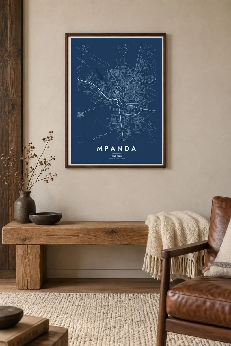
A branch line from Tanzania's central railway ends in Mpanda, and its final stretch appears on the map as a straight line reaching into the town.
Qeeqabak kaartah poster · Tanzania
6.3438° S / 31.0695° E
A regional capital in western Tanzania, its roads spreading through open woodland toward the wide Katavi plains.


Inki magaala, konoy gaba
Qande inkih tibbixeeh derre baguley table. Kulli qande missoowa caagid—daabbisimta, dirbaabu-le kaadu HD fayla akah.
 Cagalah pixels · 24 × 36″ daabbi fayla
Maxxaacah qeeqa
Tama usuk cagalah daabbi faylak 100% qambaala. Kulli poster — daabbisimta, dirbaabu-le kaadu download geytimta — ni-server-ittal 300 DPI-l ederimta, 7,200 × 10,800 pixels fanah, tokkel iyyi ellee catoy 24 × 36″ daabbi baxsi bahisak raaqu.
Gidarih


Kaarta
Mpanda lies in the west of Tanzania and is the administrative centre of Katavi Region, in a landscape of miombo woodland and low hills between Lake Tanganyika and the Rukwa valley. The town is laid out along a few main roads, and the map shows a loose network of streets around a central core, thinning quickly into scattered settlement and fields.
Mpanda is the terminus of a railway branch that connects it with Tanzania's central line, and the tracks end in the town in a clear, straight stroke. To the south lies Katavi National Park, one of the country's more remote wildlife areas, with broad floodplains and seasonal lakes that fill and dry with the rains.
A Mpanda map poster is an understated portrait of a growing regional town, showing its main roads, its railway and the open land still close around it. It suits people from Katavi, those who have worked or taught in the region, and travellers who passed through on their way to the park.
A branch line from Tanzania's central railway ends in Mpanda, and its final stretch appears on the map as a straight line reaching into the town.
The town has grown along a handful of main roads, which form the backbone of the map and lead out toward neighbouring districts and the lake region.
Beyond the centre, streets become sparse and give way to woodland and farmland, leaving a lot of calm, empty space around the town on the map.
Kok tanim ab
Ayro, migaq hinnay kok tan xagar osis; gaba, ballaqa hinnay xiqa soorris.
Free preview qansarissi kee watermark-le. Daabbisimtaan kee HD fayla 300 DPI-l, 7,200 × 10,800 px fanah, watermark maleh ederimta.
Macah Mpanda
For people from Katavi, or for those who spent a posting, a research season or a safari here, a Mpanda map holds real memories. Its simple shape makes an unusual and personal piece for a wall.
Write your own title and subtitle, perhaps with the years you spent there, and adjust the coordinates line. Choose from five styles: Classic black & white, Noir, Paper, Blueprint or Sand, as a $9 download or a printed poster.
Mpanda poster orme| Maxxaacah ballaqa | Qeeqa | Faylal |
|---|---|---|
| 30 × 40 cm (11.8 × 15.7″) | 3,543 × 4,724 px | PNG · PDF |
| 29.7 × 42 cm (A3, 11.7 × 16.5″) | 3,508 × 4,961 px | PNG · PDF |
| 42 × 59.4 cm (A2, 16.5 × 23.4″) | 4,961 × 7,016 px | PNG · PDF |
| 45.7 × 61 cm (18 × 24″) | 5,400 × 7,200 px | PNG · PDF |
| 50 × 70 cm (19.7 × 27.6″) | 5,906 × 8,268 px | PNG · PDF |
| 61 × 91.4 cm (24 × 36″) | 7,200 × 10,800 px | PNG · PDF |
Tabbaltah, limo-wayta xaqqa-le ablo 900 px ballaqa le, asta le, iskiriinih keh tan. HD faylal gexsoh inkih addal 8× fanah qeeqa le, poster ballaqa inkih addal meqeh maxxaacimta.
Baxxaqqa qari le qandiy dooriy, tohuk lakal Daabbisimtah Poster — kutuk kee, faxximek, dirbaabu — hinnay HD Digital Fayla dooru. Checkout inki wagitti geytima, kaadu ku-orme page keenih adissa akke waqdi caagoy kummite.
Usuk 200 gsm-le catam kutuk warqatal, lica katiy caagitte {printFrom}-ik hane ayta 30 × 40 cm-ik 24 × 36″ fanah, xaagu keenil warreeh.
Ee. Sarrah-le dirbaabu doori — bad, gudduc, oak-le hinnay bad-madabuy. Usuk finqisiimam ellee sange qarab-le kaadu qari umukku iyya keenih taagu. Dirbaabu-le poster {framedFrom}-ik hane, xaagu keenil warreeh.
Xaagu addunyal inkih cisab-le. Kulli poster 30+ ummattak ni-daabbi-mara mananih xayyoysa kaadu 3–7 caagu-ayróh fanah geeytima. Ku-orme kee xaagu tarikiy My Orders addal ablitta.
Geytimeek 14 ayróy addal foto naah rubbaay, cisab-le daabbisiynah hinnay ku-lacay gacisnaah.
Ee. Tama page-l edito addal, migaaq, subtitle kee coordinates sarrah faxxem fanah badal, kaadu qande kee katiy doori. Daabbisimtah, dirbaabu-le kaadu digital orme inkih ku-design cagalah yekkelen.
$9 bacisak 300 DPI PNG kee daabbisimtah adissime PDF fayla lica katiy inkih, watermark maleh, ayyi meki daabbisimtah geeytitta. Cisab makkoysemty ana? Awqak, watermark-le free preview download-eh.
Xayyo
