Temple-centred core
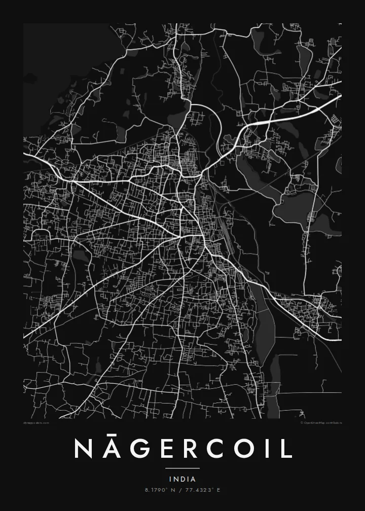
The older town gathers around the Nagaraja Temple and nearby market streets. It is the densest part of the map, and main roads spread out from it.
Qeeqabak kaartah poster · India
8.1790° N / 77.4323° E
India's southern tip, where a temple town meets paddy fields, coconut groves and the last hills of the Western Ghats



Inki magaala, konoy gaba
Qande inkih tibbixeeh derre baguley table. Kulli qande missoowa caagid—daabbisimta, dirbaabu-le kaadu HD fayla akah.
 Cagalah pixels · 24 × 36″ daabbi fayla
Maxxaacah qeeqa
Tama usuk cagalah daabbi faylak 100% qambaala. Kulli poster — daabbisimta, dirbaabu-le kaadu download geytimta — ni-server-ittal 300 DPI-l ederimta, 7,200 × 10,800 pixels fanah, tokkel iyyi ellee catoy 24 × 36″ daabbi baxsi bahisak raaqu.
Gidarih


Kaarta
Nāgercoil is the administrative centre of Kanyakumari district, near the southern end of the Indian peninsula. The town sits in a green basin with the last ridges of the Western Ghats rising to the north and west. On a map, a compact core of busy streets gives way quickly to paddy fields, tanks and coconut plantations, which fill the gaps between neighbouring villages.
The name is linked to the Nagaraja Temple, dedicated to the serpent king, which remains a central landmark. Main roads leave the centre toward Thiruvananthapuram in the northwest, Tirunelveli in the northeast and Kanyakumari, the cape where three seas meet, a short drive to the south. Irrigation channels and water tanks appear across the surrounding plain as small blue shapes.
A Nāgercoil map poster shows a town closely bound to its landscape. Streets fan out from the old centre, water tanks are scattered through the fields, and the terrain begins to rise toward the hills. It is a map of the far south, where the continent narrows and runs out.
The older town gathers around the Nagaraja Temple and nearby market streets. It is the densest part of the map, and main roads spread out from it.
Irrigation tanks and channels dot the surrounding plain. On the poster they appear as scattered, rounded shapes among the fields and roads.
Main roads lead south toward Kanyakumari and north toward the Kerala border. They make clear lines through the green basin at the tip of India.
Kok tanim ab
Ayro, migaq hinnay kok tan xagar osis; gaba, ballaqa hinnay xiqa soorris.
Free preview qansarissi kee watermark-le. Daabbisimtaan kee HD fayla 300 DPI-l, 7,200 × 10,800 px fanah, watermark maleh ederimta.
Macah Nāgercoil
Nāgercoil is home for many people who work in Kerala, Chennai or the Gulf. A poster of its streets and tanks is a quiet link to the southern tip, and it makes a good wedding or housewarming gift.
Write your own title and subtitle, such as a family name or a date, and adjust the coordinates. Then pick Classic black & white, Noir, Paper, Blueprint or Sand.
Nāgercoil poster orme| Maxxaacah ballaqa | Qeeqa | Faylal |
|---|---|---|
| 30 × 40 cm11.8 × 15.7″ | 3,543 × 4,724 px | PNG · PDF |
| 29.7 × 42 cm (A3)11.7 × 16.5″ | 3,508 × 4,961 px | PNG · PDF |
| 42 × 59.4 cm (A2)16.5 × 23.4″ | 4,961 × 7,016 px | PNG · PDF |
| 45.7 × 61 cm18 × 24″ | 5,400 × 7,200 px | PNG · PDF |
| 50 × 70 cm19.7 × 27.6″ | 5,906 × 8,268 px | PNG · PDF |
| 61 × 91.4 cm24 × 36″ | 7,200 × 10,800 px | PNG · PDF |
Tabbaltah, limo-wayta xaqqa-le ablo 900 px ballaqa le, asta le, iskiriinih keh tan. HD faylal gexsoh inkih addal 8× fanah qeeqa le, poster ballaqa inkih addal meqeh maxxaacimta.
Baxxaqqa qari le qandiy dooriy, tohuk lakal Daabbisimtah Poster — kutuk kee, faxximek, dirbaabu — hinnay HD Digital Fayla dooru. Checkout inki wagitti geytima, kaadu ku-orme page keenih adissa akke waqdi caagoy kummite.
Usuk 200 gsm-le catam kutuk warqatal, lica katiy caagitte $39-ik hane ayta 30 × 40 cm-ik 24 × 36″ fanah, xaagu keenil warreeh.
Ee. Sarrah-le dirbaabu doori — bad, gudduc, oak-le hinnay bad-madabuy. Usuk finqisiimam ellee sange qarab-le kaadu qari umukku iyya keenih taagu. Dirbaabu-le poster $99-ik hane, xaagu keenil warreeh.
Dirsa 60+ baaxoh bilsa. Poster kasa 30+ baaxoh nel print kaadu yan kee dirgeh kaxxa kee tanah printa, kee 3–7 xaqu ayyaamah yaaxigeeh. Xaaloo kee tracking "Ac Order" gexsitam. Kaadu baaxo 2–5 isbuuc yaaxigeeh, nanu dirsi yanin baaxoh sajiitah site ku kalah tekkeh.
Geytimeek 14 ayróy addal foto naah rubbaay, cisab-le daabbisiynah hinnay ku-lacay gacisnaah.
Ee. Tama page-l edito addal, migaaq, subtitle kee coordinates sarrah faxxem fanah badal, kaadu qande kee katiy doori. Daabbisimtah, dirbaabu-le kaadu digital orme inkih ku-design cagalah yekkelen.
$9 bacisak 300 DPI PNG kee daabbisimtah adissime PDF fayla lica katiy inkih, watermark maleh, ayyi meki daabbisimtah geeytitta. Cisab makkoysemty ana? Awqak, watermark-le free preview download-eh.
