Junction rail lines
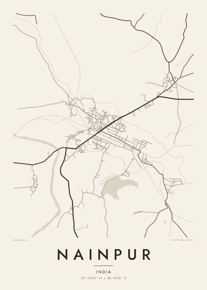
Several railway lines converge on the town, and their long, gently curving tracks and broad yard areas form the most prominent geometry on the map.
Qeeqabak kaartah poster · India
22.4300° N / 80.1056° E
A railway town in the Mandla district, where old junction tracks fan out across flat farmland and low forested ridges.




Inki magaala, konoy gaba
Qande inkih tibbixeeh derre baguley table. Kulli qande missoowa caagid—daabbisimta, dirbaabu-le kaadu HD fayla akah.
 Cagalah pixels · 24 × 36″ daabbi fayla
Maxxaacah qeeqa
Tama usuk cagalah daabbi faylak 100% qambaala. Kulli poster — daabbisimta, dirbaabu-le kaadu download geytimta — ni-server-ittal 300 DPI-l ederimta, 7,200 × 10,800 pixels fanah, tokkel iyyi ellee catoy 24 × 36″ daabbi baxsi bahisak raaqu.
Gidarih


Kaarta
Nainpur sits in the Mandla district of eastern Madhya Pradesh, in the upland country between the Narmada basin and the Satpura hills. On a map the town is a compact knot of streets bound tightly to its railway, with fields pressing in on every side. The lines of track do much of the drawing here, cutting long straight strokes through an otherwise loose, organic pattern of lanes.
For generations Nainpur was known as a junction on the Satpura narrow-gauge network, one of the larger such systems in India. That history still reads in the plan: yards, sidings and approach lines take up a large share of the built area, and the town's growth has followed the tracks rather than a planned grid. Roads leave in several directions toward surrounding villages and district towns.
A Nainpur map poster turns this working geography into a quiet composition. The heavy parallel lines of the railway set against a fine web of residential lanes, fading out into the blank of cultivated land, give the print a clear structure. It is a map shaped by transport rather than by a river or a coastline, and it looks it.
Several railway lines converge on the town, and their long, gently curving tracks and broad yard areas form the most prominent geometry on the map.
Close to the station, streets tighten into a dense, irregular cluster of lanes and markets, the darkest and most detailed part of the print.
Beyond the last houses the map thins quickly into field tracks and scattered villages, leaving generous white space around the town.
Kok tanim ab
Ayro, migaq hinnay kok tan xagar osis; gaba, ballaqa hinnay xiqa soorris.
Free preview qansarissi kee watermark-le. Daabbisimtaan kee HD fayla 300 DPI-l, 7,200 × 10,800 px fanah, watermark maleh ederimta.
Macah Nainpur
For anyone who grew up near the junction, worked on the railway or travelled through it, Nainpur is a place defined by arrivals and departures. A map on the wall keeps that sense of connection close, and it reads as a clean graphic even to guests who have never been there.
You can set your own title and subtitle, add a date that matters or adjust the coordinates line, then pick one of five styles: Classic black and white, Noir, Paper, Blueprint or Sand. Blueprint suits the railway lines particularly well.
Nainpur poster orme| Maxxaacah ballaqa | Qeeqa | Faylal |
|---|---|---|
| 30 × 40 cm11.8 × 15.7″ | 3,543 × 4,724 px | PNG · PDF |
| 29.7 × 42 cm (A3)11.7 × 16.5″ | 3,508 × 4,961 px | PNG · PDF |
| 42 × 59.4 cm (A2)16.5 × 23.4″ | 4,961 × 7,016 px | PNG · PDF |
| 45.7 × 61 cm18 × 24″ | 5,400 × 7,200 px | PNG · PDF |
| 50 × 70 cm19.7 × 27.6″ | 5,906 × 8,268 px | PNG · PDF |
| 61 × 91.4 cm24 × 36″ | 7,200 × 10,800 px | PNG · PDF |
Tabbaltah, limo-wayta xaqqa-le ablo 900 px ballaqa le, asta le, iskiriinih keh tan. HD faylal gexsoh inkih addal 8× fanah qeeqa le, poster ballaqa inkih addal meqeh maxxaacimta.
Baxxaqqa qari le qandiy dooriy, tohuk lakal Daabbisimtah Poster — kutuk kee, faxximek, dirbaabu — hinnay HD Digital Fayla dooru. Checkout inki wagitti geytima, kaadu ku-orme page keenih adissa akke waqdi caagoy kummite.
Usuk 200 gsm-le catam kutuk warqatal, lica katiy caagitte $39-ik hane ayta 30 × 40 cm-ik 24 × 36″ fanah, xaagu keenil warreeh.
Ee. Sarrah-le dirbaabu doori — bad, gudduc, oak-le hinnay bad-madabuy. Usuk finqisiimam ellee sange qarab-le kaadu qari umukku iyya keenih taagu. Dirbaabu-le poster $99-ik hane, xaagu keenil warreeh.
Dirsa 60+ baaxoh bilsa. Poster kasa 30+ baaxoh nel print kaadu yan kee dirgeh kaxxa kee tanah printa, kee 3–7 xaqu ayyaamah yaaxigeeh. Xaaloo kee tracking "Ac Order" gexsitam. Kaadu baaxo 2–5 isbuuc yaaxigeeh, nanu dirsi yanin baaxoh sajiitah site ku kalah tekkeh.
Geytimeek 14 ayróy addal foto naah rubbaay, cisab-le daabbisiynah hinnay ku-lacay gacisnaah.
Ee. Tama page-l edito addal, migaaq, subtitle kee coordinates sarrah faxxem fanah badal, kaadu qande kee katiy doori. Daabbisimtah, dirbaabu-le kaadu digital orme inkih ku-design cagalah yekkelen.
$9 bacisak 300 DPI PNG kee daabbisimtah adissime PDF fayla lica katiy inkih, watermark maleh, ayyi meki daabbisimtah geeytitta. Cisab makkoysemty ana? Awqak, watermark-le free preview download-eh.
Xayyo
