Lake Biwa shoreline
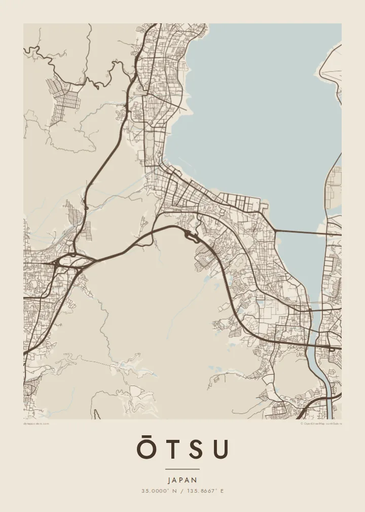
The lake fills a large part of the frame, and the city follows its edge in a long, gently curving strip of streets, promenades and reclaimed waterfront.
Qeeqabak kaartah poster · Japan
35.0000° N / 135.8667° E
A long lakeside city on the southern tip of Lake Biwa, pressed between the water and the slopes of Mount Hiei


Inki magaala, konoy gaba
Qande inkih tibbixeeh derre baguley table. Kulli qande missoowa caagid—daabbisimta, dirbaabu-le kaadu HD fayla akah.
 Cagalah pixels · 24 × 36″ daabbi fayla
Maxxaacah qeeqa
Tama usuk cagalah daabbi faylak 100% qambaala. Kulli poster — daabbisimta, dirbaabu-le kaadu download geytimta — ni-server-ittal 300 DPI-l ederimta, 7,200 × 10,800 pixels fanah, tokkel iyyi ellee catoy 24 × 36″ daabbi baxsi bahisak raaqu.
Gidarih


Kaarta
Ōtsu, the capital of Shiga Prefecture, stretches along the southwestern shore of Lake Biwa, the largest lake in Japan. The city is long and narrow: a band of streets and rail lines squeezed between the lake and the wooded ridges that separate it from Kyoto. On a map the shoreline and the mountains define almost every neighbourhood.
The city's roots run deep. In the seventh century it briefly served as the imperial capital under Emperor Tenji, and above it, on Mount Hiei, stands Enryaku-ji, the head temple of Tendai Buddhism. Closer to the water are Mii-dera and, to the south, Ishiyama-dera, where Murasaki Shikibu is said to have begun The Tale of Genji.
At the lake's southern end the Seta River flows out beneath the old Seta bridge, and the Lake Biwa Canal leaves the city through tunnels towards Kyoto. An Ōtsu map poster traces these lines of water and movement: the shore, the river, the canal and the roads that have linked the lake to the old capital for centuries.
The lake fills a large part of the frame, and the city follows its edge in a long, gently curving strip of streets, promenades and reclaimed waterfront.
At the southern tip the lake narrows into the Seta River, its only natural outlet, crossed by the long Seta no Karahashi bridge that has stood at this point in various forms for centuries.
Behind the city the ground rises sharply into Mount Hiei and the neighbouring hills, where the street grid gives way to forest and winding temple roads.
Kok tanim ab
Ayro, migaq hinnay kok tan xagar osis; gaba, ballaqa hinnay xiqa soorris.
Free preview qansarissi kee watermark-le. Daabbisimtaan kee HD fayla 300 DPI-l, 7,200 × 10,800 px fanah, watermark maleh ederimta.
Macah Ōtsu
Ōtsu appeals to anyone who loves the meeting of water and mountains, and to those who know it from temple visits, lakeside walks or a daily commute to Kyoto. The long shoreline composition works especially well on a tall portrait format.
Personalise the title, subtitle and coordinates, perhaps with a date or a lakeside address, and select one of five styles: Classic black & white, Noir, Paper, Blueprint or Sand. Each style gives the broad shape of the lake a different weight against the streets.
Ōtsu poster orme| Maxxaacah ballaqa | Qeeqa | Faylal |
|---|---|---|
| 30 × 40 cm (11.8 × 15.7″) | 3,543 × 4,724 px | PNG · PDF |
| 29.7 × 42 cm (A3, 11.7 × 16.5″) | 3,508 × 4,961 px | PNG · PDF |
| 42 × 59.4 cm (A2, 16.5 × 23.4″) | 4,961 × 7,016 px | PNG · PDF |
| 45.7 × 61 cm (18 × 24″) | 5,400 × 7,200 px | PNG · PDF |
| 50 × 70 cm (19.7 × 27.6″) | 5,906 × 8,268 px | PNG · PDF |
| 61 × 91.4 cm (24 × 36″) | 7,200 × 10,800 px | PNG · PDF |
Tabbaltah, limo-wayta xaqqa-le ablo 900 px ballaqa le, asta le, iskiriinih keh tan. HD faylal gexsoh inkih addal 8× fanah qeeqa le, poster ballaqa inkih addal meqeh maxxaacimta.
Baxxaqqa qari le qandiy dooriy, tohuk lakal Daabbisimtah Poster — kutuk kee, faxximek, dirbaabu — hinnay HD Digital Fayla dooru. Checkout inki wagitti geytima, kaadu ku-orme page keenih adissa akke waqdi caagoy kummite.
Usuk 200 gsm-le catam kutuk warqatal, lica katiy caagitte {printFrom}-ik hane ayta 30 × 40 cm-ik 24 × 36″ fanah, xaagu keenil warreeh.
Ee. Sarrah-le dirbaabu doori — bad, gudduc, oak-le hinnay bad-madabuy. Usuk finqisiimam ellee sange qarab-le kaadu qari umukku iyya keenih taagu. Dirbaabu-le poster {framedFrom}-ik hane, xaagu keenil warreeh.
Xaagu addunyal inkih cisab-le. Kulli poster 30+ ummattak ni-daabbi-mara mananih xayyoysa kaadu 3–7 caagu-ayróh fanah geeytima. Ku-orme kee xaagu tarikiy My Orders addal ablitta.
Geytimeek 14 ayróy addal foto naah rubbaay, cisab-le daabbisiynah hinnay ku-lacay gacisnaah.
Ee. Tama page-l edito addal, migaaq, subtitle kee coordinates sarrah faxxem fanah badal, kaadu qande kee katiy doori. Daabbisimtah, dirbaabu-le kaadu digital orme inkih ku-design cagalah yekkelen.
$9 bacisak 300 DPI PNG kee daabbisimtah adissime PDF fayla lica katiy inkih, watermark maleh, ayyi meki daabbisimtah geeytitta. Cisab makkoysemty ana? Awqak, watermark-le free preview download-eh.
Xayyo
