Eastern islets
A group of small islands and rocks lies east of Panarea. On the poster they appear as scattered forms around the main island, turning the sea into part of the design.
Qeeqabak kaartah poster · Italy
38.6360° N / 15.0664° E
The smallest inhabited Aeolian island, a compact green shape scattered with islets and rocks off its eastern shore.




Inki magaala, konoy gaba
Qande inkih tibbixeeh derre baguley table. Kulli qande missoowa caagid—daabbisimta, dirbaabu-le kaadu HD fayla akah.
 Cagalah pixels · 24 × 36″ daabbi fayla
Maxxaacah qeeqa
Tama usuk cagalah daabbi faylak 100% qambaala. Kulli poster — daabbisimta, dirbaabu-le kaadu download geytimta — ni-server-ittal 300 DPI-l ederimta, 7,200 × 10,800 pixels fanah, tokkel iyyi ellee catoy 24 × 36″ daabbi baxsi bahisak raaqu.
Gidarih


Kaarta
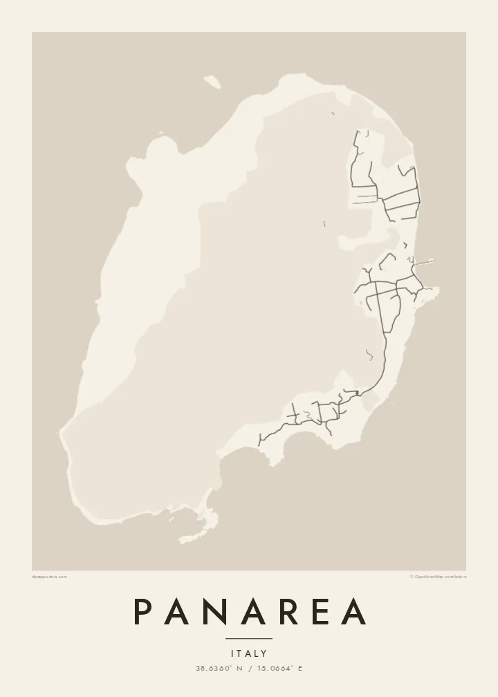
Panarea is the smallest of the inhabited Aeolian Islands, lying between Lipari and Stromboli. Its shape is compact and slightly elongated, with a gentler eastern side where the villages sit and a steep western flank of cliffs. Just offshore to the east, a cluster of islets and rocks, including Basiluzzo, Lisca Bianca and Dattilo, forms a small archipelago of its own.
The island's houses spread along the east coast between San Pietro, where the ferries arrive, and the neighbouring hamlets of Drauto and Ditella. Streets are narrow and cars are largely absent, with small electric vehicles and walking paths doing most of the work. At Capo Milazzese in the south, the remains of a Bronze Age village overlook the sea near the cove of Cala Junco.
A Panarea map poster is an intimate composition, with a thread of lanes along one shore and a scatter of islets offshore that give the sea real presence. The island may be tiny, but the combination of land and fragments around it makes it one of the more intriguing Aeolian shapes to see from above.
A group of small islands and rocks lies east of Panarea. On the poster they appear as scattered forms around the main island, turning the sea into part of the design.
A narrow headland in the south holds the remains of a prehistoric village. It is one of the most distinctive points on the coastline, jutting out beside a small cove.
The main settlement follows the harbour on the east coast with a web of narrow lanes. It is the densest detail on the map and the island's point of arrival.
Kok tanim ab
Ayro, migaq hinnay kok tan xagar osis; gaba, ballaqa hinnay xiqa soorris.
Free preview qansarissi kee watermark-le. Daabbisimtaan kee HD fayla 300 DPI-l, 7,200 × 10,800 px fanah, watermark maleh ederimta.
Macah Panarea
Panarea is a summer island for many, associated with boats, swims around the islets and evenings looking out to Stromboli. A poster keeps that small world in view long after the season has ended and the boats have been pulled ashore.
Add your own title, a subtitle with the dates of a summer, and a custom coordinates line. Choose among Classic black & white, Noir, Paper, Blueprint and Sand. Try the free 900 px watermarked preview first, then order a print or download HD files for $9.
Panarea poster orme| Maxxaacah ballaqa | Qeeqa | Faylal |
|---|---|---|
| 30 × 40 cm (11.8 × 15.7″) | 3,543 × 4,724 px | PNG · PDF |
| 29.7 × 42 cm (A3, 11.7 × 16.5″) | 3,508 × 4,961 px | PNG · PDF |
| 42 × 59.4 cm (A2, 16.5 × 23.4″) | 4,961 × 7,016 px | PNG · PDF |
| 45.7 × 61 cm (18 × 24″) | 5,400 × 7,200 px | PNG · PDF |
| 50 × 70 cm (19.7 × 27.6″) | 5,906 × 8,268 px | PNG · PDF |
| 61 × 91.4 cm (24 × 36″) | 7,200 × 10,800 px | PNG · PDF |
Tabbaltah, limo-wayta xaqqa-le ablo 900 px ballaqa le, asta le, iskiriinih keh tan. HD faylal gexsoh inkih addal 8× fanah qeeqa le, poster ballaqa inkih addal meqeh maxxaacimta.
Baxxaqqa qari le qandiy dooriy, tohuk lakal Daabbisimtah Poster — kutuk kee, faxximek, dirbaabu — hinnay HD Digital Fayla dooru. Checkout inki wagitti geytima, kaadu ku-orme page keenih adissa akke waqdi caagoy kummite.
Usuk 200 gsm-le catam kutuk warqatal, lica katiy caagitte {printFrom}-ik hane ayta 30 × 40 cm-ik 24 × 36″ fanah, xaagu keenil warreeh.
Ee. Sarrah-le dirbaabu doori — bad, gudduc, oak-le hinnay bad-madabuy. Usuk finqisiimam ellee sange qarab-le kaadu qari umukku iyya keenih taagu. Dirbaabu-le poster {framedFrom}-ik hane, xaagu keenil warreeh.
Xaagu addunyal inkih cisab-le. Kulli poster 30+ ummattak ni-daabbi-mara mananih xayyoysa kaadu 3–7 caagu-ayróh fanah geeytima. Ku-orme kee xaagu tarikiy My Orders addal ablitta.
Geytimeek 14 ayróy addal foto naah rubbaay, cisab-le daabbisiynah hinnay ku-lacay gacisnaah.
Ee. Tama page-l edito addal, migaaq, subtitle kee coordinates sarrah faxxem fanah badal, kaadu qande kee katiy doori. Daabbisimtah, dirbaabu-le kaadu digital orme inkih ku-design cagalah yekkelen.
$9 bacisak 300 DPI PNG kee daabbisimtah adissime PDF fayla lica katiy inkih, watermark maleh, ayyi meki daabbisimtah geeytitta. Cisab makkoysemty ana? Awqak, watermark-le free preview download-eh.
Xayyo
