Liao River delta
The river and its branches loop across the flat delta around the city. Their curves soften the otherwise regular street layout.
Qeeqabak kaartah poster · China
41.1210° N / 122.0739° E
A delta city in the Liao River wetlands, surrounded by reed beds, rice paddies and oil fields near the Bohai coast.



Inki magaala, konoy gaba
Qande inkih tibbixeeh derre baguley table. Kulli qande missoowa caagid—daabbisimta, dirbaabu-le kaadu HD fayla akah.
 Cagalah pixels · 24 × 36″ daabbi fayla
Maxxaacah qeeqa
Tama usuk cagalah daabbi faylak 100% qambaala. Kulli poster — daabbisimta, dirbaabu-le kaadu download geytimta — ni-server-ittal 300 DPI-l ederimta, 7,200 × 10,800 pixels fanah, tokkel iyyi ellee catoy 24 × 36″ daabbi baxsi bahisak raaqu.
Gidarih


Kaarta
Panjin lies on the delta of the Liao River in Liaoning province, where the land slopes very gently down to the Bohai Sea. From above, the city is a planned grid on completely flat land, with the Liao River and its branches curving through and around it. The surrounding area is a patchwork of rice paddies, marsh and some of the largest reed beds in Asia.
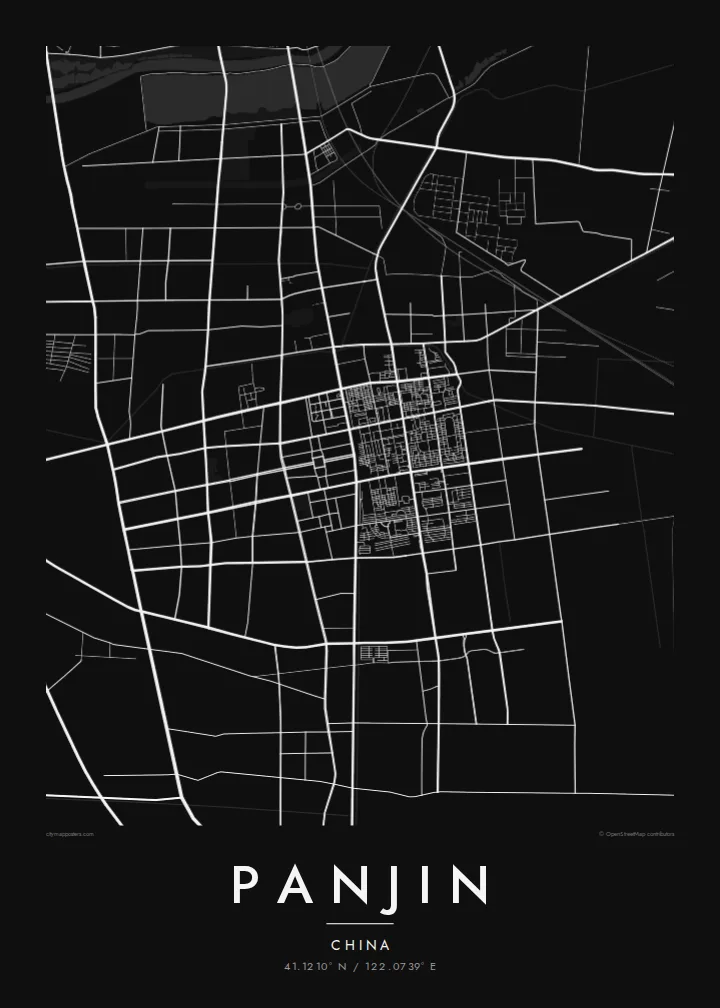
The city was built largely to support the Liaohe Oilfield, which was developed from the 1970s onward. On a Panjin map poster, the wide, straight streets and large rectangular blocks reflect that recent, planned origin. They contrast with the looping river channels and the tidal wetlands to the south.
The delta is best known for the Red Beach, where the tidal flats turn deep red each autumn with a coastal plant called seepweed. The wetlands are also a stopover for migratory birds, including red-crowned cranes. The city itself is inland, but the river's path from the city toward the sea gives the map a strong sense of place.
The river and its branches loop across the flat delta around the city. Their curves soften the otherwise regular street layout.
The city built for the oil field is laid out on wide, straight roads. They form large rectangular blocks, very different from older Chinese city centres.
South of the city, reed beds and tidal flats extend to the Bohai coast. This is where the Red Beach turns red every autumn.
Kok tanim ab
Ayro, migaq hinnay kok tan xagar osis; gaba, ballaqa hinnay xiqa soorris.
Free preview qansarissi kee watermark-le. Daabbisimtaan kee HD fayla 300 DPI-l, 7,200 × 10,800 px fanah, watermark maleh ederimta.
Macah Panjin
Panjin is where river, wetland and city meet, and the delta setting makes for a well-balanced composition. It is a natural choice for people from Liaoning or families linked to the oil field.
Choose Classic black & white, Noir, Paper, Blueprint or Sand, and personalise the title, subtitle and coordinates line. Start with a free 900 px preview, then download the HD files or order a print.
Panjin poster orme| Maxxaacah ballaqa | Qeeqa | Faylal |
|---|---|---|
| 30 × 40 cm (11.8 × 15.7″) | 3,543 × 4,724 px | PNG · PDF |
| 29.7 × 42 cm (A3, 11.7 × 16.5″) | 3,508 × 4,961 px | PNG · PDF |
| 42 × 59.4 cm (A2, 16.5 × 23.4″) | 4,961 × 7,016 px | PNG · PDF |
| 45.7 × 61 cm (18 × 24″) | 5,400 × 7,200 px | PNG · PDF |
| 50 × 70 cm (19.7 × 27.6″) | 5,906 × 8,268 px | PNG · PDF |
| 61 × 91.4 cm (24 × 36″) | 7,200 × 10,800 px | PNG · PDF |
Tabbaltah, limo-wayta xaqqa-le ablo 900 px ballaqa le, asta le, iskiriinih keh tan. HD faylal gexsoh inkih addal 8× fanah qeeqa le, poster ballaqa inkih addal meqeh maxxaacimta.
Baxxaqqa qari le qandiy dooriy, tohuk lakal Daabbisimtah Poster — kutuk kee, faxximek, dirbaabu — hinnay HD Digital Fayla dooru. Checkout inki wagitti geytima, kaadu ku-orme page keenih adissa akke waqdi caagoy kummite.
Usuk 200 gsm-le catam kutuk warqatal, lica katiy caagitte {printFrom}-ik hane ayta 30 × 40 cm-ik 24 × 36″ fanah, xaagu keenil warreeh.
Ee. Sarrah-le dirbaabu doori — bad, gudduc, oak-le hinnay bad-madabuy. Usuk finqisiimam ellee sange qarab-le kaadu qari umukku iyya keenih taagu. Dirbaabu-le poster {framedFrom}-ik hane, xaagu keenil warreeh.
Xaagu addunyal inkih cisab-le. Kulli poster 30+ ummattak ni-daabbi-mara mananih xayyoysa kaadu 3–7 caagu-ayróh fanah geeytima. Ku-orme kee xaagu tarikiy My Orders addal ablitta.
Geytimeek 14 ayróy addal foto naah rubbaay, cisab-le daabbisiynah hinnay ku-lacay gacisnaah.
Ee. Tama page-l edito addal, migaaq, subtitle kee coordinates sarrah faxxem fanah badal, kaadu qande kee katiy doori. Daabbisimtah, dirbaabu-le kaadu digital orme inkih ku-design cagalah yekkelen.
$9 bacisak 300 DPI PNG kee daabbisimtah adissime PDF fayla lica katiy inkih, watermark maleh, ayyi meki daabbisimtah geeytitta. Cisab makkoysemty ana? Awqak, watermark-le free preview download-eh.
Xayyo
