Lahar-shaped riverbeds
The channels draining from the Pinatubo area run through the municipality as wide, braided corridors, left behind by the volcanic sediment that moved down them after the 1991 eruption.
Qeeqabak kaartah poster · Philippines
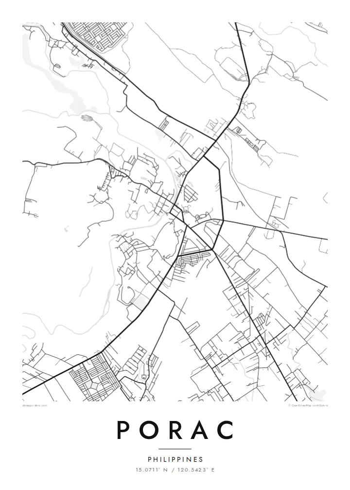
15.0711° N / 120.5423° E
A Pampanga town spreading west from the plain toward the foothills, crossed by wide, pale lahar-scarred riverbeds.


Inki magaala, konoy gaba
Qande inkih tibbixeeh derre baguley table. Kulli qande missoowa caagid—daabbisimta, dirbaabu-le kaadu HD fayla akah.
 Cagalah pixels · 24 × 36″ daabbi fayla
Maxxaacah qeeqa
Tama usuk cagalah daabbi faylak 100% qambaala. Kulli poster — daabbisimta, dirbaabu-le kaadu download geytimta — ni-server-ittal 300 DPI-l ederimta, 7,200 × 10,800 pixels fanah, tokkel iyyi ellee catoy 24 × 36″ daabbi baxsi bahisak raaqu.
Gidarih


Kaarta
Porac lies on the western edge of the Central Luzon plain, where flat rice land starts to rise toward the Zambales Mountains. From above, the town centre is a compact cluster of streets, while barangays spread outward along roads, the lines between them filled with fields. To the west the land becomes rougher and the street pattern thins out.
The town's recent history is written on its rivers. After Mount Pinatubo erupted in 1991, lahar flows moved down the channels that drain the volcano's slopes and buried large areas of Porac under volcanic sediment. On a map, the Porac River and nearby waterways show up as unusually wide, braided corridors, much broader than the water they usually carry.
A Porac map poster captures a place that rebuilt on new ground. The regular grid of the centre, the scattered villages and the broad riverbeds together describe a town between plain and mountain. In monochrome the sand channels read as pale bands running across the fields. The result is a record of change as much as of streets.
The channels draining from the Pinatubo area run through the municipality as wide, braided corridors, left behind by the volcanic sediment that moved down them after the 1991 eruption.
The poblacion forms a small, orderly block of streets, the densest part of the map and the point from which roads spread out to the surrounding barangays.
West of the centre, settlement thins and the roads start to wind. The map shows the change from flat Pampanga farmland to the uplands below the Zambales range.
Kok tanim ab
Ayro, migaq hinnay kok tan xagar osis; gaba, ballaqa hinnay xiqa soorris.
Free preview qansarissi kee watermark-le. Daabbisimtaan kee HD fayla 300 DPI-l, 7,200 × 10,800 px fanah, watermark maleh ederimta.
Macah Porac
For families from Porac, and those who have moved away, this map carries the town's story of loss and rebuilding. It works as a quiet reminder of home, and the braided riverbeds make an unusual composition that visitors ask about.
Add a barangay name, a family name or an important date to the title and subtitle, and adjust the coordinates line. Pick one of five styles, from Classic black & white to Sand. Order it as a matte print, framed or unframed, or download the files for $9.
Porac poster orme| Maxxaacah ballaqa | Qeeqa | Faylal |
|---|---|---|
| 30 × 40 cm11.8 × 15.7″ | 3,543 × 4,724 px | PNG · PDF |
| 29.7 × 42 cm (A3)11.7 × 16.5″ | 3,508 × 4,961 px | PNG · PDF |
| 42 × 59.4 cm (A2)16.5 × 23.4″ | 4,961 × 7,016 px | PNG · PDF |
| 45.7 × 61 cm18 × 24″ | 5,400 × 7,200 px | PNG · PDF |
| 50 × 70 cm19.7 × 27.6″ | 5,906 × 8,268 px | PNG · PDF |
| 61 × 91.4 cm24 × 36″ | 7,200 × 10,800 px | PNG · PDF |
Tabbaltah, limo-wayta xaqqa-le ablo 900 px ballaqa le, asta le, iskiriinih keh tan. HD faylal gexsoh inkih addal 8× fanah qeeqa le, poster ballaqa inkih addal meqeh maxxaacimta.
Baxxaqqa qari le qandiy dooriy, tohuk lakal Daabbisimtah Poster — kutuk kee, faxximek, dirbaabu — hinnay HD Digital Fayla dooru. Checkout inki wagitti geytima, kaadu ku-orme page keenih adissa akke waqdi caagoy kummite.
Usuk 200 gsm-le catam kutuk warqatal, lica katiy caagitte $39-ik hane ayta 30 × 40 cm-ik 24 × 36″ fanah, xaagu keenil warreeh.
Ee. Sarrah-le dirbaabu doori — bad, gudduc, oak-le hinnay bad-madabuy. Usuk finqisiimam ellee sange qarab-le kaadu qari umukku iyya keenih taagu. Dirbaabu-le poster $99-ik hane, xaagu keenil warreeh.
Dirsa 60+ baaxoh bilsa. Poster kasa 30+ baaxoh nel print kaadu yan kee dirgeh kaxxa kee tanah printa, kee 3–7 xaqu ayyaamah yaaxigeeh. Xaaloo kee tracking "Ac Order" gexsitam. Kaadu baaxo 2–5 isbuuc yaaxigeeh, nanu dirsi yanin baaxoh sajiitah site ku kalah tekkeh.
Geytimeek 14 ayróy addal foto naah rubbaay, cisab-le daabbisiynah hinnay ku-lacay gacisnaah.
Ee. Tama page-l edito addal, migaaq, subtitle kee coordinates sarrah faxxem fanah badal, kaadu qande kee katiy doori. Daabbisimtah, dirbaabu-le kaadu digital orme inkih ku-design cagalah yekkelen.
$9 bacisak 300 DPI PNG kee daabbisimtah adissime PDF fayla lica katiy inkih, watermark maleh, ayyi meki daabbisimtah geeytitta. Cisab makkoysemty ana? Awqak, watermark-le free preview download-eh.
