Bonny River waterfront
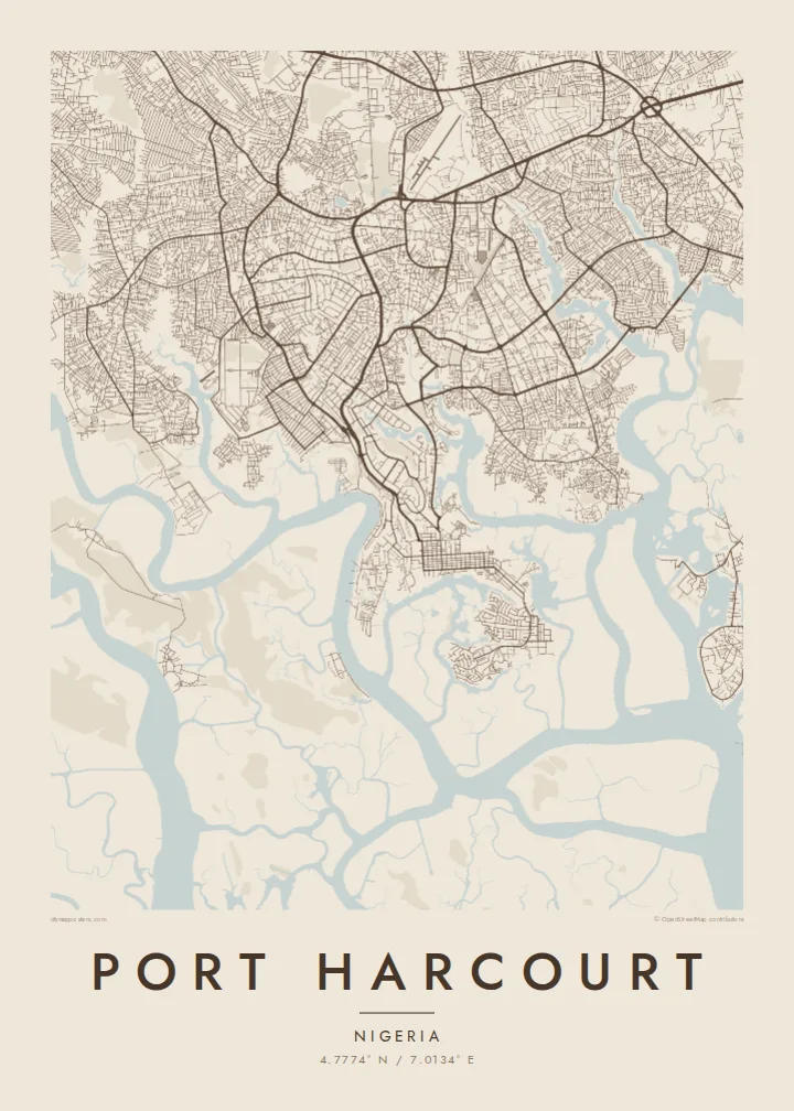
The river and its estuary border the city to the south and east, where port facilities and waterside settlements line up along the shore.
Qeeqabak kaartah poster · Nigeria
4.7774° N / 7.0134° E
A delta city surrounded by creeks and mangroves on the Bonny River, its streets bending around water on every side.


Inki magaala, konoy gaba
Qande inkih tibbixeeh derre baguley table. Kulli qande missoowa caagid—daabbisimta, dirbaabu-le kaadu HD fayla akah.
 Cagalah pixels · 24 × 36″ daabbi fayla
Maxxaacah qeeqa
Tama usuk cagalah daabbi faylak 100% qambaala. Kulli poster — daabbisimta, dirbaabu-le kaadu download geytimta — ni-server-ittal 300 DPI-l ederimta, 7,200 × 10,800 pixels fanah, tokkel iyyi ellee catoy 24 × 36″ daabbi baxsi bahisak raaqu.
Gidarih


Kaarta
Port Harcourt was founded by the British in 1912 as a port for exporting coal from Enugu, and it grew into the centre of Nigeria's oil industry and the capital of Rivers State. The city sits in the Niger Delta on the Bonny River estuary, and water is everywhere on its map, in creeks, inlets and swampy ground that shaped how every district was built.
The older parts of the city, including the Old Township and the Government Reservation Areas, show the more ordered street patterns of the colonial layout. Beyond them, neighbourhoods spread north and east along main roads, often stopping at the edges of creeks and mangrove channels that cut deep into the land.
Its many parks and planted avenues earned Port Harcourt the nickname Garden City. A Port Harcourt map poster shows a city defined by the delta, with branching waterways and irregular shorelines giving the print a character quite different from inland grids, and with the river and port always close to the centre of the frame.
The river and its estuary border the city to the south and east, where port facilities and waterside settlements line up along the shore.
Narrow tidal channels thread between districts, drawing irregular, winding lines that break the street network into islands and peninsulas and give the map its delta texture.
The historic core near the waterfront keeps a denser, more regular block pattern, the original layout from which the rest of the city expanded.
Kok tanim ab
Ayro, migaq hinnay kok tan xagar osis; gaba, ballaqa hinnay xiqa soorris.
Free preview qansarissi kee watermark-le. Daabbisimtaan kee HD fayla 300 DPI-l, 7,200 × 10,800 px fanah, watermark maleh ederimta.
Macah Port Harcourt
Port Harcourt means work, family and a particular way of living with water. For people who have moved away from Rivers State, a map of the Garden City keeps the creeks, estates and familiar roads within sight every day.
Add a title, subtitle and coordinates line of your choice, and pick Classic black & white, Noir, Paper, Blueprint or Sand. Blueprint shows the waterways crisply. A free watermarked preview is available before you buy the $9 HD files or a framed print.
Port Harcourt poster orme| Maxxaacah ballaqa | Qeeqa | Faylal |
|---|---|---|
| 30 × 40 cm11.8 × 15.7″ | 3,543 × 4,724 px | PNG · PDF |
| 29.7 × 42 cm (A3)11.7 × 16.5″ | 3,508 × 4,961 px | PNG · PDF |
| 42 × 59.4 cm (A2)16.5 × 23.4″ | 4,961 × 7,016 px | PNG · PDF |
| 45.7 × 61 cm18 × 24″ | 5,400 × 7,200 px | PNG · PDF |
| 50 × 70 cm19.7 × 27.6″ | 5,906 × 8,268 px | PNG · PDF |
| 61 × 91.4 cm24 × 36″ | 7,200 × 10,800 px | PNG · PDF |
Tabbaltah, limo-wayta xaqqa-le ablo 900 px ballaqa le, asta le, iskiriinih keh tan. HD faylal gexsoh inkih addal 8× fanah qeeqa le, poster ballaqa inkih addal meqeh maxxaacimta.
Baxxaqqa qari le qandiy dooriy, tohuk lakal Daabbisimtah Poster — kutuk kee, faxximek, dirbaabu — hinnay HD Digital Fayla dooru. Checkout inki wagitti geytima, kaadu ku-orme page keenih adissa akke waqdi caagoy kummite.
Usuk 200 gsm-le catam kutuk warqatal, lica katiy caagitte $39-ik hane ayta 30 × 40 cm-ik 24 × 36″ fanah, xaagu keenil warreeh.
Ee. Sarrah-le dirbaabu doori — bad, gudduc, oak-le hinnay bad-madabuy. Usuk finqisiimam ellee sange qarab-le kaadu qari umukku iyya keenih taagu. Dirbaabu-le poster $99-ik hane, xaagu keenil warreeh.
Dirsa 60+ baaxoh bilsa. Poster kasa 30+ baaxoh nel print kaadu yan kee dirgeh kaxxa kee tanah printa, kee 3–7 xaqu ayyaamah yaaxigeeh. Xaaloo kee tracking "Ac Order" gexsitam. Kaadu baaxo 2–5 isbuuc yaaxigeeh, nanu dirsi yanin baaxoh sajiitah site ku kalah tekkeh.
Geytimeek 14 ayróy addal foto naah rubbaay, cisab-le daabbisiynah hinnay ku-lacay gacisnaah.
Ee. Tama page-l edito addal, migaaq, subtitle kee coordinates sarrah faxxem fanah badal, kaadu qande kee katiy doori. Daabbisimtah, dirbaabu-le kaadu digital orme inkih ku-design cagalah yekkelen.
$9 bacisak 300 DPI PNG kee daabbisimtah adissime PDF fayla lica katiy inkih, watermark maleh, ayyi meki daabbisimtah geeytitta. Cisab makkoysemty ana? Awqak, watermark-le free preview download-eh.
Xayyo
