Historic centre
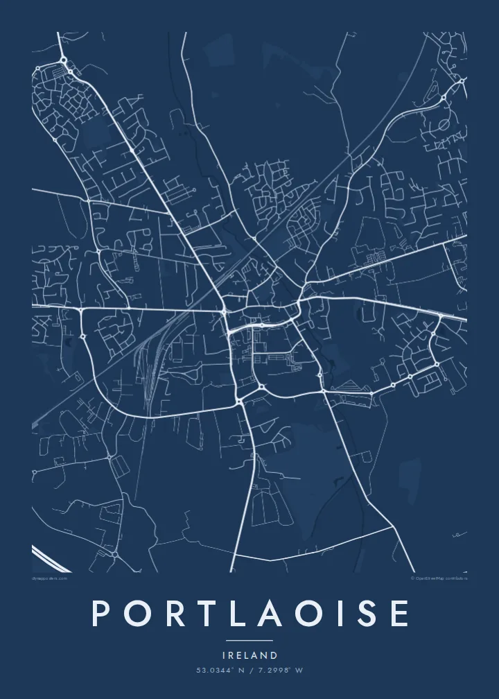
The old centre, which grew around the site of a sixteenth-century fort, is a compact cluster of streets. It forms the dense heart of the poster.
Qeeqabak kaartah poster · Ireland
53.0344° N / 7.2998° W
The county town of Laois, a compact centre ringed by roads and newer estates in the Irish midlands.



Inki magaala, konoy gaba
Qande inkih tibbixeeh derre baguley table. Kulli qande missoowa caagid—daabbisimta, dirbaabu-le kaadu HD fayla akah.
 Cagalah pixels · 24 × 36″ daabbi fayla
Maxxaacah qeeqa
Tama usuk cagalah daabbi faylak 100% qambaala. Kulli poster — daabbisimta, dirbaabu-le kaadu download geytimta — ni-server-ittal 300 DPI-l ederimta, 7,200 × 10,800 pixels fanah, tokkel iyyi ellee catoy 24 × 36″ daabbi baxsi bahisak raaqu.
Gidarih


Kaarta
Portlaoise is the county town of Laois, in the midlands of Ireland. Its origins go back to a sixteenth-century fort, and the town was known as Maryborough until the early twentieth century. On the map, the older centre is a compact cluster of streets, surrounded by a ring of newer residential estates with curving roads and cul-de-sacs.
The M7 motorway runs south of the town, and the Dublin–Cork railway line passes through it, giving the plan two strong long lines. Roads radiate from the centre toward neighbouring towns. The land around is flat to gently rolling farmland, with the Slieve Bloom Mountains to the northwest and the Rock of Dunamase a few kilometres east.
A Portlaoise map poster shows the typical growth of an Irish county town: a small historic core, a railway, a motorway and newer estates filling the space between them. In black and white, the different layers of the town read clearly, making it a considered print for people who live there or commute from it.
The old centre, which grew around the site of a sixteenth-century fort, is a compact cluster of streets. It forms the dense heart of the poster.
The Dublin–Cork railway and the M7 motorway run past the town in long lines. They give the composition a strong sense of direction and connection.
Newer housing estates surround the centre with curving roads and cul-de-sacs. Their looping shapes contrast with the straighter streets of the old town.
Kok tanim ab
Ayro, migaq hinnay kok tan xagar osis; gaba, ballaqa hinnay xiqa soorris.
Free preview qansarissi kee watermark-le. Daabbisimtaan kee HD fayla 300 DPI-l, 7,200 × 10,800 px fanah, watermark maleh ederimta.
Macah Portlaoise
Portlaoise is home to many people who commute to Dublin and to families rooted in Laois for generations. A map of the town is a personal way to mark a house, a hometown or a move to the midlands.
You can personalise the title, subtitle and coordinates line, and choose one of five styles: Classic black & white, Noir, Paper, Blueprint or Sand. Download six HD sizes for $9, or order a printed poster shipped from partners in over 30 countries.
Portlaoise poster orme| Maxxaacah ballaqa | Qeeqa | Faylal |
|---|---|---|
| 30 × 40 cm (11.8 × 15.7″) | 3,543 × 4,724 px | PNG · PDF |
| 29.7 × 42 cm (A3, 11.7 × 16.5″) | 3,508 × 4,961 px | PNG · PDF |
| 42 × 59.4 cm (A2, 16.5 × 23.4″) | 4,961 × 7,016 px | PNG · PDF |
| 45.7 × 61 cm (18 × 24″) | 5,400 × 7,200 px | PNG · PDF |
| 50 × 70 cm (19.7 × 27.6″) | 5,906 × 8,268 px | PNG · PDF |
| 61 × 91.4 cm (24 × 36″) | 7,200 × 10,800 px | PNG · PDF |
Tabbaltah, limo-wayta xaqqa-le ablo 900 px ballaqa le, asta le, iskiriinih keh tan. HD faylal gexsoh inkih addal 8× fanah qeeqa le, poster ballaqa inkih addal meqeh maxxaacimta.
Baxxaqqa qari le qandiy dooriy, tohuk lakal Daabbisimtah Poster — kutuk kee, faxximek, dirbaabu — hinnay HD Digital Fayla dooru. Checkout inki wagitti geytima, kaadu ku-orme page keenih adissa akke waqdi caagoy kummite.
Usuk 200 gsm-le catam kutuk warqatal, lica katiy caagitte {printFrom}-ik hane ayta 30 × 40 cm-ik 24 × 36″ fanah, xaagu keenil warreeh.
Ee. Sarrah-le dirbaabu doori — bad, gudduc, oak-le hinnay bad-madabuy. Usuk finqisiimam ellee sange qarab-le kaadu qari umukku iyya keenih taagu. Dirbaabu-le poster {framedFrom}-ik hane, xaagu keenil warreeh.
Shipping is free worldwide. Each poster is printed by the nearest of our print partners in 30+ countries and usually arrives in 3–7 business days. You can follow the status and tracking under My Orders. A few countries take 2–5 weeks, and where we don't ship yet, the site tells you before you pay.
Geytimeek 14 ayróy addal foto naah rubbaay, cisab-le daabbisiynah hinnay ku-lacay gacisnaah.
Ee. Tama page-l edito addal, migaaq, subtitle kee coordinates sarrah faxxem fanah badal, kaadu qande kee katiy doori. Daabbisimtah, dirbaabu-le kaadu digital orme inkih ku-design cagalah yekkelen.
$9 bacisak 300 DPI PNG kee daabbisimtah adissime PDF fayla lica katiy inkih, watermark maleh, ayyi meki daabbisimtah geeytitta. Cisab makkoysemty ana? Awqak, watermark-le free preview download-eh.
