Ribble riverside
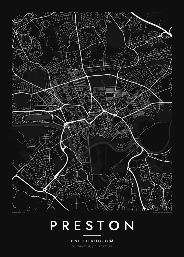
The River Ribble curves along the southern edge, with Avenham and Miller Parks sloping down to meet it, forming a green band beneath the dense centre.
Qeeqabak kaartah poster · United Kingdom
53.7628° N / 2.7045° W
A Lancashire city above a curve of the Ribble, with riverside parks below the centre and a marina to the west.



Inki magaala, konoy gaba
Qande inkih tibbixeeh derre baguley table. Kulli qande missoowa caagid—daabbisimta, dirbaabu-le kaadu HD fayla akah.
 Cagalah pixels · 24 × 36″ daabbi fayla
Maxxaacah qeeqa
Tama usuk cagalah daabbi faylak 100% qambaala. Kulli poster — daabbisimta, dirbaabu-le kaadu download geytimta — ni-server-ittal 300 DPI-l ederimta, 7,200 × 10,800 pixels fanah, tokkel iyyi ellee catoy 24 × 36″ daabbi baxsi bahisak raaqu.
Gidarih


Kaarta
Preston stands on rising ground on the north bank of the River Ribble, and the river's broad curve forms the southern edge of the city on the map. The centre is compact, with streets converging on the market area and the Flag Market, while terraced neighbourhoods spread north and east in tight parallel rows typical of a Lancashire mill town.
Below the centre, Avenham and Miller Parks slope down to the riverbank in green terraces, and to the west the former dock has become a marina off the Ribble. Preston gained city status in 2002, is home to the University of Central Lancashire, and holds the Preston Guild once every twenty years, a tradition reaching back to the Middle Ages.
The M6 skirts the city to the east; its Preston bypass section, opened in 1958, was the first stretch of motorway in Britain. On a Preston map poster, that motorway, the rail lines and the Lancaster Canal add long lines through the grid, while the river and parks give the composition a soft, open base.
The River Ribble curves along the southern edge, with Avenham and Miller Parks sloping down to meet it, forming a green band beneath the dense centre.
West of the centre, the rectangular former dock basin connects to the river, an unmistakable geometric shape among the curves of the surrounding streets.
Rows of Victorian terraced houses run in tight parallel lines north and east of the centre, giving the map its fine, even texture.
Kok tanim ab
Ayro, migaq hinnay kok tan xagar osis; gaba, ballaqa hinnay xiqa soorris.
Free preview qansarissi kee watermark-le. Daabbisimtaan kee HD fayla 300 DPI-l, 7,200 × 10,800 px fanah, watermark maleh ederimta.
Macah Preston
Preston is where many people studied, started work or grew up, and a map poster keeps the shape of those streets close. It is a considered piece for a living room or office, especially for anyone who knows the walk down through the parks to the river.
Personalise the title, subtitle and coordinates, perhaps with a Guild year or a graduation date, and choose from Classic black & white, Noir, Paper, Blueprint or Sand. Digital files are $9 with six sizes included, and printed posters come on matte paper, framed if you like.
Preston poster orme| Maxxaacah ballaqa | Qeeqa | Faylal |
|---|---|---|
| 30 × 40 cm (11.8 × 15.7″) | 3,543 × 4,724 px | PNG · PDF |
| 29.7 × 42 cm (A3, 11.7 × 16.5″) | 3,508 × 4,961 px | PNG · PDF |
| 42 × 59.4 cm (A2, 16.5 × 23.4″) | 4,961 × 7,016 px | PNG · PDF |
| 45.7 × 61 cm (18 × 24″) | 5,400 × 7,200 px | PNG · PDF |
| 50 × 70 cm (19.7 × 27.6″) | 5,906 × 8,268 px | PNG · PDF |
| 61 × 91.4 cm (24 × 36″) | 7,200 × 10,800 px | PNG · PDF |
Tabbaltah, limo-wayta xaqqa-le ablo 900 px ballaqa le, asta le, iskiriinih keh tan. HD faylal gexsoh inkih addal 8× fanah qeeqa le, poster ballaqa inkih addal meqeh maxxaacimta.
Baxxaqqa qari le qandiy dooriy, tohuk lakal Daabbisimtah Poster — kutuk kee, faxximek, dirbaabu — hinnay HD Digital Fayla dooru. Checkout inki wagitti geytima, kaadu ku-orme page keenih adissa akke waqdi caagoy kummite.
Usuk 200 gsm-le catam kutuk warqatal, lica katiy caagitte $39-ik hane ayta 30 × 40 cm-ik 24 × 36″ fanah, xaagu keenil warreeh.
Ee. Sarrah-le dirbaabu doori — bad, gudduc, oak-le hinnay bad-madabuy. Usuk finqisiimam ellee sange qarab-le kaadu qari umukku iyya keenih taagu. Dirbaabu-le poster $99-ik hane, xaagu keenil warreeh.
Shipping is free worldwide. Each poster is printed by the nearest of our print partners in 30+ countries and usually arrives in 3–7 business days. You can follow the status and tracking under My Orders. A few countries take 2–5 weeks, and where we don't ship yet, the site tells you before you pay.
Geytimeek 14 ayróy addal foto naah rubbaay, cisab-le daabbisiynah hinnay ku-lacay gacisnaah.
Ee. Tama page-l edito addal, migaaq, subtitle kee coordinates sarrah faxxem fanah badal, kaadu qande kee katiy doori. Daabbisimtah, dirbaabu-le kaadu digital orme inkih ku-design cagalah yekkelen.
$9 bacisak 300 DPI PNG kee daabbisimtah adissime PDF fayla lica katiy inkih, watermark maleh, ayyi meki daabbisimtah geeytitta. Cisab makkoysemty ana? Awqak, watermark-le free preview download-eh.
