River confluence
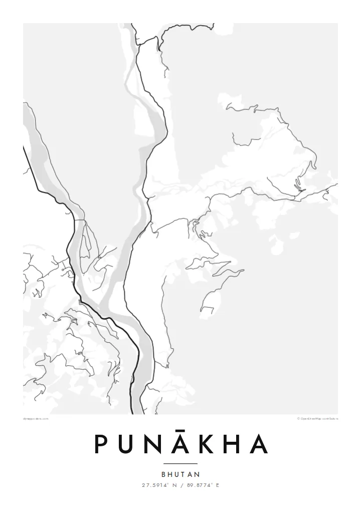
The Pho Chhu and Mo Chhu, often called the father and mother rivers, join just below the dzong and continue down the valley as a single, wider channel.
Qeeqabak kaartah poster · Bhutan
27.5914° N / 89.8774° E
Two glacial rivers meeting on a warm valley floor, with a fortress set on the point of land where they join.


Inki magaala, konoy gaba
Qande inkih tibbixeeh derre baguley table. Kulli qande missoowa caagid—daabbisimta, dirbaabu-le kaadu HD fayla akah.
 Cagalah pixels · 24 × 36″ daabbi fayla
Maxxaacah qeeqa
Tama usuk cagalah daabbi faylak 100% qambaala. Kulli poster — daabbisimta, dirbaabu-le kaadu download geytimta — ni-server-ittal 300 DPI-l ederimta, 7,200 × 10,800 pixels fanah, tokkel iyyi ellee catoy 24 × 36″ daabbi baxsi bahisak raaqu.
Gidarih


Kaarta
Punākha sits low for Bhutan, in a broad valley at around 1,200 metres where the Pho Chhu and the Mo Chhu flow together. From above, the two rivers make up most of the picture: pale ribbons braiding across gravel bars, then merging into one channel that heads south. Roads keep to the valley sides, and houses gather on the few flat terraces the slopes allow.
On the narrow spit between the rivers stands Punākha Dzong. This fortress-monastery was the seat of government while Punākha served as Bhutan's capital, a role it held until the 1950s, and it is still the winter residence of the country's central monastic body. On the map the dzong is a compact block pressed against the water, reached by a covered bridge across the Mo Chhu.
A Punākha map poster keeps that geography plain. There is no dense grid to fill the frame, so the rivers, the valley road and the scattered lanes of the modern town carry the drawing. The result is quieter than most city maps and closer to a landscape study, with the confluence as its natural centre of gravity.
The Pho Chhu and Mo Chhu, often called the father and mother rivers, join just below the dzong and continue down the valley as a single, wider channel.
The fortress fills the tip of land between the two rivers. Its position makes it one of the most recognisable shapes on any map of the valley.
Near the dzong, a long pedestrian suspension bridge crosses the Pho Chhu. It is a thin, taut line on the map linking the paths and villages on either bank.
Kok tanim ab
Ayro, migaq hinnay kok tan xagar osis; gaba, ballaqa hinnay xiqa soorris.
Free preview qansarissi kee watermark-le. Daabbisimtaan kee HD fayla 300 DPI-l, 7,200 × 10,800 px fanah, watermark maleh ederimta.
Macah Punākha
People who have walked or travelled through western Bhutan often want something that recalls the whole valley rather than a single photograph. A map of Punākha does this with line alone: two rivers, one fortress and a road following the water. It suits a study, a hallway or any corner where detail can be read slowly.
You can set your own title and subtitle, and replace the coordinates line with a date or a note about the journey. There are five styles: Classic black & white, Noir, Paper, Blueprint and Sand. Paper and Sand suit the softer valley light. Download the HD files for $9 or order a matte print, framed or unframed.
Punākha poster orme| Maxxaacah ballaqa | Qeeqa | Faylal |
|---|---|---|
| 30 × 40 cm11.8 × 15.7″ | 3,543 × 4,724 px | PNG · PDF |
| 29.7 × 42 cm (A3)11.7 × 16.5″ | 3,508 × 4,961 px | PNG · PDF |
| 42 × 59.4 cm (A2)16.5 × 23.4″ | 4,961 × 7,016 px | PNG · PDF |
| 45.7 × 61 cm18 × 24″ | 5,400 × 7,200 px | PNG · PDF |
| 50 × 70 cm19.7 × 27.6″ | 5,906 × 8,268 px | PNG · PDF |
| 61 × 91.4 cm24 × 36″ | 7,200 × 10,800 px | PNG · PDF |
Tabbaltah, limo-wayta xaqqa-le ablo 900 px ballaqa le, asta le, iskiriinih keh tan. HD faylal gexsoh inkih addal 8× fanah qeeqa le, poster ballaqa inkih addal meqeh maxxaacimta.
Baxxaqqa qari le qandiy dooriy, tohuk lakal Daabbisimtah Poster — kutuk kee, faxximek, dirbaabu — hinnay HD Digital Fayla dooru. Checkout inki wagitti geytima, kaadu ku-orme page keenih adissa akke waqdi caagoy kummite.
Usuk 200 gsm-le catam kutuk warqatal, lica katiy caagitte $39-ik hane ayta 30 × 40 cm-ik 24 × 36″ fanah, xaagu keenil warreeh.
Ee. Sarrah-le dirbaabu doori — bad, gudduc, oak-le hinnay bad-madabuy. Usuk finqisiimam ellee sange qarab-le kaadu qari umukku iyya keenih taagu. Dirbaabu-le poster $99-ik hane, xaagu keenil warreeh.
Dirsa 60+ baaxoh bilsa. Poster kasa 30+ baaxoh nel print kaadu yan kee dirgeh kaxxa kee tanah printa, kee 3–7 xaqu ayyaamah yaaxigeeh. Xaaloo kee tracking "Ac Order" gexsitam. Kaadu baaxo 2–5 isbuuc yaaxigeeh, nanu dirsi yanin baaxoh sajiitah site ku kalah tekkeh.
Geytimeek 14 ayróy addal foto naah rubbaay, cisab-le daabbisiynah hinnay ku-lacay gacisnaah.
Ee. Tama page-l edito addal, migaaq, subtitle kee coordinates sarrah faxxem fanah badal, kaadu qande kee katiy doori. Daabbisimtah, dirbaabu-le kaadu digital orme inkih ku-design cagalah yekkelen.
$9 bacisak 300 DPI PNG kee daabbisimtah adissime PDF fayla lica katiy inkih, watermark maleh, ayyi meki daabbisimtah geeytitta. Cisab makkoysemty ana? Awqak, watermark-le free preview download-eh.
