Highway 307
The main road runs a short way inland, almost parallel to the coast. It is a single strong line with short spurs leading down to the beaches and resorts.
Qeeqabak kaartah poster · Mexico
20.5805° N / 87.1175° W
A long Caribbean shoreline of beaches and reef, running south from Cancún with one highway parallel to the sea


Inki magaala, konoy gaba
Qande inkih tibbixeeh derre baguley table. Kulli qande missoowa caagid—daabbisimta, dirbaabu-le kaadu HD fayla akah.
 Cagalah pixels · 24 × 36″ daabbi fayla
Maxxaacah qeeqa
Tama usuk cagalah daabbi faylak 100% qambaala. Kulli poster — daabbisimta, dirbaabu-le kaadu download geytimta — ni-server-ittal 300 DPI-l ederimta, 7,200 × 10,800 pixels fanah, tokkel iyyi ellee catoy 24 × 36″ daabbi baxsi bahisak raaqu.
Gidarih


Kaarta
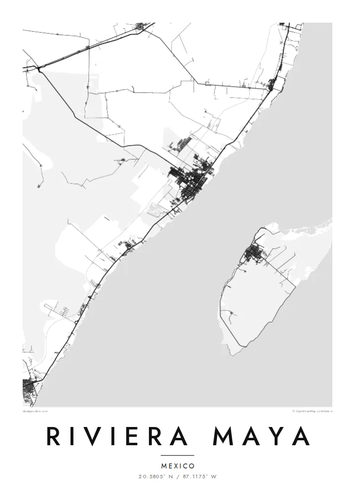
The Riviera Maya follows the Caribbean coast of the Mexican state of Quintana Roo, usually counted from just south of Cancún down to Tulum and beyond. The land here is flat limestone with almost no rivers on the surface, so the map looks strikingly simple: a long, gently curving coastline, with Federal Highway 307 running a little inland and almost parallel to it.
The water moves underground instead, through large cave systems that open up as cenotes, sinkholes scattered through the forest. Offshore, the Mesoamerican Barrier Reef follows the coast, and the island of Cozumel lies across a channel from Playa del Carmen. At Tulum, the ruins of a walled Maya city stand on a cliff directly above the sea.
A Riviera Maya map poster captures this linear structure. Playa del Carmen's street grid spreads out from the ferry pier, access roads to the resorts branch toward the beaches like the teeth of a comb, and lagoons and small bays break the shoreline here and there. Where the frame reaches it, Cozumel appears as a large shape offshore.
The main road runs a short way inland, almost parallel to the coast. It is a single strong line with short spurs leading down to the beaches and resorts.
The walled Maya site sits on a low cliff above the Caribbean, a small enclosure on the shore to the east of the modern town.
Across a strait from Playa del Carmen lies Cozumel, Mexico's largest Caribbean island, with its town of San Miguel facing the mainland.
Kok tanim ab
Ayro, migaq hinnay kok tan xagar osis; gaba, ballaqa hinnay xiqa soorris.
Free preview qansarissi kee watermark-le. Daabbisimtaan kee HD fayla 300 DPI-l, 7,200 × 10,800 px fanah, watermark maleh ederimta.
Macah Riviera Maya
Many couples marry on these beaches, and many travellers return to the same stretch of sand year after year. Put names in the title and the date in the subtitle, and move the coordinates to the resort, cenote or beach you remember.
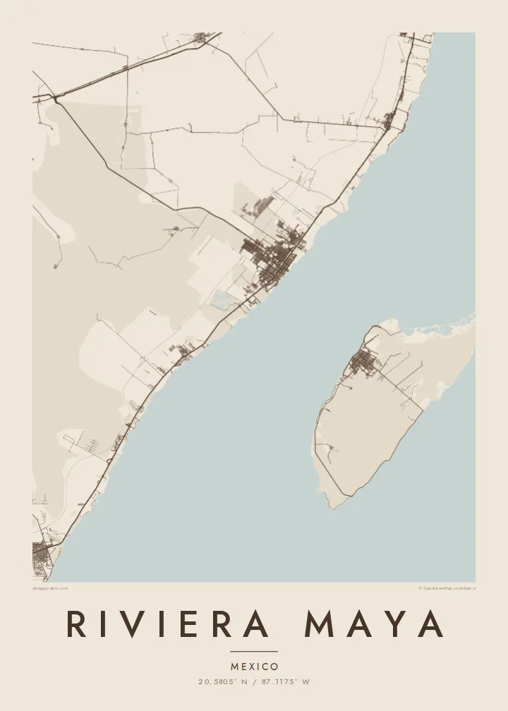
Sand and Paper give the coast a soft, sunlit tone, while Blueprint and Noir bring out the clean geometry of road and shore. Classic black & white is also available. The $9 download includes six print sizes, with no watermark.
Riviera Maya poster orme| Maxxaacah ballaqa | Qeeqa | Faylal |
|---|---|---|
| 30 × 40 cm11.8 × 15.7″ | 3,543 × 4,724 px | PNG · PDF |
| 29.7 × 42 cm (A3)11.7 × 16.5″ | 3,508 × 4,961 px | PNG · PDF |
| 42 × 59.4 cm (A2)16.5 × 23.4″ | 4,961 × 7,016 px | PNG · PDF |
| 45.7 × 61 cm18 × 24″ | 5,400 × 7,200 px | PNG · PDF |
| 50 × 70 cm19.7 × 27.6″ | 5,906 × 8,268 px | PNG · PDF |
| 61 × 91.4 cm24 × 36″ | 7,200 × 10,800 px | PNG · PDF |
Tabbaltah, limo-wayta xaqqa-le ablo 900 px ballaqa le, asta le, iskiriinih keh tan. HD faylal gexsoh inkih addal 8× fanah qeeqa le, poster ballaqa inkih addal meqeh maxxaacimta.
Baxxaqqa qari le qandiy dooriy, tohuk lakal Daabbisimtah Poster — kutuk kee, faxximek, dirbaabu — hinnay HD Digital Fayla dooru. Checkout inki wagitti geytima, kaadu ku-orme page keenih adissa akke waqdi caagoy kummite.
Usuk 200 gsm-le catam kutuk warqatal, lica katiy caagitte $39-ik hane ayta 30 × 40 cm-ik 24 × 36″ fanah, xaagu keenil warreeh.
Ee. Sarrah-le dirbaabu doori — bad, gudduc, oak-le hinnay bad-madabuy. Usuk finqisiimam ellee sange qarab-le kaadu qari umukku iyya keenih taagu. Dirbaabu-le poster $99-ik hane, xaagu keenil warreeh.
Dirsa 60+ baaxoh bilsa. Poster kasa 30+ baaxoh nel print kaadu yan kee dirgeh kaxxa kee tanah printa, kee 3–7 xaqu ayyaamah yaaxigeeh. Xaaloo kee tracking "Ac Order" gexsitam. Kaadu baaxo 2–5 isbuuc yaaxigeeh, nanu dirsi yanin baaxoh sajiitah site ku kalah tekkeh.
Geytimeek 14 ayróy addal foto naah rubbaay, cisab-le daabbisiynah hinnay ku-lacay gacisnaah.
Ee. Tama page-l edito addal, migaaq, subtitle kee coordinates sarrah faxxem fanah badal, kaadu qande kee katiy doori. Daabbisimtah, dirbaabu-le kaadu digital orme inkih ku-design cagalah yekkelen.
$9 bacisak 300 DPI PNG kee daabbisimtah adissime PDF fayla lica katiy inkih, watermark maleh, ayyi meki daabbisimtah geeytitta. Cisab makkoysemty ana? Awqak, watermark-le free preview download-eh.
