Crescent outline
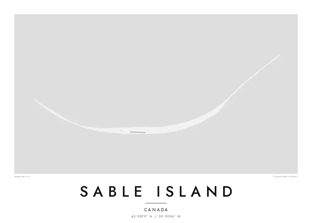
The island curves in a long, shallow arc, so its entire shape can be read at a glance, with generous open water above and below it.
Qeeqabak kaartah poster · Canada
43.9879° N / 59.9096° W
A slender crescent of sand far out in the North Atlantic, bowed gently and alone on the open sea


Inki magaala, konoy gaba
Qande inkih tibbixeeh derre baguley table. Kulli qande missoowa caagid—daabbisimta, dirbaabu-le kaadu HD fayla akah.
 Cagalah pixels · 24 × 36″ daabbi fayla
Maxxaacah qeeqa
Tama usuk cagalah daabbi faylak 100% qambaala. Kulli poster — daabbisimta, dirbaabu-le kaadu download geytimta — ni-server-ittal 300 DPI-l ederimta, 7,200 × 10,800 pixels fanah, tokkel iyyi ellee catoy 24 × 36″ daabbi baxsi bahisak raaqu.
Gidarih


Kaarta
Sable Island lies in the North Atlantic about 300 kilometres southeast of Halifax, a narrow crescent of dunes and grassland standing alone on the continental shelf. It is long and very thin, curved gently along its length, with a shallow lake in its interior and wide beaches running along both its northern and southern sides.
The island is known for its free-roaming horses, which have lived here for generations without human management, and for the grey seals that breed on its beaches. The shifting sandbars around it caused so many wrecks that it earned the name Graveyard of the Atlantic. Since 2013 it has been protected as Sable Island National Park Reserve.
A Sable Island map poster is almost pure line: one curved sliver of land with very little built on it and nothing around it but water. That simplicity makes it one of the most graphic island maps possible. On a large print, the crescent becomes a single quiet arc across the paper, and the empty sea does the rest.
The island curves in a long, shallow arc, so its entire shape can be read at a glance, with generous open water above and below it.
A shallow lake sits among the dunes near the middle of the island, adding a small, soft shape within the slender strip of land.
Nothing else appears in the frame. The emptiness around Sable makes the island feel even more remote and gives the poster a strong, minimal balance.
Kok tanim ab
Ayro, migaq hinnay kok tan xagar osis; gaba, ballaqa hinnay xiqa soorris.
Free preview qansarissi kee watermark-le. Daabbisimtaan kee HD fayla 300 DPI-l, 7,200 × 10,800 px fanah, watermark maleh ederimta.
Macah Sable Island
Sable Island appeals to people who love wild horses, shipwreck history or the Nova Scotia coast, and to anyone who likes a map that looks almost like a drawing. Few people ever visit, which makes it an unusual and thoughtful thing to hang.
Choose Classic black & white, Noir, Paper, Blueprint or Sand, and personalise the title, subtitle and coordinates line, for example with a meaningful date. Files arrive as a 300 DPI PNG and print-ready PDF for $9, or you can order a matte print shipped from a nearby partner.
Sable Island poster orme| Maxxaacah ballaqa | Qeeqa | Faylal |
|---|---|---|
| 30 × 40 cm11.8 × 15.7″ | 3,543 × 4,724 px | PNG · PDF |
| 29.7 × 42 cm (A3)11.7 × 16.5″ | 3,508 × 4,961 px | PNG · PDF |
| 42 × 59.4 cm (A2)16.5 × 23.4″ | 4,961 × 7,016 px | PNG · PDF |
| 45.7 × 61 cm18 × 24″ | 5,400 × 7,200 px | PNG · PDF |
| 50 × 70 cm19.7 × 27.6″ | 5,906 × 8,268 px | PNG · PDF |
| 61 × 91.4 cm24 × 36″ | 7,200 × 10,800 px | PNG · PDF |
Tabbaltah, limo-wayta xaqqa-le ablo 900 px ballaqa le, asta le, iskiriinih keh tan. HD faylal gexsoh inkih addal 8× fanah qeeqa le, poster ballaqa inkih addal meqeh maxxaacimta.
Baxxaqqa qari le qandiy dooriy, tohuk lakal Daabbisimtah Poster — kutuk kee, faxximek, dirbaabu — hinnay HD Digital Fayla dooru. Checkout inki wagitti geytima, kaadu ku-orme page keenih adissa akke waqdi caagoy kummite.
Usuk 200 gsm-le catam kutuk warqatal, lica katiy caagitte $39-ik hane ayta 30 × 40 cm-ik 24 × 36″ fanah, xaagu keenil warreeh.
Ee. Sarrah-le dirbaabu doori — bad, gudduc, oak-le hinnay bad-madabuy. Usuk finqisiimam ellee sange qarab-le kaadu qari umukku iyya keenih taagu. Dirbaabu-le poster $99-ik hane, xaagu keenil warreeh.
Dirsa 60+ baaxoh bilsa. Poster kasa 30+ baaxoh nel print kaadu yan kee dirgeh kaxxa kee tanah printa, kee 3–7 xaqu ayyaamah yaaxigeeh. Xaaloo kee tracking "Ac Order" gexsitam. Kaadu baaxo 2–5 isbuuc yaaxigeeh, nanu dirsi yanin baaxoh sajiitah site ku kalah tekkeh.
Geytimeek 14 ayróy addal foto naah rubbaay, cisab-le daabbisiynah hinnay ku-lacay gacisnaah.
Ee. Tama page-l edito addal, migaaq, subtitle kee coordinates sarrah faxxem fanah badal, kaadu qande kee katiy doori. Daabbisimtah, dirbaabu-le kaadu digital orme inkih ku-design cagalah yekkelen.
$9 bacisak 300 DPI PNG kee daabbisimtah adissime PDF fayla lica katiy inkih, watermark maleh, ayyi meki daabbisimtah geeytitta. Cisab makkoysemty ana? Awqak, watermark-le free preview download-eh.
Xayyo
