The Váh river
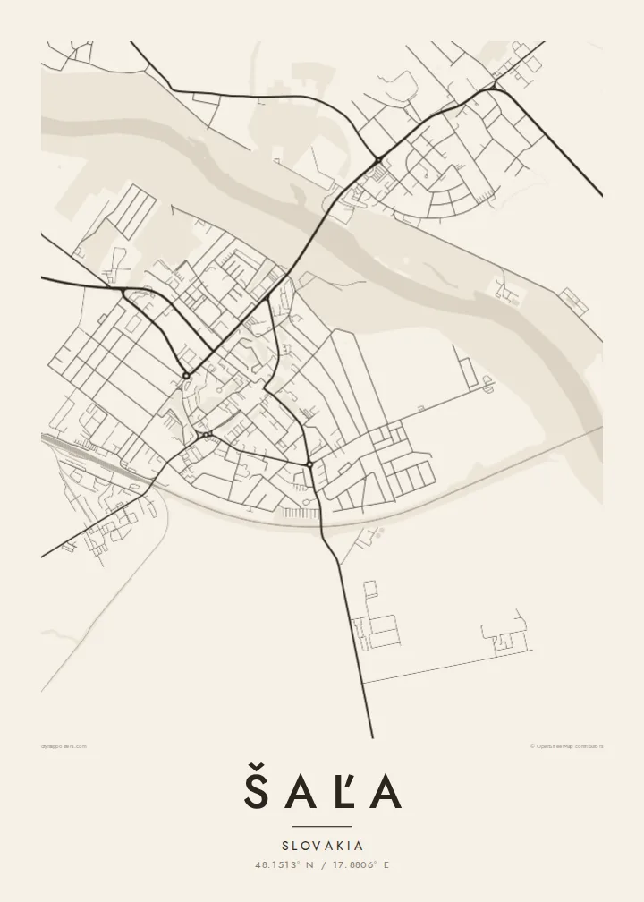
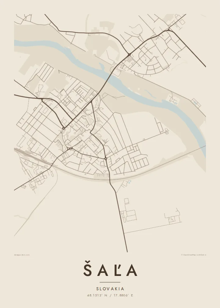
The Váh curves through the lowland and divides Šaľa in two. Its wide channel and the bridges across it form the strongest line on the poster, dark against the pale street pattern.
Qeeqabak kaartah poster · Slovakia
48.1513° N / 17.8806° E
A compact lowland town drawn along the curve of the Váh, with bridges tying the centre to Veča on the opposite bank.



Inki magaala, konoy gaba
Qande inkih tibbixeeh derre baguley table. Kulli qande missoowa caagid—daabbisimta, dirbaabu-le kaadu HD fayla akah.
 Cagalah pixels · 24 × 36″ daabbi fayla
Maxxaacah qeeqa
Tama usuk cagalah daabbi faylak 100% qambaala. Kulli poster — daabbisimta, dirbaabu-le kaadu download geytimta — ni-server-ittal 300 DPI-l ederimta, 7,200 × 10,800 pixels fanah, tokkel iyyi ellee catoy 24 × 36″ daabbi baxsi bahisak raaqu.
Gidarih


Kaarta
Šaľa sits on the flat Danubian Lowland in the Nitra Region, and on a map the Váh is the first thing the eye follows. The river bends past the town in a broad, unhurried line and splits the built-up area in two: the main centre on one bank and the district of Veča on the other. Around them the land opens into large rectangular fields that run almost to the horizon.
Šaľa has one of the oldest written records of any town in Slovakia, with a first mention in a charter dated 1002. That long timeline is not obvious in the street pattern, which was mostly shaped in the twentieth century: housing estates, straight avenues and a railway line crossing the plain. The contrast between the river's curve and the geometry of the streets gives the map its character.
Šaľa is also home to Duslo, one of the largest chemical producers in the country, and its industrial site shows on the map as a block of large, regular shapes at the edge of town. A Šaľa map poster keeps all of this in black and white, so the river, the estates, the plant and the fields read together as one clean drawing.
The Váh curves through the lowland and divides Šaľa in two. Its wide channel and the bridges across it form the strongest line on the poster, dark against the pale street pattern.
On the opposite bank, Veča forms a second cluster of streets. Seen from above it balances the main centre, so the town reads as a pair rather than a single block.
Beyond the last houses the Danubian Lowland stretches out in long, rectangular plots. Their straight edges frame the town and give the composition a quiet, measured border.
Kok tanim ab
Ayro, migaq hinnay kok tan xagar osis; gaba, ballaqa hinnay xiqa soorris.
Free preview qansarissi kee watermark-le. Daabbisimtaan kee HD fayla 300 DPI-l, 7,200 × 10,800 px fanah, watermark maleh ederimta.
Macah Šaľa
People who grew up in Šaľa, or who crossed the Váh every day on the way to school or work, often want a map that shows the whole town at once. The river's curve makes a strong central motif for a wall above a desk or in a hallway.
You can set your own title, subtitle and coordinates line, adding a family name or a meaningful date, and choose from five styles: Classic black & white, Noir, Paper, Blueprint or Sand. The $9 digital files include six print sizes as 300 DPI PNG and print-ready PDF.
Šaľa poster orme| Maxxaacah ballaqa | Qeeqa | Faylal |
|---|---|---|
| 30 × 40 cm (11.8 × 15.7″) | 3,543 × 4,724 px | PNG · PDF |
| 29.7 × 42 cm (A3, 11.7 × 16.5″) | 3,508 × 4,961 px | PNG · PDF |
| 42 × 59.4 cm (A2, 16.5 × 23.4″) | 4,961 × 7,016 px | PNG · PDF |
| 45.7 × 61 cm (18 × 24″) | 5,400 × 7,200 px | PNG · PDF |
| 50 × 70 cm (19.7 × 27.6″) | 5,906 × 8,268 px | PNG · PDF |
| 61 × 91.4 cm (24 × 36″) | 7,200 × 10,800 px | PNG · PDF |
Tabbaltah, limo-wayta xaqqa-le ablo 900 px ballaqa le, asta le, iskiriinih keh tan. HD faylal gexsoh inkih addal 8× fanah qeeqa le, poster ballaqa inkih addal meqeh maxxaacimta.
Baxxaqqa qari le qandiy dooriy, tohuk lakal Daabbisimtah Poster — kutuk kee, faxximek, dirbaabu — hinnay HD Digital Fayla dooru. Checkout inki wagitti geytima, kaadu ku-orme page keenih adissa akke waqdi caagoy kummite.
Usuk 200 gsm-le catam kutuk warqatal, lica katiy caagitte {printFrom}-ik hane ayta 30 × 40 cm-ik 24 × 36″ fanah, xaagu keenil warreeh.
Ee. Sarrah-le dirbaabu doori — bad, gudduc, oak-le hinnay bad-madabuy. Usuk finqisiimam ellee sange qarab-le kaadu qari umukku iyya keenih taagu. Dirbaabu-le poster {framedFrom}-ik hane, xaagu keenil warreeh.
Xaagu addunyal inkih cisab-le. Kulli poster 30+ ummattak ni-daabbi-mara mananih xayyoysa kaadu 3–7 caagu-ayróh fanah geeytima. Ku-orme kee xaagu tarikiy My Orders addal ablitta.
Geytimeek 14 ayróy addal foto naah rubbaay, cisab-le daabbisiynah hinnay ku-lacay gacisnaah.
Ee. Tama page-l edito addal, migaaq, subtitle kee coordinates sarrah faxxem fanah badal, kaadu qande kee katiy doori. Daabbisimtah, dirbaabu-le kaadu digital orme inkih ku-design cagalah yekkelen.
$9 bacisak 300 DPI PNG kee daabbisimtah adissime PDF fayla lica katiy inkih, watermark maleh, ayyi meki daabbisimtah geeytitta. Cisab makkoysemty ana? Awqak, watermark-le free preview download-eh.
