Indented coastline
Bays, coves and headlands follow each other along the shore. Together they create a long, intricate edge that carries much of the visual weight of the print.
Qeeqabak kaartah poster · Thailand
12.6663° N / 100.9018° E
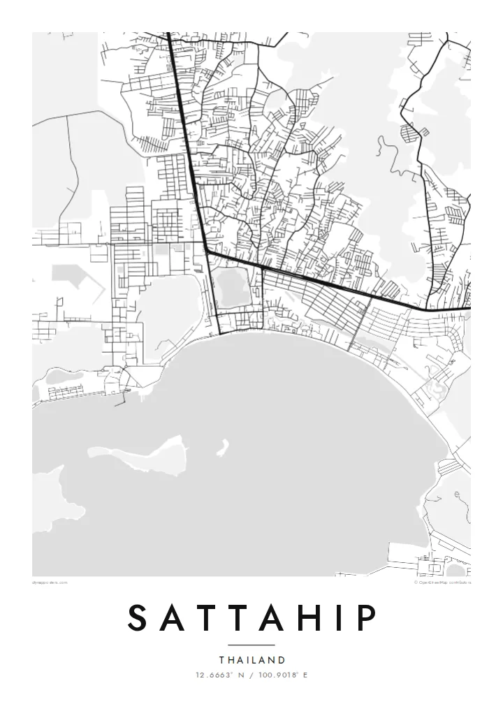
A deeply indented stretch of Gulf of Thailand coast south of Pattaya, with bays, headlands, offshore islands and a large naval base.


Inki magaala, konoy gaba
Qande inkih tibbixeeh derre baguley table. Kulli qande missoowa caagid—daabbisimta, dirbaabu-le kaadu HD fayla akah.
 Cagalah pixels · 24 × 36″ daabbi fayla
Maxxaacah qeeqa
Tama usuk cagalah daabbi faylak 100% qambaala. Kulli poster — daabbisimta, dirbaabu-le kaadu download geytimta — ni-server-ittal 300 DPI-l ederimta, 7,200 × 10,800 pixels fanah, tokkel iyyi ellee catoy 24 × 36″ daabbi baxsi bahisak raaqu.
Gidarih


Kaarta
Sattahip is on the eastern shore of the Gulf of Thailand in Chon Buri province, south of Pattaya. Its coastline is one of the most complex in the region, with a series of bays, rocky headlands and small peninsulas, and a scattering of islands just offshore. On a map, this gives the land a jagged, highly detailed edge.
The district is home to the main base of the Royal Thai Navy, and much of the coast is occupied by naval facilities, harbours and piers. The town itself is a compact grid near the water, while main roads run inland along the coast. U-Tapao airport lies just to the east, near the border with Rayong province.
A Sattahip map poster uses the coastline as its main subject. Deep bays and headlands, small islands dotted across the water and the tidy layout of the town make a composition with a lot of edges and contrast. It appeals to sailors, people who have served at the base and anyone who knows this less touristy part of the gulf.
Bays, coves and headlands follow each other along the shore. Together they create a long, intricate edge that carries much of the visual weight of the print.
Small islands near the coast appear as separate shapes in open water. They balance the busy land area with quiet, isolated forms.
Piers, basins and quays of the naval base add straight, engineered lines along the shore. They contrast with the natural curves of the bays.
Kok tanim ab
Ayro, migaq hinnay kok tan xagar osis; gaba, ballaqa hinnay xiqa soorris.
Free preview qansarissi kee watermark-le. Daabbisimtaan kee HD fayla 300 DPI-l, 7,200 × 10,800 px fanah, watermark maleh ederimta.
Macah Sattahip
Sattahip means something specific to many people, whether they served at the naval base, grew up in the area or found a quieter corner of the coast. A map of it captures the coastline in a way that feels both precise and personal.
You can change the title, subtitle and coordinates line, and add a unit, a family name or a date. Choose one of five styles; Blueprint works especially well with the harbour lines. You get six print sizes as 300 DPI PNGs and print-ready PDFs.
Sattahip poster orme| Maxxaacah ballaqa | Qeeqa | Faylal |
|---|---|---|
| 30 × 40 cm11.8 × 15.7″ | 3,543 × 4,724 px | PNG · PDF |
| 29.7 × 42 cm (A3)11.7 × 16.5″ | 3,508 × 4,961 px | PNG · PDF |
| 42 × 59.4 cm (A2)16.5 × 23.4″ | 4,961 × 7,016 px | PNG · PDF |
| 45.7 × 61 cm18 × 24″ | 5,400 × 7,200 px | PNG · PDF |
| 50 × 70 cm19.7 × 27.6″ | 5,906 × 8,268 px | PNG · PDF |
| 61 × 91.4 cm24 × 36″ | 7,200 × 10,800 px | PNG · PDF |
Tabbaltah, limo-wayta xaqqa-le ablo 900 px ballaqa le, asta le, iskiriinih keh tan. HD faylal gexsoh inkih addal 8× fanah qeeqa le, poster ballaqa inkih addal meqeh maxxaacimta.
Baxxaqqa qari le qandiy dooriy, tohuk lakal Daabbisimtah Poster — kutuk kee, faxximek, dirbaabu — hinnay HD Digital Fayla dooru. Checkout inki wagitti geytima, kaadu ku-orme page keenih adissa akke waqdi caagoy kummite.
Usuk 200 gsm-le catam kutuk warqatal, lica katiy caagitte $39-ik hane ayta 30 × 40 cm-ik 24 × 36″ fanah, xaagu keenil warreeh.
Ee. Sarrah-le dirbaabu doori — bad, gudduc, oak-le hinnay bad-madabuy. Usuk finqisiimam ellee sange qarab-le kaadu qari umukku iyya keenih taagu. Dirbaabu-le poster $99-ik hane, xaagu keenil warreeh.
Dirsa 60+ baaxoh bilsa. Poster kasa 30+ baaxoh nel print kaadu yan kee dirgeh kaxxa kee tanah printa, kee 3–7 xaqu ayyaamah yaaxigeeh. Xaaloo kee tracking "Ac Order" gexsitam. Kaadu baaxo 2–5 isbuuc yaaxigeeh, nanu dirsi yanin baaxoh sajiitah site ku kalah tekkeh.
Geytimeek 14 ayróy addal foto naah rubbaay, cisab-le daabbisiynah hinnay ku-lacay gacisnaah.
Ee. Tama page-l edito addal, migaaq, subtitle kee coordinates sarrah faxxem fanah badal, kaadu qande kee katiy doori. Daabbisimtah, dirbaabu-le kaadu digital orme inkih ku-design cagalah yekkelen.
$9 bacisak 300 DPI PNG kee daabbisimtah adissime PDF fayla lica katiy inkih, watermark maleh, ayyi meki daabbisimtah geeytitta. Cisab makkoysemty ana? Awqak, watermark-le free preview download-eh.
