Hooghly waterfront
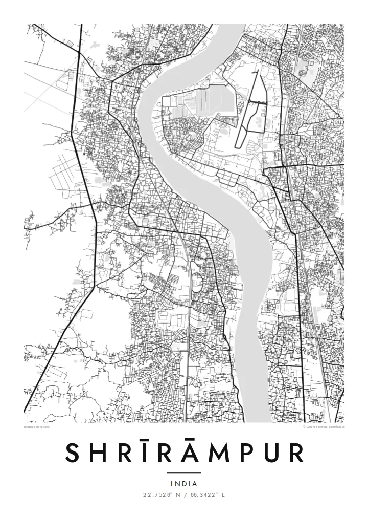
The river forms the eastern edge of the town, a wide pale band on the poster. Ghats and lanes meet it at regular intervals along the bank.
Qeeqabak kaartah poster · India
22.7528° N / 88.3422° E
A long riverside town on the west bank of the Hooghly, its old Danish quarter facing Barrackpore across the water.


Inki magaala, konoy gaba
Qande inkih tibbixeeh derre baguley table. Kulli qande missoowa caagid—daabbisimta, dirbaabu-le kaadu HD fayla akah.
 Cagalah pixels · 24 × 36″ daabbi fayla
Maxxaacah qeeqa
Tama usuk cagalah daabbi faylak 100% qambaala. Kulli poster — daabbisimta, dirbaabu-le kaadu download geytimta — ni-server-ittal 300 DPI-l ederimta, 7,200 × 10,800 pixels fanah, tokkel iyyi ellee catoy 24 × 36″ daabbi baxsi bahisak raaqu.
Gidarih


Kaarta
Shrīrāmpur stretches along the western bank of the Hooghly River, north of Kolkata, and the river defines its map. The town is a narrow ribbon between the water and the railway line that runs parallel to it inland, with lanes leading down to ghats on the riverfront. On the opposite bank lies Barrackpore, and the broad band of the river separates the two like a wide avenue.
From 1755 to 1845 the town was a Danish trading settlement called Frederiksnagore, and traces of that period remain, including St Olav's Church and the old Government House. Serampore College, founded in 1818 by the missionaries William Carey, Joshua Marshman and William Ward, stands by the river and is among the oldest colleges in India.
A Shrīrāmpur map poster frames the relationship between town and river: the dense lanes along the bank, the straight rail line inland, and the empty width of the Hooghly with its gentle bends. It is a map about edges and crossings, a reminder of the town's long role as a port, a college town and a quiet neighbour to Kolkata.
The river forms the eastern edge of the town, a wide pale band on the poster. Ghats and lanes meet it at regular intervals along the bank.
Near the riverfront, the older core from the Danish period, with its church and former Government House, sits among a tighter pattern of streets than the newer districts inland.
Serampore College occupies a riverside site, a larger open plot among the lanes that recalls the town's long history as a centre of learning and printing.
Kok tanim ab
Ayro, migaq hinnay kok tan xagar osis; gaba, ballaqa hinnay xiqa soorris.
Free preview qansarissi kee watermark-le. Daabbisimtaan kee HD fayla 300 DPI-l, 7,200 × 10,800 px fanah, watermark maleh ederimta.
Macah Shrīrāmpur
Shrīrāmpur has deep roots for Bengali families, for alumni of its college and for anyone interested in the colonial history of the Hooghly settlements. A map of the riverbank makes a thoughtful gift and sits well in a study or reading room.
Add a name, an alumni year or a family address to the title and subtitle, and choose one of five styles, from the warm Paper and Sand to the crisp Classic black & white, Noir and Blueprint. Order it printed on matte paper or download the HD files.
Shrīrāmpur poster orme| Maxxaacah ballaqa | Qeeqa | Faylal |
|---|---|---|
| 30 × 40 cm11.8 × 15.7″ | 3,543 × 4,724 px | PNG · PDF |
| 29.7 × 42 cm (A3)11.7 × 16.5″ | 3,508 × 4,961 px | PNG · PDF |
| 42 × 59.4 cm (A2)16.5 × 23.4″ | 4,961 × 7,016 px | PNG · PDF |
| 45.7 × 61 cm18 × 24″ | 5,400 × 7,200 px | PNG · PDF |
| 50 × 70 cm19.7 × 27.6″ | 5,906 × 8,268 px | PNG · PDF |
| 61 × 91.4 cm24 × 36″ | 7,200 × 10,800 px | PNG · PDF |
Tabbaltah, limo-wayta xaqqa-le ablo 900 px ballaqa le, asta le, iskiriinih keh tan. HD faylal gexsoh inkih addal 8× fanah qeeqa le, poster ballaqa inkih addal meqeh maxxaacimta.
Baxxaqqa qari le qandiy dooriy, tohuk lakal Daabbisimtah Poster — kutuk kee, faxximek, dirbaabu — hinnay HD Digital Fayla dooru. Checkout inki wagitti geytima, kaadu ku-orme page keenih adissa akke waqdi caagoy kummite.
Usuk 200 gsm-le catam kutuk warqatal, lica katiy caagitte $39-ik hane ayta 30 × 40 cm-ik 24 × 36″ fanah, xaagu keenil warreeh.
Ee. Sarrah-le dirbaabu doori — bad, gudduc, oak-le hinnay bad-madabuy. Usuk finqisiimam ellee sange qarab-le kaadu qari umukku iyya keenih taagu. Dirbaabu-le poster $99-ik hane, xaagu keenil warreeh.
Dirsa 60+ baaxoh bilsa. Poster kasa 30+ baaxoh nel print kaadu yan kee dirgeh kaxxa kee tanah printa, kee 3–7 xaqu ayyaamah yaaxigeeh. Xaaloo kee tracking "Ac Order" gexsitam. Kaadu baaxo 2–5 isbuuc yaaxigeeh, nanu dirsi yanin baaxoh sajiitah site ku kalah tekkeh.
Geytimeek 14 ayróy addal foto naah rubbaay, cisab-le daabbisiynah hinnay ku-lacay gacisnaah.
Ee. Tama page-l edito addal, migaaq, subtitle kee coordinates sarrah faxxem fanah badal, kaadu qande kee katiy doori. Daabbisimtah, dirbaabu-le kaadu digital orme inkih ku-design cagalah yekkelen.
$9 bacisak 300 DPI PNG kee daabbisimtah adissime PDF fayla lica katiy inkih, watermark maleh, ayyi meki daabbisimtah geeytitta. Cisab makkoysemty ana? Awqak, watermark-le free preview download-eh.
Xayyo
