Grande Île
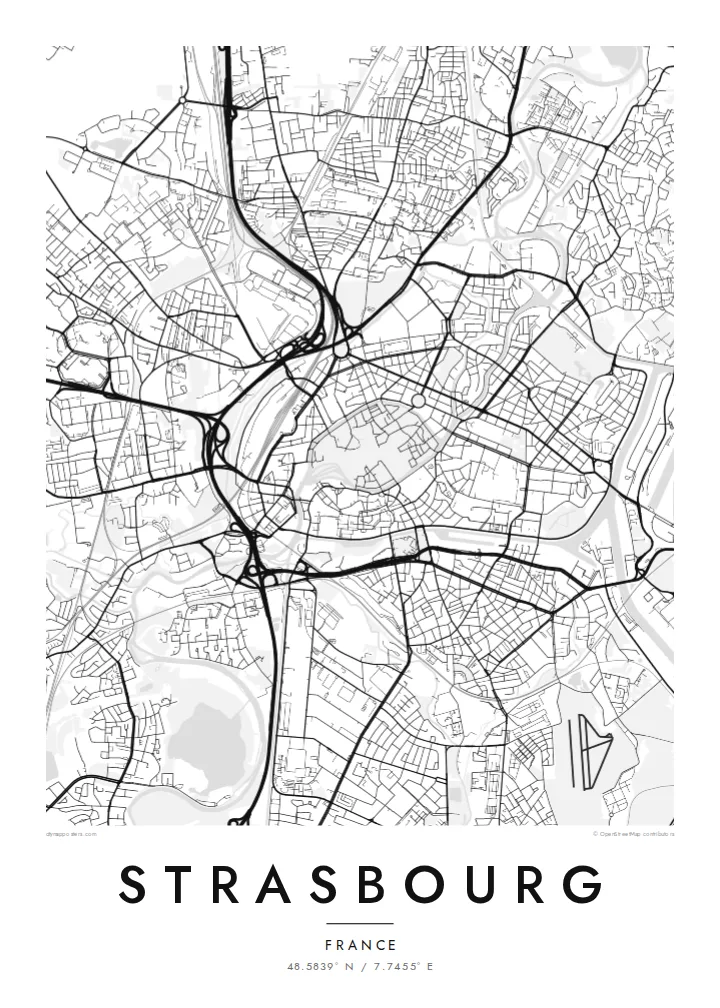
The historic centre sits on an island ringed by the Ill, a dense oval of streets around the cathedral that anchors the whole map.
Qeeqabak kaartah poster · France
48.5839° N / 7.7455° E
An island old town wrapped by the Ill, with canals, a cathedral quarter and the Rhine's wide port to the east.


Inki magaala, konoy gaba
Qande inkih tibbixeeh derre baguley table. Kulli qande missoowa caagid—daabbisimta, dirbaabu-le kaadu HD fayla akah.
 Cagalah pixels · 24 × 36″ daabbi fayla
Maxxaacah qeeqa
Tama usuk cagalah daabbi faylak 100% qambaala. Kulli poster — daabbisimta, dirbaabu-le kaadu download geytimta — ni-server-ittal 300 DPI-l ederimta, 7,200 × 10,800 pixels fanah, tokkel iyyi ellee catoy 24 × 36″ daabbi baxsi bahisak raaqu.
Gidarih


Kaarta
Strasbourg's historic centre is an island. The Grande Île, encircled by two arms of the Ill, holds the cathedral, the medieval lanes and the half-timbered quarter of La Petite France. There, the river splits into canals around covered bridges and locks. From above, this oval of dense streets ringed by water is the clearest shape on the map, and it has been a UNESCO World Heritage Site since 1988.
Beyond the island lies the Neustadt, built during the German period after 1871, with broad avenues and planned squares. It was added to the UNESCO listing in 2017. Further out, the European Parliament and other European institutions stand beside the water. To the east, the Rhine port and its long basins face Germany, with bridges crossing to Kehl.
A Strasbourg map poster combines several distinct cities in one frame: the medieval island, the German imperial district, the European quarter and the industrial harbour. Rivers and canals give the composition its structure, and tram lines thread across it. In black and white, the layers of different eras become especially easy to read.
The historic centre sits on an island ringed by the Ill, a dense oval of streets around the cathedral that anchors the whole map.
At the island's western tip, the river divides into canals, locks and covered bridges, producing a delicate tangle of water and lanes.
To the east, long port basins and the broad Rhine mark the border with Germany and add bold geometric shapes to the composition.
Kok tanim ab
Ayro, migaq hinnay kok tan xagar osis; gaba, ballaqa hinnay xiqa soorris.
Free preview qansarissi kee watermark-le. Daabbisimtaan kee HD fayla 300 DPI-l, 7,200 × 10,800 px fanah, watermark maleh ederimta.
Macah Strasbourg
Many people pass through Strasbourg to study, to work at the European institutions or to visit a winter market, and its island centre is instantly recognisable. A map makes a precise souvenir of a city that sits between two cultures.
Personalise the title, subtitle and coordinates line with a date or a neighbourhood. Choose Classic black & white, Noir, Paper, Blueprint or Sand, then download six print sizes for $9 or order a printed poster shipped from a print partner near you.
Strasbourg poster orme| Maxxaacah ballaqa | Qeeqa | Faylal |
|---|---|---|
| 30 × 40 cm (11.8 × 15.7″) | 3,543 × 4,724 px | PNG · PDF |
| 29.7 × 42 cm (A3, 11.7 × 16.5″) | 3,508 × 4,961 px | PNG · PDF |
| 42 × 59.4 cm (A2, 16.5 × 23.4″) | 4,961 × 7,016 px | PNG · PDF |
| 45.7 × 61 cm (18 × 24″) | 5,400 × 7,200 px | PNG · PDF |
| 50 × 70 cm (19.7 × 27.6″) | 5,906 × 8,268 px | PNG · PDF |
| 61 × 91.4 cm (24 × 36″) | 7,200 × 10,800 px | PNG · PDF |
Tabbaltah, limo-wayta xaqqa-le ablo 900 px ballaqa le, asta le, iskiriinih keh tan. HD faylal gexsoh inkih addal 8× fanah qeeqa le, poster ballaqa inkih addal meqeh maxxaacimta.
Baxxaqqa qari le qandiy dooriy, tohuk lakal Daabbisimtah Poster — kutuk kee, faxximek, dirbaabu — hinnay HD Digital Fayla dooru. Checkout inki wagitti geytima, kaadu ku-orme page keenih adissa akke waqdi caagoy kummite.
Usuk 200 gsm-le catam kutuk warqatal, lica katiy caagitte $39-ik hane ayta 30 × 40 cm-ik 24 × 36″ fanah, xaagu keenil warreeh.
Ee. Sarrah-le dirbaabu doori — bad, gudduc, oak-le hinnay bad-madabuy. Usuk finqisiimam ellee sange qarab-le kaadu qari umukku iyya keenih taagu. Dirbaabu-le poster $99-ik hane, xaagu keenil warreeh.
Shipping is free worldwide. Each poster is printed by the nearest of our print partners in 30+ countries and usually arrives in 3–7 business days. You can follow the status and tracking under My Orders. A few countries take 2–5 weeks, and where we don't ship yet, the site tells you before you pay.
Geytimeek 14 ayróy addal foto naah rubbaay, cisab-le daabbisiynah hinnay ku-lacay gacisnaah.
Ee. Tama page-l edito addal, migaaq, subtitle kee coordinates sarrah faxxem fanah badal, kaadu qande kee katiy doori. Daabbisimtah, dirbaabu-le kaadu digital orme inkih ku-design cagalah yekkelen.
$9 bacisak 300 DPI PNG kee daabbisimtah adissime PDF fayla lica katiy inkih, watermark maleh, ayyi meki daabbisimtah geeytitta. Cisab makkoysemty ana? Awqak, watermark-le free preview download-eh.
