Parnaíba waterfront
The river forms the town's long edge and the border between Piauí and Maranhão. Its broad curve is the natural anchor for the whole composition.
Qeeqabak kaartah poster · Brazil
7.2294° S / 44.5561° W
A river town on the Parnaíba, facing Maranhão across the water, with farmland stretching out over the cerrado.


Inki magaala, konoy gaba
Qande inkih tibbixeeh derre baguley table. Kulli qande missoowa caagid—daabbisimta, dirbaabu-le kaadu HD fayla akah.
 Cagalah pixels · 24 × 36″ daabbi fayla
Maxxaacah qeeqa
Tama usuk cagalah daabbi faylak 100% qambaala. Kulli poster — daabbisimta, dirbaabu-le kaadu download geytimta — ni-server-ittal 300 DPI-l ederimta, 7,200 × 10,800 pixels fanah, tokkel iyyi ellee catoy 24 × 36″ daabbi baxsi bahisak raaqu.
Gidarih


Kaarta
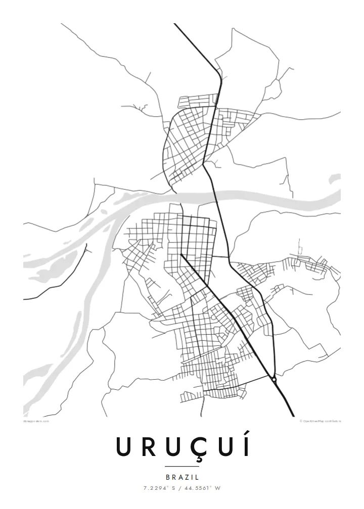
Uruçuí lies on the right bank of the Parnaíba River in southern Piauí. The river marks the state border with Maranhão, and the town of Benedito Leite sits on the opposite bank. From above, Uruçuí is a street grid lined up along the waterfront, with the wide, curving river forming a strong edge on one side of the map.
In recent decades the land around Uruçuí has become part of Brazil's soybean frontier. The flat cerrado plateaus nearby are farmed on a large scale. On a detailed map, the surrounding countryside shows as long, straight roads and rectangular field boundaries, a different geometry from the river's natural curves.
A Uruçuí map poster sets these two patterns side by side. The meandering Parnaíba represents the older river town, and the straight lines inland represent the agricultural present. In black and white the contrast is clear. It is a portrait of a place on a border, between two states and between two ways of using the land.
The river forms the town's long edge and the border between Piauí and Maranhão. Its broad curve is the natural anchor for the whole composition.
Benedito Leite sits on the Maranhão bank opposite. The two towns face each other across the water, which gives the map a mirrored quality.
Inland, large-scale agriculture has divided the plateaus into long straight roads and wide rectangular plots, a sharp geometric contrast to the river.
Kok tanim ab
Ayro, migaq hinnay kok tan xagar osis; gaba, ballaqa hinnay xiqa soorris.
Free preview qansarissi kee watermark-le. Daabbisimtaan kee HD fayla 300 DPI-l, 7,200 × 10,800 px fanah, watermark maleh ederimta.
Macah Uruçuí
Uruçuí is home to people whose families have fished the Parnaíba for generations and to others who came for the farming boom. A map of the town gives both groups something to recognise: the river, the grid and the road out to the fields.
Add your own title, subtitle and coordinates, and choose from five styles, including Noir for a darker room. The $9 digital files include six sizes as 300 DPI PNG and print-ready PDF, with no watermark.
Uruçuí poster orme| Maxxaacah ballaqa | Qeeqa | Faylal |
|---|---|---|
| 30 × 40 cm (11.8 × 15.7″) | 3,543 × 4,724 px | PNG · PDF |
| 29.7 × 42 cm (A3, 11.7 × 16.5″) | 3,508 × 4,961 px | PNG · PDF |
| 42 × 59.4 cm (A2, 16.5 × 23.4″) | 4,961 × 7,016 px | PNG · PDF |
| 45.7 × 61 cm (18 × 24″) | 5,400 × 7,200 px | PNG · PDF |
| 50 × 70 cm (19.7 × 27.6″) | 5,906 × 8,268 px | PNG · PDF |
| 61 × 91.4 cm (24 × 36″) | 7,200 × 10,800 px | PNG · PDF |
Tabbaltah, limo-wayta xaqqa-le ablo 900 px ballaqa le, asta le, iskiriinih keh tan. HD faylal gexsoh inkih addal 8× fanah qeeqa le, poster ballaqa inkih addal meqeh maxxaacimta.
Baxxaqqa qari le qandiy dooriy, tohuk lakal Daabbisimtah Poster — kutuk kee, faxximek, dirbaabu — hinnay HD Digital Fayla dooru. Checkout inki wagitti geytima, kaadu ku-orme page keenih adissa akke waqdi caagoy kummite.
Usuk 200 gsm-le catam kutuk warqatal, lica katiy caagitte {printFrom}-ik hane ayta 30 × 40 cm-ik 24 × 36″ fanah, xaagu keenil warreeh.
Ee. Sarrah-le dirbaabu doori — bad, gudduc, oak-le hinnay bad-madabuy. Usuk finqisiimam ellee sange qarab-le kaadu qari umukku iyya keenih taagu. Dirbaabu-le poster {framedFrom}-ik hane, xaagu keenil warreeh.
Xaagu addunyal inkih cisab-le. Kulli poster 30+ ummattak ni-daabbi-mara mananih xayyoysa kaadu 3–7 caagu-ayróh fanah geeytima. Ku-orme kee xaagu tarikiy My Orders addal ablitta.
Geytimeek 14 ayróy addal foto naah rubbaay, cisab-le daabbisiynah hinnay ku-lacay gacisnaah.
Ee. Tama page-l edito addal, migaaq, subtitle kee coordinates sarrah faxxem fanah badal, kaadu qande kee katiy doori. Daabbisimtah, dirbaabu-le kaadu digital orme inkih ku-design cagalah yekkelen.
$9 bacisak 300 DPI PNG kee daabbisimtah adissime PDF fayla lica katiy inkih, watermark maleh, ayyi meki daabbisimtah geeytitta. Cisab makkoysemty ana? Awqak, watermark-le free preview download-eh.
