Lovers' Road coast
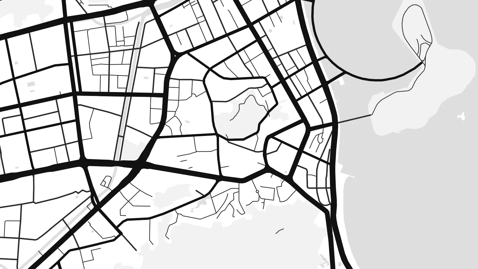
The seaside road along the Xiangzhou bays traces the city's eastern edge in a long, gentle curve, one of the most recognisable lines on the whole map.
Qeeqabak kaartah poster · China
22.2769° N / 113.5678° E
A coastal city of hills, bays and islands on the Pearl River Delta, linked to Macau and Hong Kong by sea.


Inki magaala, konoy gaba
Qande inkih tibbixeeh derre baguley table. Kulli qande missoowa caagid—daabbisimta, dirbaabu-le kaadu HD fayla akah.
 Cagalah pixels · 24 × 36″ daabbi fayla
Maxxaacah qeeqa
Tama usuk cagalah daabbi faylak 100% qambaala. Kulli poster — daabbisimta, dirbaabu-le kaadu download geytimta — ni-server-ittal 300 DPI-l ederimta, 7,200 × 10,800 pixels fanah, tokkel iyyi ellee catoy 24 × 36″ daabbi baxsi bahisak raaqu.
Gidarih


Kaarta
Zhuhai sits on the western side of the Pearl River Delta in Guangdong, where the mainland breaks into headlands, inlets and a scatter of offshore islands. It was one of China's first Special Economic Zones, created in 1980, and it shares a land border with Macau. On a map the city never settles into a single centre; it strings itself along the coast between green hills.
The shoreline does most of the drawing. A long seaside road curves around the bays of Xiangzhou, with the sea on one side and wooded slopes on the other, and districts spread inland wherever the valleys open up. To the south, Hengqin Island faces Macau across a narrow channel, its newer street grid laid out in broad, regular blocks.
Out in the water, the Hong Kong–Zhuhai–Macao Bridge, opened in 2018, runs across the estuary as a single thin line of bridges and tunnels. A Zhuhai map poster brings together that engineering, the fragmented coastline and the hills behind it, and the islands of the outer delta give the lower part of the sheet an unusual lightness.
The seaside road along the Xiangzhou bays traces the city's eastern edge in a long, gentle curve, one of the most recognisable lines on the whole map.
Facing Macau across a narrow waterway, Hengqin combines hills with a grid of wide, newer avenues, a clear contrast to the more organic streets of the older districts.
The Hong Kong–Zhuhai–Macao Bridge leaves the coast as a fine line heading east across open water, one of the longest sea crossings in the world.
Kok tanim ab
Ayro, migaq hinnay kok tan xagar osis; gaba, ballaqa hinnay xiqa soorris.
Free preview qansarissi kee watermark-le. Daabbisimtaan kee HD fayla 300 DPI-l, 7,200 × 10,800 px fanah, watermark maleh ederimta.
Macah Zhuhai
Zhuhai appeals to people who value sea, space and greenery in a city, and to anyone whose life moves between Zhuhai, Macau and Hong Kong. The coastline makes for a composition that feels open rather than dense, which suits calm living rooms and bedrooms.
Personalise the title and subtitle with a name or date, adjust the coordinates line, and pick from Classic black & white, Noir, Paper, Blueprint and Sand. A free 900 px watermarked preview lets you check the framing before buying the $9 HD files or a printed poster.
Zhuhai poster orme| Maxxaacah ballaqa | Qeeqa | Faylal |
|---|---|---|
| 30 × 40 cm11.8 × 15.7″ | 3,543 × 4,724 px | PNG · PDF |
| 29.7 × 42 cm (A3)11.7 × 16.5″ | 3,508 × 4,961 px | PNG · PDF |
| 42 × 59.4 cm (A2)16.5 × 23.4″ | 4,961 × 7,016 px | PNG · PDF |
| 45.7 × 61 cm18 × 24″ | 5,400 × 7,200 px | PNG · PDF |
| 50 × 70 cm19.7 × 27.6″ | 5,906 × 8,268 px | PNG · PDF |
| 61 × 91.4 cm24 × 36″ | 7,200 × 10,800 px | PNG · PDF |
Tabbaltah, limo-wayta xaqqa-le ablo 900 px ballaqa le, asta le, iskiriinih keh tan. HD faylal gexsoh inkih addal 8× fanah qeeqa le, poster ballaqa inkih addal meqeh maxxaacimta.
Baxxaqqa qari le qandiy dooriy, tohuk lakal Daabbisimtah Poster — kutuk kee, faxximek, dirbaabu — hinnay HD Digital Fayla dooru. Checkout inki wagitti geytima, kaadu ku-orme page keenih adissa akke waqdi caagoy kummite.
Usuk 200 gsm-le catam kutuk warqatal, lica katiy caagitte $39-ik hane ayta 30 × 40 cm-ik 24 × 36″ fanah, xaagu keenil warreeh.
Ee. Sarrah-le dirbaabu doori — bad, gudduc, oak-le hinnay bad-madabuy. Usuk finqisiimam ellee sange qarab-le kaadu qari umukku iyya keenih taagu. Dirbaabu-le poster $99-ik hane, xaagu keenil warreeh.
Dirsa 60+ baaxoh bilsa. Poster kasa 30+ baaxoh nel print kaadu yan kee dirgeh kaxxa kee tanah printa, kee 3–7 xaqu ayyaamah yaaxigeeh. Xaaloo kee tracking "Ac Order" gexsitam. Kaadu baaxo 2–5 isbuuc yaaxigeeh, nanu dirsi yanin baaxoh sajiitah site ku kalah tekkeh.
Geytimeek 14 ayróy addal foto naah rubbaay, cisab-le daabbisiynah hinnay ku-lacay gacisnaah.
Ee. Tama page-l edito addal, migaaq, subtitle kee coordinates sarrah faxxem fanah badal, kaadu qande kee katiy doori. Daabbisimtah, dirbaabu-le kaadu digital orme inkih ku-design cagalah yekkelen.
$9 bacisak 300 DPI PNG kee daabbisimtah adissime PDF fayla lica katiy inkih, watermark maleh, ayyi meki daabbisimtah geeytitta. Cisab makkoysemty ana? Awqak, watermark-le free preview download-eh.
