Sultanate quarter
The historic heart of the Ouaddaï capital, with an irregular web of lanes around the old palace and mosque sites. It is the densest, least geometric part of the map.
ملصق خريطة بسيط · تشاد
13.8292° N / 20.8324° E
A low, sprawling Sahelian town of sandy lanes and walled compounds, crossed by seasonal wadis on the eastern Chadian plain


مدينة واحدة، خمسة أمزجة
اضغط على أي نمط لتراه على الحائط. جميع الأنماط بنفس السعر — مطبوعة أو مؤطرة أو كملفات HD.
 بكسلات حقيقية · ملف طباعة 24 × 36 بوصة
حدّة الطباعة
هذا اقتصاص 100% من ملف الطباعة الحقيقي. كل بوستر — مطبوع أو مؤطر أو منزّل — يُعالَج على خوادمنا بدقة 300 DPI، وصولًا إلى 7,200 × 10,800 بكسل، لتبقى أدق الشوارع واضحة حتى على طباعة 24 × 36 بوصة.
على الحائط


الخريطة
Abéché is the main city of eastern Chad and the capital of Ouaddaï province. It stands on a dry plain far from the sea, and on a map it spreads out loosely rather than climbing upward. Lanes run between walled family compounds, and a handful of wider roads head out toward the rest of the region. Sandy wadis flow here only after the rains.
The town has a long political history. In the mid-nineteenth century it became the capital of the Ouaddaï Sultanate, one of the powerful Sahelian states of the region, and remains of the sultans' residence and old mosques still stand in the historic core. More recently Abéché has served as a logistics base for humanitarian operations in eastern Chad.
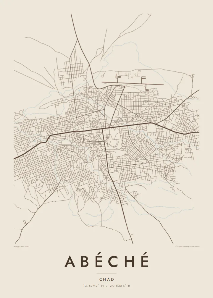
An Abéché map poster shows a city that does not follow a strict grid. The oldest quarters are made of irregular blocks, while the newer districts sit in looser rectangles farther out. The airport runway forms a clean, straight line on the edge. The result is an honest picture of a desert-edge town whose shape comes from climate, trade routes and centuries of regional power.
The historic heart of the Ouaddaï capital, with an irregular web of lanes around the old palace and mosque sites. It is the densest, least geometric part of the map.
Dry riverbeds wind through and around the town. They are drawn as soft, meandering bands that carry water only briefly during the rainy season.
A long, straight runway sits beside the built-up area. Its hard geometry contrasts with the organic street pattern and acts as a strong graphic anchor.
اجعله خاصًا بك
أضف تاريخًا أو اسمًا أو عبارة خاصة بك، وغيّر النمط أو المقاس أو الاتجاه.
المعاينة المجانية منخفضة الدقة وتحمل علامة مائية. المطبوعات وملفات HD تُعالَج بدقة 300 DPI، وصولًا إلى 7,200 × 10,800 بكسل، بلا علامة مائية.
لماذا Abéché
Abéché is a place people carry with them: aid workers, researchers and families from Ouaddaï often have a lasting tie to it. A map poster keeps that connection in a calm, understated form that works in almost any room.
Add a personal title, the years you spent there or the coordinates, and choose from Classic black & white, Noir, Paper, Blueprint or Sand. Sand and Paper suit the dry, earthen character of the city especially well.
اطلب بوستر Abéché| مقاس الطباعة | الدقة | الملفات |
|---|---|---|
| 30 × 40 cm (11.8 × 15.7″) | 3,543 × 4,724 px | PNG · PDF |
| 29.7 × 42 cm (A3, 11.7 × 16.5″) | 3,508 × 4,961 px | PNG · PDF |
| 42 × 59.4 cm (A2, 16.5 × 23.4″) | 4,961 × 7,016 px | PNG · PDF |
| 45.7 × 61 cm (18 × 24″) | 5,400 × 7,200 px | PNG · PDF |
| 50 × 70 cm (19.7 × 27.6″) | 5,906 × 8,268 px | PNG · PDF |
| 61 × 91.4 cm (24 × 36″) | 7,200 × 10,800 px | PNG · PDF |
للمقارنة، يبلغ عرض المعاينة المجانية 900 بكسل، وتحمل علامة مائية ومخصصة للشاشات. أما ملفات HD فدقتها أعلى بما يصل إلى 8 أضعاف في كل اتجاه، وتُطبع بوضوح تام بالمقاس الكامل للملصق.
اختر نمطًا من أعلى الصفحة، ثم اختر بوستر مطبوع — بحجم وإطار إن أردت — أو ملفات HD رقمية. الدفع يتم بخطوة واحدة، وتتحدّث صفحة طلبك فور إتمام الدفع.
يُطبع على ورق مطفي فاخر بوزن 200 جرام بأحد ستة مقاسات، من 30 × 40 سم إلى 24 × 36 بوصة. تبدأ أسعار البوسترات المطبوعة من {printFrom}، والشحن مشمول.
نعم. اختر إطارًا من الخشب الصلب باللون الأسود أو الأبيض أو خشب البلوط الطبيعي أو الخشب الداكن. يأتي بزجاج مقاوم للكسر وجاهز للتعليق مباشرة. تبدأ أسعار البوسترات المؤطرة من {framedFrom}، والشحن مشمول.
الشحن مجاني إلى جميع أنحاء العالم. تتم طباعة كل بوستر لدى أقرب شريك طباعة لنا من بين شركائنا في أكثر من 30 دولة، ويصل عادةً خلال 3–7 أيام عمل. يمكنك متابعة حالة الطلب ورقم التتبع من صفحة «طلباتي». تستغرق بعض الدول من 2 إلى 5 أسابيع، وإذا كنا لا نشحن إلى بلدك بعد، سيخبرك الموقع بذلك قبل الدفع.
أرسل لنا صورة خلال 14 يومًا من الاستلام، وسنعيد الطباعة مجانًا أو نرد المبلغ.
نعم. من المحرر في هذه الصفحة، غيّر العنوان والعنوان الفرعي وسطر الإحداثيات كما تشاء، واختر النمط والحجم. الطلبات المطبوعة والمؤطرة والرقمية تستخدم تصميمك بالضبط.
مقابل $9 تحصل على ملفات PNG بدقة 300 DPI وملفات PDF جاهزة للطباعة بجميع المقاسات الستة، بلا علامة مائية، لطباعتها في أي مكان. لست متأكدًا بعد؟ نزّل معاينة مجانية بعلامة مائية أولًا.
