Hill of Difficulty
The steep track from the landing up to the village is the island's essential route, drawn on the map as a short, sharply climbing line from the shore.
ملصق خريطة بسيط · جزر بيتكيرن
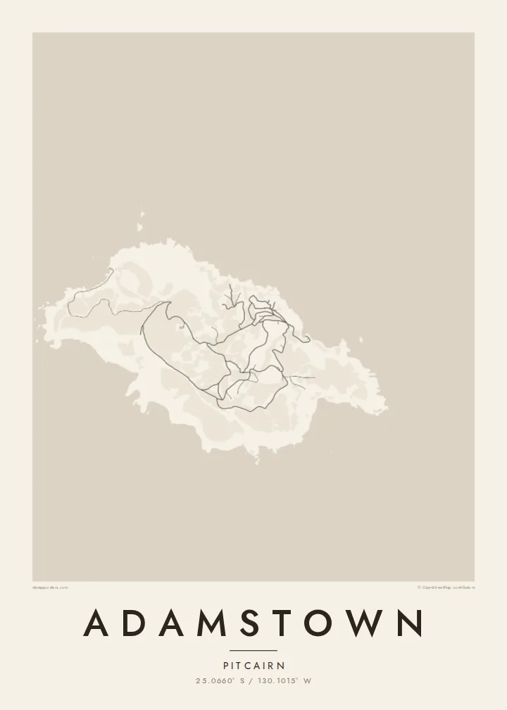
25.0660° S / 130.1015° W
The only settlement on Pitcairn, a scatter of homes and dirt tracks on green slopes high above Bounty Bay.




مدينة واحدة، خمسة أمزجة
اضغط على أي نمط لتراه على الحائط. جميع الأنماط بنفس السعر — مطبوعة أو مؤطرة أو كملفات HD.
 بكسلات حقيقية · ملف طباعة 24 × 36 بوصة
حدّة الطباعة
هذا اقتصاص 100% من ملف الطباعة الحقيقي. كل بوستر — مطبوع أو مؤطر أو منزّل — يُعالَج على خوادمنا بدقة 300 DPI، وصولًا إلى 7,200 × 10,800 بكسل، لتبقى أدق الشوارع واضحة حتى على طباعة 24 × 36 بوصة.
على الحائط


الخريطة
Adamstown is the capital and only village of the Pitcairn Islands, a British Overseas Territory in the South Pacific and one of the least populated jurisdictions in the world. The island was settled in 1790 by mutineers from HMS Bounty and the Tahitians who travelled with them, and many of today's islanders are their descendants. The village is named after John Adams, the last surviving mutineer.
On a map, Adamstown is not a grid but a loose arrangement of houses and public buildings along a network of unpaved tracks on the island's northern slopes. A steep road known as the Hill of Difficulty climbs from the landing at Bounty Bay to the village, and a few further tracks wander out across the rest of the island's small, rugged surface.
Pitcairn is volcanic and only a few square kilometres in area, with cliffs on almost every side and no harbour for large ships. An Adamstown map poster reflects that intimacy of scale: a handful of lines on a hillside and the long, rocky coast of an island where every track eventually leads back to the sea.
The steep track from the landing up to the village is the island's essential route, drawn on the map as a short, sharply climbing line from the shore.
A small cove on the northeast coast serves as the island's landing place, a modest indentation in a coastline otherwise defined by cliffs and rock.
Unpaved roads and paths spread loosely across the slopes around Adamstown, linking homes, public buildings and outlying plots in an informal, organic web.
اجعله خاصًا بك
أضف تاريخًا أو اسمًا أو عبارة خاصة بك، وغيّر النمط أو المقاس أو الاتجاه.
المعاينة المجانية منخفضة الدقة وتحمل علامة مائية. المطبوعات وملفات HD تُعالَج بدقة 300 DPI، وصولًا إلى 7,200 × 10,800 بكسل، بلا علامة مائية.
لماذا Adamstown
Adamstown is a map for people fascinated by the Bounty story, for descendants of the island families, and for those who collect the world's most remote places. Its few, almost hand-drawn lines and generous coastline make a thoughtful piece for a study or library wall.
Add a title, a subtitle or a date of your choosing, and a coordinates line, then choose Classic black & white, Noir, Paper, Blueprint or Sand. The Paper style gives it the feel of an old chart. Download for $9, or order a matte print with an optional wooden frame.
اطلب بوستر Adamstown| مقاس الطباعة | الدقة | الملفات |
|---|---|---|
| 30 × 40 cm11.8 × 15.7″ | 3,543 × 4,724 px | PNG · PDF |
| 29.7 × 42 cm (A3)11.7 × 16.5″ | 3,508 × 4,961 px | PNG · PDF |
| 42 × 59.4 cm (A2)16.5 × 23.4″ | 4,961 × 7,016 px | PNG · PDF |
| 45.7 × 61 cm18 × 24″ | 5,400 × 7,200 px | PNG · PDF |
| 50 × 70 cm19.7 × 27.6″ | 5,906 × 8,268 px | PNG · PDF |
| 61 × 91.4 cm24 × 36″ | 7,200 × 10,800 px | PNG · PDF |
للمقارنة، يبلغ عرض المعاينة المجانية 900 بكسل، وتحمل علامة مائية ومخصصة للشاشات. أما ملفات HD فدقتها أعلى بما يصل إلى 8 أضعاف في كل اتجاه، وتُطبع بوضوح تام بالمقاس الكامل للملصق.
اختر نمطًا من أعلى الصفحة، ثم اختر بوستر مطبوع — بحجم وإطار إن أردت — أو ملفات HD رقمية. الدفع يتم بخطوة واحدة، وتتحدّث صفحة طلبك فور إتمام الدفع.
يُطبع على ورق مطفي فاخر بوزن 200 جرام بأحد ستة مقاسات، من 30 × 40 سم إلى 24 × 36 بوصة. تبدأ أسعار البوسترات المطبوعة من $39، والشحن مشمول.
نعم. اختر إطارًا من الخشب الصلب باللون الأسود أو الأبيض أو خشب البلوط الطبيعي أو الخشب الداكن. يأتي بزجاج مقاوم للكسر وجاهز للتعليق مباشرة. تبدأ أسعار البوسترات المؤطرة من $99، والشحن مشمول.
الشحن مجاني إلى أكثر من 60 دولة. تتم طباعة كل ملصق لدى أقرب شريك طباعة لنا من بين شركاء في أكثر من 30 دولة، ويصل عادةً خلال 3–7 أيام عمل. يمكنك متابعة الحالة وتتبع الشحنة من صفحة «طلباتي». تستغرق بعض الدول من 2 إلى 5 أسابيع، وإذا كنا لا نشحن إلى بلدك بعد، فسيخبرك الموقع بذلك قبل الدفع.
أرسل لنا صورة خلال 14 يومًا من الاستلام، وسنعيد الطباعة مجانًا أو نرد المبلغ.
نعم. من المحرر في هذه الصفحة، غيّر العنوان والعنوان الفرعي وسطر الإحداثيات كما تشاء، واختر النمط والحجم. الطلبات المطبوعة والمؤطرة والرقمية تستخدم تصميمك بالضبط.
مقابل $9 تحصل على ملفات PNG بدقة 300 DPI وملفات PDF جاهزة للطباعة بجميع المقاسات الستة، بلا علامة مائية، لطباعتها في أي مكان. لست متأكدًا بعد؟ نزّل معاينة مجانية بعلامة مائية أولًا.
