Shared urban area
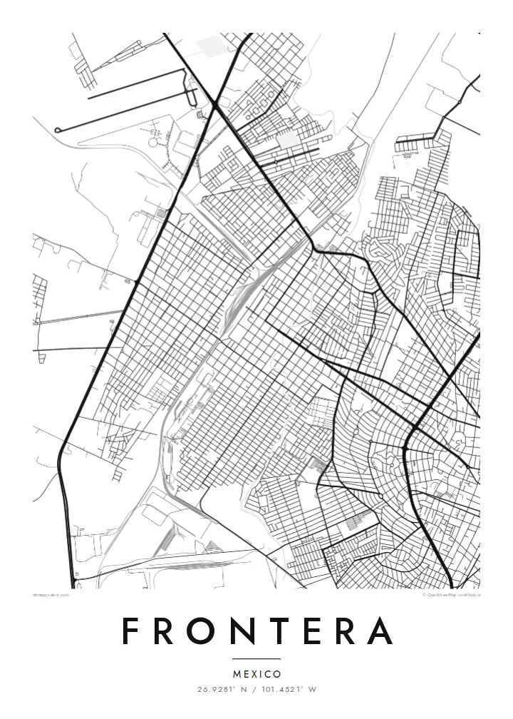
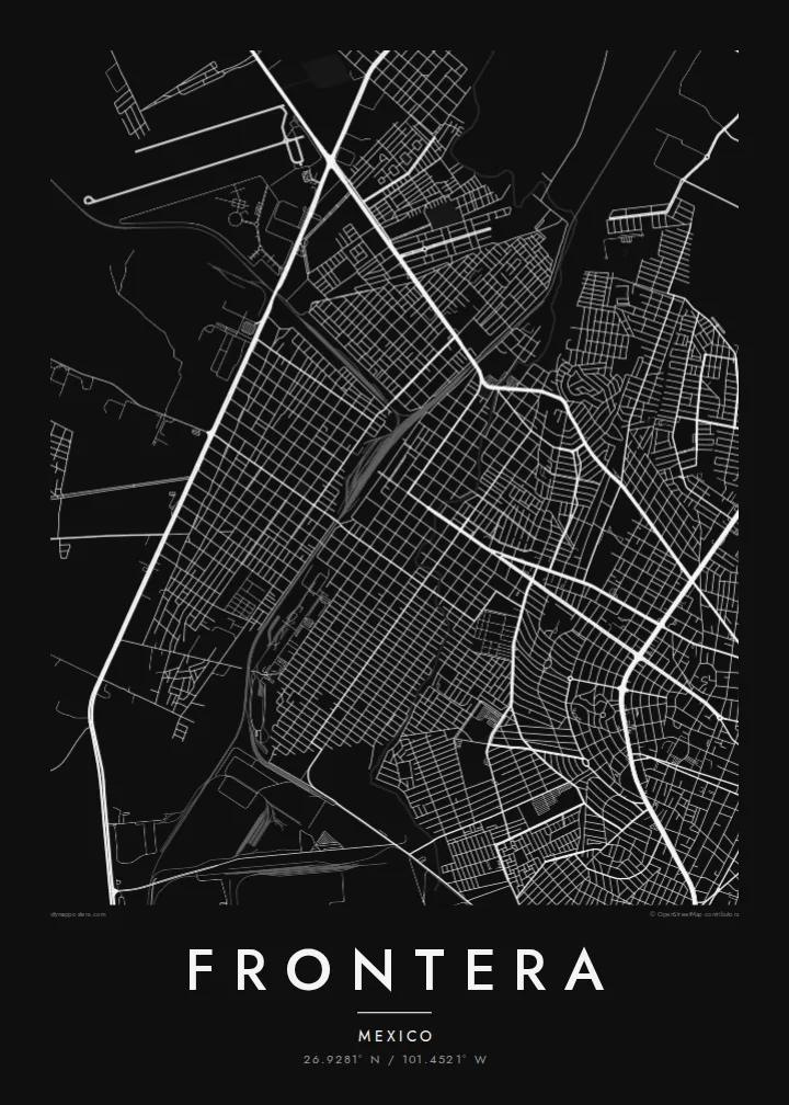
Frontera and Monclova have grown together into one continuous built-up area. On the map, the grid runs from one to the other without a visible break, so the two read as one city.
ملصق خريطة بسيط · المكسيك
26.9281° N / 101.4521° W
A desert-plain city grown into its neighbour Monclova, with river channels, rail lines and industrial blocks framed by bare sierras.


مدينة واحدة، خمسة أمزجة
اضغط على أي نمط لتراه على الحائط. جميع الأنماط بنفس السعر — مطبوعة أو مؤطرة أو كملفات HD.
 بكسلات حقيقية · ملف طباعة 24 × 36 بوصة
حدّة الطباعة
هذا اقتصاص 100% من ملف الطباعة الحقيقي. كل بوستر — مطبوع أو مؤطر أو منزّل — يُعالَج على خوادمنا بدقة 300 DPI، وصولًا إلى 7,200 × 10,800 بكسل، لتبقى أدق الشوارع واضحة حتى على طباعة 24 × 36 بوصة.
على الحائط


الخريطة
Frontera sits on a broad, dry plain in central Coahuila, and from above it is hard to tell where it ends and Monclova begins. The two grew into one urban area, so the street grid runs straight across the municipal line. Long, straight avenues cut across smaller residential blocks. Pale mountain ridges rise on the horizon on almost every side.
Much of the map is shaped by work. Rail spurs, large industrial lots and wide roads for heavy traffic tie Frontera to the steel industry that defined the Monclova region in the twentieth century. Between them sit tight neighbourhoods of small parcels. On paper they look like fine texture set against the big, simple shapes of the plants and yards.
A Frontera map poster keeps this contrast clean: dense housing, large industrial footprints and the thin lines of the local watercourses, drawn in one weight of ink. Because the river channels are dry for much of the year, the city's shape comes mainly from roads and rails. That gives the poster a structured, almost diagrammatic look.
Frontera and Monclova have grown together into one continuous built-up area. On the map, the grid runs from one to the other without a visible break, so the two read as one city.
Large rectangular lots and rail spurs show the region's steel-making past. They form wide, calm shapes that sit apart from the fine grain of the residential streets around them.
Around the city, the lines thin out quickly into open ground. That emptiness is typical of Coahuila's dry plains, and it gives the street network a clear, sharp edge.
اجعله خاصًا بك
أضف تاريخًا أو اسمًا أو عبارة خاصة بك، وغيّر النمط أو المقاس أو الاتجاه.
المعاينة المجانية منخفضة الدقة وتحمل علامة مائية. المطبوعات وملفات HD تُعالَج بدقة 300 DPI، وصولًا إلى 7,200 × 10,800 بكسل، بلا علامة مائية.
لماذا Frontera
For people from Frontera, this map shows home at the scale people actually live it: the avenue to work, the neighbourhood block, the edge where the city gives way to open land. It also suits anyone whose family history runs through northern Mexico's industrial towns.
You can set your own title, subtitle and coordinates line, for example a family name or a year you moved. Then pick Classic black & white, Noir, Paper, Blueprint or Sand. Blueprint suits the city's industrial geometry especially well.
اطلب بوستر Frontera| مقاس الطباعة | الدقة | الملفات |
|---|---|---|
| 30 × 40 cm (11.8 × 15.7″) | 3,543 × 4,724 px | PNG · PDF |
| 29.7 × 42 cm (A3, 11.7 × 16.5″) | 3,508 × 4,961 px | PNG · PDF |
| 42 × 59.4 cm (A2, 16.5 × 23.4″) | 4,961 × 7,016 px | PNG · PDF |
| 45.7 × 61 cm (18 × 24″) | 5,400 × 7,200 px | PNG · PDF |
| 50 × 70 cm (19.7 × 27.6″) | 5,906 × 8,268 px | PNG · PDF |
| 61 × 91.4 cm (24 × 36″) | 7,200 × 10,800 px | PNG · PDF |
للمقارنة، يبلغ عرض المعاينة المجانية 900 بكسل، وتحمل علامة مائية ومخصصة للشاشات. أما ملفات HD فدقتها أعلى بما يصل إلى 8 أضعاف في كل اتجاه، وتُطبع بوضوح تام بالمقاس الكامل للملصق.
اختر نمطًا من أعلى الصفحة، ثم اختر بوستر مطبوع — بحجم وإطار إن أردت — أو ملفات HD رقمية. الدفع يتم بخطوة واحدة، وتتحدّث صفحة طلبك فور إتمام الدفع.
يُطبع على ورق مطفي فاخر بوزن 200 جرام بأحد ستة مقاسات، من 30 × 40 سم إلى 24 × 36 بوصة. تبدأ أسعار البوسترات المطبوعة من {printFrom}، والشحن مشمول.
نعم. اختر إطارًا من الخشب الصلب باللون الأسود أو الأبيض أو خشب البلوط الطبيعي أو الخشب الداكن. يأتي بزجاج مقاوم للكسر وجاهز للتعليق مباشرة. تبدأ أسعار البوسترات المؤطرة من {framedFrom}، والشحن مشمول.
الشحن مجاني حول العالم. يُطبع كل بوستر لدى أقرب شريك طباعة لدينا في أكثر من 30 دولة، وعادة ما يصل خلال 3–7 أيام عمل. يمكنك متابعة الحالة ورقم التتبع من صفحة طلباتي.
أرسل لنا صورة خلال 14 يومًا من الاستلام، وسنعيد الطباعة مجانًا أو نرد المبلغ.
نعم. من المحرر في هذه الصفحة، غيّر العنوان والعنوان الفرعي وسطر الإحداثيات كما تشاء، واختر النمط والحجم. الطلبات المطبوعة والمؤطرة والرقمية تستخدم تصميمك بالضبط.
مقابل $9 تحصل على ملفات PNG بدقة 300 DPI وملفات PDF جاهزة للطباعة بجميع المقاسات الستة، بلا علامة مائية، لطباعتها في أي مكان. لست متأكدًا بعد؟ نزّل معاينة مجانية بعلامة مائية أولًا.
بالقرب منك
