Canal and river
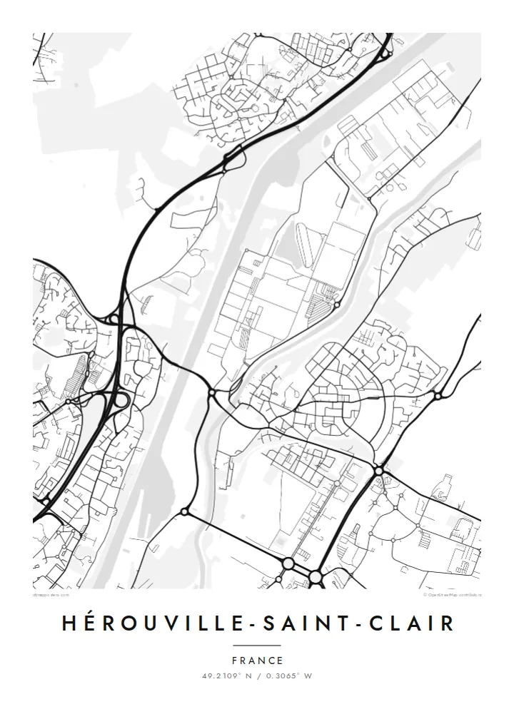
The Caen canal and the Orne run in parallel along the town's eastern side, two straight lines of water that give the poster a firm edge.
ملصق خريطة بسيط · فرنسا
49.2109° N / 0.3065° W
A planned new town beside Caen, its modernist districts bounded by the Orne and the Caen canal


مدينة واحدة، خمسة أمزجة
اضغط على أي نمط لتراه على الحائط. جميع الأنماط بنفس السعر — مطبوعة أو مؤطرة أو كملفات HD.
 بكسلات حقيقية · ملف طباعة 24 × 36 بوصة
حدّة الطباعة
هذا اقتصاص 100% من ملف الطباعة الحقيقي. كل بوستر — مطبوع أو مؤطر أو منزّل — يُعالَج على خوادمنا بدقة 300 DPI، وصولًا إلى 7,200 × 10,800 بكسل، لتبقى أدق الشوارع واضحة حتى على طباعة 24 × 36 بوصة.
على الحائط


الخريطة
Hérouville-Saint-Clair adjoins Caen to the north-east, and most of what appears on the map was built from the 1960s onward, when a small village was transformed into a planned new town. From above, the result is unmistakably modern: large residential districts with curving access roads, pedestrian routes, green spaces and clusters of apartment blocks set apart from through traffic.
The town's eastern edge is defined by water. The Orne river and the Caen canal, which runs to the sea at Ouistreham, lie side by side here, forming two long parallel lines that separate Hérouville from the land beyond. Ring roads and main arteries around Caen cut across the map with sweeping curves.
A Hérouville-Saint-Clair map poster is especially interesting for anyone who appreciates post-war urban planning. Instead of a medieval core, the map shows distinct neighbourhoods, each designed as a unit, stitched together by boulevards and green corridors. The canal and river provide a strong, straight counterpoint to those rounded, self-contained forms.
The Caen canal and the Orne run in parallel along the town's eastern side, two straight lines of water that give the poster a firm edge.
Neighbourhoods laid out during the new-town era appear as distinct units with looping internal roads, a pattern very different from a traditional French centre.
Main roads and the ring road around Caen sweep across the map, connecting Hérouville to the city and giving the composition its broad curves.
اجعله خاصًا بك
أضف تاريخًا أو اسمًا أو عبارة خاصة بك، وغيّر النمط أو المقاس أو الاتجاه.
المعاينة المجانية منخفضة الدقة وتحمل علامة مائية. المطبوعات وملفات HD تُعالَج بدقة 300 DPI، وصولًا إلى 7,200 × 10,800 بكسل، بلا علامة مائية.
لماذا Hérouville-Saint-Clair
Hérouville suits people who grew up in its districts, studied in Caen or simply enjoy the look of mid-century planning. The map has a graphic, almost architectural quality that works well in modern interiors.
Personalise the title and subtitle, perhaps with a district name or the year you moved, and set the coordinates line. Blueprint highlights the planned layout, while Classic black & white, Noir, Paper and Sand offer other moods.
اطلب بوستر Hérouville-Saint-Clair| مقاس الطباعة | الدقة | الملفات |
|---|---|---|
| 30 × 40 cm11.8 × 15.7″ | 3,543 × 4,724 px | PNG · PDF |
| 29.7 × 42 cm (A3)11.7 × 16.5″ | 3,508 × 4,961 px | PNG · PDF |
| 42 × 59.4 cm (A2)16.5 × 23.4″ | 4,961 × 7,016 px | PNG · PDF |
| 45.7 × 61 cm18 × 24″ | 5,400 × 7,200 px | PNG · PDF |
| 50 × 70 cm19.7 × 27.6″ | 5,906 × 8,268 px | PNG · PDF |
| 61 × 91.4 cm24 × 36″ | 7,200 × 10,800 px | PNG · PDF |
للمقارنة، يبلغ عرض المعاينة المجانية 900 بكسل، وتحمل علامة مائية ومخصصة للشاشات. أما ملفات HD فدقتها أعلى بما يصل إلى 8 أضعاف في كل اتجاه، وتُطبع بوضوح تام بالمقاس الكامل للملصق.
اختر نمطًا من أعلى الصفحة، ثم اختر بوستر مطبوع — بحجم وإطار إن أردت — أو ملفات HD رقمية. الدفع يتم بخطوة واحدة، وتتحدّث صفحة طلبك فور إتمام الدفع.
يُطبع على ورق مطفي فاخر بوزن 200 جرام بأحد ستة مقاسات، من 30 × 40 سم إلى 24 × 36 بوصة. تبدأ أسعار البوسترات المطبوعة من $39، والشحن مشمول.
نعم. اختر إطارًا من الخشب الصلب باللون الأسود أو الأبيض أو خشب البلوط الطبيعي أو الخشب الداكن. يأتي بزجاج مقاوم للكسر وجاهز للتعليق مباشرة. تبدأ أسعار البوسترات المؤطرة من $99، والشحن مشمول.
الشحن مجاني إلى أكثر من 60 دولة. تتم طباعة كل ملصق لدى أقرب شريك طباعة لنا من بين شركاء في أكثر من 30 دولة، ويصل عادةً خلال 3–7 أيام عمل. يمكنك متابعة الحالة وتتبع الشحنة من صفحة «طلباتي». تستغرق بعض الدول من 2 إلى 5 أسابيع، وإذا كنا لا نشحن إلى بلدك بعد، فسيخبرك الموقع بذلك قبل الدفع.
أرسل لنا صورة خلال 14 يومًا من الاستلام، وسنعيد الطباعة مجانًا أو نرد المبلغ.
نعم. من المحرر في هذه الصفحة، غيّر العنوان والعنوان الفرعي وسطر الإحداثيات كما تشاء، واختر النمط والحجم. الطلبات المطبوعة والمؤطرة والرقمية تستخدم تصميمك بالضبط.
مقابل $9 تحصل على ملفات PNG بدقة 300 DPI وملفات PDF جاهزة للطباعة بجميع المقاسات الستة، بلا علامة مائية، لطباعتها في أي مكان. لست متأكدًا بعد؟ نزّل معاينة مجانية بعلامة مائية أولًا.
بالقرب منك
