Beerenberg
The volcano fills the northern end of the island, and its round, glacier-covered cone gives the map a strong, heavy head. The coastline around it is steep and largely inaccessible.
ملصق خريطة بسيط · النرويج
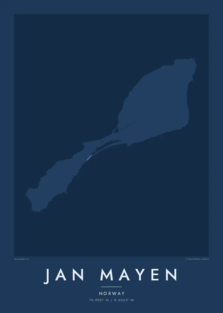
70.9931° N / 8.5029° W
A narrow Arctic island of two volcanic halves joined by a thin neck, crowned by a glaciated volcano in the north.



مدينة واحدة، خمسة أمزجة
اضغط على أي نمط لتراه على الحائط. جميع الأنماط بنفس السعر — مطبوعة أو مؤطرة أو كملفات HD.
 بكسلات حقيقية · ملف طباعة 24 × 36 بوصة
حدّة الطباعة
هذا اقتصاص 100% من ملف الطباعة الحقيقي. كل بوستر — مطبوع أو مؤطر أو منزّل — يُعالَج على خوادمنا بدقة 300 DPI، وصولًا إلى 7,200 × 10,800 بكسل، لتبقى أدق الشوارع واضحة حتى على طباعة 24 × 36 بوصة.
على الحائط


الخريطة
Jan Mayen is a Norwegian volcanic island in the Arctic Ocean, northeast of Iceland. It is long and slender, and its outline falls into two parts: a broad northern section dominated by the volcano Beerenberg, and a lower, narrower southern section, linked by a slim isthmus. Beerenberg is the northernmost active volcano above sea level, and glaciers flow down its flanks toward the sea.
There is no permanent population. A small station staffed by Norwegian personnel handles weather observation and other services, and it accounts for most of the island's few tracks and buildings. A Jan Mayen map poster is therefore almost entirely coastline: capes, lagoons and the round mass of the volcano, with only the faintest trace of anything built by people.
Access is restricted, and the island is rarely visited outside official duty or occasional expeditions. Its isolation is part of its appeal as a subject. The outline, with its heavy northern head and thin southern tail, is one of the more unusual shapes a map poster can hold, and it reads clearly even without streets.
The volcano fills the northern end of the island, and its round, glacier-covered cone gives the map a strong, heavy head. The coastline around it is steep and largely inaccessible.
A narrow neck of land joins the two halves, with small lagoons along its shores. On the poster it is the thinnest point of the outline, easy to trace by eye.
The island's only settlement is a small cluster of buildings and tracks used by station staff. It is the one place where the map shows anything made by people.
اجعله خاصًا بك
أضف تاريخًا أو اسمًا أو عبارة خاصة بك، وغيّر النمط أو المقاس أو الاتجاه.
المعاينة المجانية منخفضة الدقة وتحمل علامة مائية. المطبوعات وملفات HD تُعالَج بدقة 300 DPI، وصولًا إلى 7,200 × 10,800 بكسل، بلا علامة مائية.
لماذا Jan Mayen
Jan Mayen appeals to people who have served on the station, polar travellers and those who collect remote places. It is a map almost free of roads, which makes the poster feel more like a drawing of land and sea than a guide.
Use the title and subtitle for a posting, an expedition year or simply the island's name, and adjust the coordinates line. Noir and Blueprint suit its Arctic character, though all five styles, including Classic, Paper and Sand, are available. Files include six sizes as PNG and PDF.
اطلب بوستر Jan Mayen| مقاس الطباعة | الدقة | الملفات |
|---|---|---|
| 30 × 40 cm11.8 × 15.7″ | 3,543 × 4,724 px | PNG · PDF |
| 29.7 × 42 cm (A3)11.7 × 16.5″ | 3,508 × 4,961 px | PNG · PDF |
| 42 × 59.4 cm (A2)16.5 × 23.4″ | 4,961 × 7,016 px | PNG · PDF |
| 45.7 × 61 cm18 × 24″ | 5,400 × 7,200 px | PNG · PDF |
| 50 × 70 cm19.7 × 27.6″ | 5,906 × 8,268 px | PNG · PDF |
| 61 × 91.4 cm24 × 36″ | 7,200 × 10,800 px | PNG · PDF |
للمقارنة، يبلغ عرض المعاينة المجانية 900 بكسل، وتحمل علامة مائية ومخصصة للشاشات. أما ملفات HD فدقتها أعلى بما يصل إلى 8 أضعاف في كل اتجاه، وتُطبع بوضوح تام بالمقاس الكامل للملصق.
اختر نمطًا من أعلى الصفحة، ثم اختر بوستر مطبوع — بحجم وإطار إن أردت — أو ملفات HD رقمية. الدفع يتم بخطوة واحدة، وتتحدّث صفحة طلبك فور إتمام الدفع.
يُطبع على ورق مطفي فاخر بوزن 200 جرام بأحد ستة مقاسات، من 30 × 40 سم إلى 24 × 36 بوصة. تبدأ أسعار البوسترات المطبوعة من $39، والشحن مشمول.
نعم. اختر إطارًا من الخشب الصلب باللون الأسود أو الأبيض أو خشب البلوط الطبيعي أو الخشب الداكن. يأتي بزجاج مقاوم للكسر وجاهز للتعليق مباشرة. تبدأ أسعار البوسترات المؤطرة من $99، والشحن مشمول.
الشحن مجاني إلى أكثر من 60 دولة. تتم طباعة كل ملصق لدى أقرب شريك طباعة لنا من بين شركاء في أكثر من 30 دولة، ويصل عادةً خلال 3–7 أيام عمل. يمكنك متابعة الحالة وتتبع الشحنة من صفحة «طلباتي». تستغرق بعض الدول من 2 إلى 5 أسابيع، وإذا كنا لا نشحن إلى بلدك بعد، فسيخبرك الموقع بذلك قبل الدفع.
أرسل لنا صورة خلال 14 يومًا من الاستلام، وسنعيد الطباعة مجانًا أو نرد المبلغ.
نعم. من المحرر في هذه الصفحة، غيّر العنوان والعنوان الفرعي وسطر الإحداثيات كما تشاء، واختر النمط والحجم. الطلبات المطبوعة والمؤطرة والرقمية تستخدم تصميمك بالضبط.
مقابل $9 تحصل على ملفات PNG بدقة 300 DPI وملفات PDF جاهزة للطباعة بجميع المقاسات الستة، بلا علامة مائية، لطباعتها في أي مكان. لست متأكدًا بعد؟ نزّل معاينة مجانية بعلامة مائية أولًا.
