Uraniborg site
Near the middle of the island, the site of Tycho Brahe's observatory and its reconstructed garden forms a small, deliberate geometric figure among the surrounding farmland.
ملصق خريطة بسيط · السويد
55.9058° N / 12.6958° E
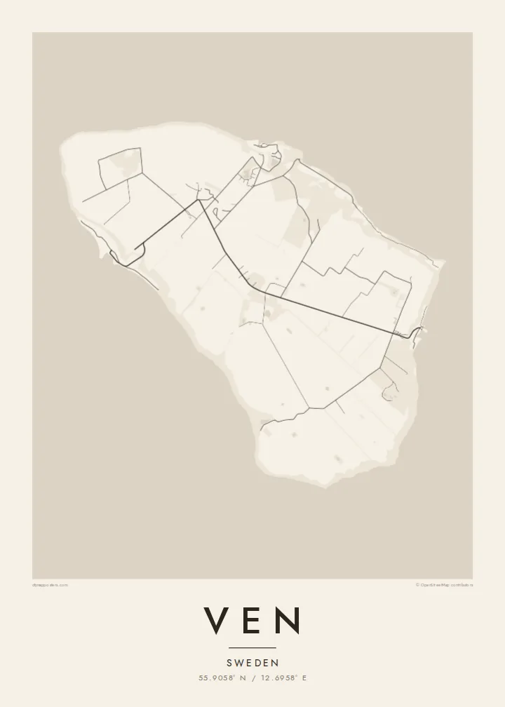
A small, flat-topped island in the Øresund, ringed by steep banks and crossed by quiet lanes between open fields.




مدينة واحدة، خمسة أمزجة
اضغط على أي نمط لتراه على الحائط. جميع الأنماط بنفس السعر — مطبوعة أو مؤطرة أو كملفات HD.
 بكسلات حقيقية · ملف طباعة 24 × 36 بوصة
حدّة الطباعة
هذا اقتصاص 100% من ملف الطباعة الحقيقي. كل بوستر — مطبوع أو مؤطر أو منزّل — يُعالَج على خوادمنا بدقة 300 DPI، وصولًا إلى 7,200 × 10,800 بكسل، لتبقى أدق الشوارع واضحة حتى على طباعة 24 × 36 بوصة.
على الحائط


الخريطة
Ven sits in the middle of the Øresund, the strait between Sweden and Denmark, and belongs to Landskrona municipality on the Swedish side. It is a compact oval island, a raised plateau of farmland whose steep slopes and cliffs drop to narrow beaches. From above, the patchwork of fields and the thin lanes crossing them give the interior a gentle, almost ruled texture.
The island is best known for Tycho Brahe, the Danish astronomer who was granted Ven in the 1570s and built two observatories there, Uraniborg and the partly underground Stjerneborg. His precise observations of the stars and planets later helped Johannes Kepler work out the laws of planetary motion. The site is now a museum, and its Renaissance garden has been reconstructed in a clear geometric plan.
The harbours of Bäckviken and Kyrkbacken sit on the east and west coasts respectively, and the lanes between them are mostly travelled by bicycle. A Ven map poster shows the whole island at a glance. A little of the Swedish or Danish shore at the edge hints at how close the island is to both countries, and how separate from them.
Near the middle of the island, the site of Tycho Brahe's observatory and its reconstructed garden forms a small, deliberate geometric figure among the surrounding farmland.
The plateau ends abruptly at steep grassy slopes that drop to the water, so the coastline on the map is a firm, clean edge rather than a ragged one.
The ferry from Landskrona arrives at this small east-coast harbour. From there a short road climbs off the water onto the plateau and fans out into the island's lanes.
اجعله خاصًا بك
أضف تاريخًا أو اسمًا أو عبارة خاصة بك، وغيّر النمط أو المقاس أو الاتجاه.
المعاينة المجانية منخفضة الدقة وتحمل علامة مائية. المطبوعات وملفات HD تُعالَج بدقة 300 DPI، وصولًا إلى 7,200 × 10,800 بكسل، بلا علامة مائية.
لماذا Ven
Ven suits anyone drawn to the history of astronomy, and the many people who have cycled its lanes on a summer day out from Landskrona or Copenhagen. Its tidy oval shape is easy to recognise and holds a surprising amount of history for so small a place.
Personalise the title, subtitle and coordinates line, perhaps with the date of that ride or a line about Tycho, and choose one of five styles. Noir makes a fitting night sky. The files come as 300 DPI PNG and print-ready PDF in six sizes for $9, or you can order a printed poster, framed if you like.
اطلب بوستر Ven| مقاس الطباعة | الدقة | الملفات |
|---|---|---|
| 30 × 40 cm (11.8 × 15.7″) | 3,543 × 4,724 px | PNG · PDF |
| 29.7 × 42 cm (A3, 11.7 × 16.5″) | 3,508 × 4,961 px | PNG · PDF |
| 42 × 59.4 cm (A2, 16.5 × 23.4″) | 4,961 × 7,016 px | PNG · PDF |
| 45.7 × 61 cm (18 × 24″) | 5,400 × 7,200 px | PNG · PDF |
| 50 × 70 cm (19.7 × 27.6″) | 5,906 × 8,268 px | PNG · PDF |
| 61 × 91.4 cm (24 × 36″) | 7,200 × 10,800 px | PNG · PDF |
للمقارنة، يبلغ عرض المعاينة المجانية 900 بكسل، وتحمل علامة مائية ومخصصة للشاشات. أما ملفات HD فدقتها أعلى بما يصل إلى 8 أضعاف في كل اتجاه، وتُطبع بوضوح تام بالمقاس الكامل للملصق.
اختر نمطًا من أعلى الصفحة، ثم اختر بوستر مطبوع — بحجم وإطار إن أردت — أو ملفات HD رقمية. الدفع يتم بخطوة واحدة، وتتحدّث صفحة طلبك فور إتمام الدفع.
يُطبع على ورق مطفي فاخر بوزن 200 جرام بأحد ستة مقاسات، من 30 × 40 سم إلى 24 × 36 بوصة. تبدأ أسعار البوسترات المطبوعة من {printFrom}، والشحن مشمول.
نعم. اختر إطارًا من الخشب الصلب باللون الأسود أو الأبيض أو خشب البلوط الطبيعي أو الخشب الداكن. يأتي بزجاج مقاوم للكسر وجاهز للتعليق مباشرة. تبدأ أسعار البوسترات المؤطرة من {framedFrom}، والشحن مشمول.
الشحن مجاني حول العالم. يُطبع كل بوستر لدى أقرب شريك طباعة لدينا في أكثر من 30 دولة، وعادة ما يصل خلال 3–7 أيام عمل. يمكنك متابعة الحالة ورقم التتبع من صفحة طلباتي.
أرسل لنا صورة خلال 14 يومًا من الاستلام، وسنعيد الطباعة مجانًا أو نرد المبلغ.
نعم. من المحرر في هذه الصفحة، غيّر العنوان والعنوان الفرعي وسطر الإحداثيات كما تشاء، واختر النمط والحجم. الطلبات المطبوعة والمؤطرة والرقمية تستخدم تصميمك بالضبط.
مقابل $9 تحصل على ملفات PNG بدقة 300 DPI وملفات PDF جاهزة للطباعة بجميع المقاسات الستة، بلا علامة مائية، لطباعتها في أي مكان. لست متأكدًا بعد؟ نزّل معاينة مجانية بعلامة مائية أولًا.
