Green River bends
The river meanders across the valley in wide loops, lined with trails and parks. Its curves contrast with the straight industrial roads and rail corridors that run alongside it.
پوستر نقشه مینیمال · ایالات متحده
47.3809° N / 122.2348° W
A flat river valley of warehouses and rail lines, climbing on both sides to residential hills cut by winding streets



یک شهر، پنج حالوهوا
روی یک سبک ضربه بزنید تا آن را روی دیوار ببینید. همه سبکها قیمت یکسانی دارند — چاپی، قابشده یا فایلهای HD.
 پیکسل واقعی · فایل چاپی ۲۴ × ۳۶ اینچ
وضوح چاپی
این یک برش ۱۰۰٪ از فایل چاپی واقعی است. هر پوستر — چاپی، قابشده یا دانلودی — روی سرورهای ما با کیفیت 300 DPI و تا 7,200 × 10,800 پیکسل رندر میشود، به همین دلیل حتی ریزترین خیابانها هم روی چاپ ۲۴ × ۳۶ اینچ واضح میمانند.
روی دیوار


نقشه
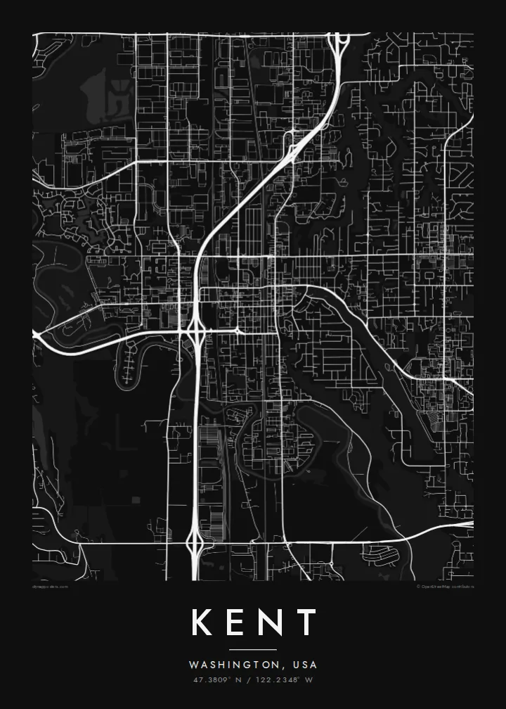
Kent sits in the Green River valley in King County, between Seattle and Tacoma. The map makes the landform obvious. The valley floor is flat and filled with large, rectangular industrial parcels, rail lines and long straight roads, while East Hill and West Hill rise on either side with curving residential streets and cul-de-sacs. The Green River winds through the valley in slow loops, clearly visible even at small scale.
The valley has long been one of the largest warehouse and distribution areas on the West Coast, and aerospace work, including Boeing facilities, has shaped the local economy for decades. A compact historic downtown sits near the rail lines, and highways such as Interstate 5 to the west and State Route 167 through the valley tie the city into the wider Puget Sound region.
A Kent map poster shows these contrasts cleanly. Wide blank blocks on the valley floor sit against the fine texture of hillside neighbourhoods, and the river threads between them. In black and white, the city reads less like a suburb and more like a landscape: a floodplain, two ridges and the networks laid over them.
The river meanders across the valley in wide loops, lined with trails and parks. Its curves contrast with the straight industrial roads and rail corridors that run alongside it.
Large rectangular lots and long, straight streets fill the valley floor. On the poster they create broad calm areas that make the busier hillside streets stand out.
Residential neighbourhoods on the slopes use curving roads and short loops that follow the terrain, giving each side of the valley a softer, more organic pattern.
شخصیسازی کنید
یک تاریخ، یک نام یا جملهای از خودتان اضافه کنید و سبک، اندازه یا جهت را تغییر دهید.
پیشنمایش رایگان کیفیت پایین و دارای واترمارک است. نسخههای چاپی و فایلهای HD با کیفیت 300 DPI، تا 7,200 × 10,800 پیکسل و بدون واترمارک رندر میشوند.
چرا Kent
The Kent map suits people who grew up on one of the hills, work in the valley or moved away from the Puget Sound area and want a reminder of it. It shows the shape of the place in a way a skyline photo can't, with the river at the centre.
Personalise the title, subtitle and coordinates, and pick one of five styles: Classic black & white, Noir, Paper, Blueprint or Sand. A free 900 px preview lets you check the framing, and printed posters ship from partners in more than 30 countries.
سفارش پوستر Kent| اندازه چاپ | وضوح | فایلها |
|---|---|---|
| 30 × 40 cm (11.8 × 15.7″) | 3,543 × 4,724 px | PNG · PDF |
| 29.7 × 42 cm (A3, 11.7 × 16.5″) | 3,508 × 4,961 px | PNG · PDF |
| 42 × 59.4 cm (A2, 16.5 × 23.4″) | 4,961 × 7,016 px | PNG · PDF |
| 45.7 × 61 cm (18 × 24″) | 5,400 × 7,200 px | PNG · PDF |
| 50 × 70 cm (19.7 × 27.6″) | 5,906 × 8,268 px | PNG · PDF |
| 61 × 91.4 cm (24 × 36″) | 7,200 × 10,800 px | PNG · PDF |
برای مقایسه، پیشنمایش رایگان ۹۰۰ پیکسل عرض دارد، واترمارکدار است و برای نمایش روی صفحه در نظر گرفته شده. فایلهای HD در هر جهت تا ۸ برابر وضوح بیشتری دارند و در اندازه کامل پوستر بهخوبی چاپ میشوند.
یک سبک را از بالای صفحه انتخاب کنید، سپس پوستر چاپی — یک اندازه و در صورت تمایل یک قاب — یا فایلهای دیجیتال HD را انتخاب کنید. پرداخت فقط یک مرحله دارد و صفحه سفارش شما به محض تکمیل پرداخت بهروزرسانی میشود.
روی کاغذ مات پرمیوم ۲۰۰ گرمی و در یکی از شش اندازه، از ۳۰ × ۴۰ سانتیمتر تا ۲۴ × ۳۶ اینچ، چاپ میشود. قیمت پوسترهای چاپی از {printFrom} شروع میشود و هزینه ارسال هم شامل آن است.
بله. یک قاب چوب طبیعی به رنگ مشکی، سفید، بلوط طبیعی یا چوب تیره انتخاب کنید. این قاب با شیشه ضدشکست عرضه میشود و آماده نصب است. قیمت پوسترهای قابشده از {framedFrom} شروع میشود و هزینه ارسال هم شامل آن است.
ارسال در سراسر جهان رایگان است. هر پوستر توسط نزدیکترین شریک چاپ ما در بیش از ۳۰ کشور چاپ میشود و معمولاً طی ۳ تا ۷ روز کاری میرسد. میتوانید وضعیت و رهگیری سفارش را در بخش سفارشهای من دنبال کنید.
ظرف ۱۴ روز از تحویل، یک عکس برای ما بفرستید تا آن را بهصورت رایگان دوباره چاپ کنیم یا هزینهتان را بازگردانیم.
بله. در ویرایشگر همین صفحه، عنوان، زیرعنوان و خط مختصات را به دلخواه تغییر دهید و یک سبک و اندازه انتخاب کنید. سفارشهای چاپی، قابشده و دیجیتال همگی دقیقاً از طرح شما استفاده میکنند.
با $9 فایلهای PNG با کیفیت 300 DPI و فایلهای PDF آماده چاپ را در هر شش اندازه، بدون واترمارک، دریافت میکنید تا هر جا خواستید چاپ کنید. هنوز مطمئن نیستید؟ ابتدا یک پیشنمایش رایگان با واترمارک دانلود کنید.
