Historic centre
The older heart of Borne has a looser, more irregular street pattern than the planned districts around it, a small knot of history in the middle of the map.
Minimalistiskt kortplakat · Niðurlond
52.3014° N / 6.7482° E
A Twente town between Hengelo and Almelo, its old core surrounded by tidy residential districts, green belts and farmland


Ein býur, fimm stemningar
Trýst á ein stíl fyri at síggja hann á veggnum. Allir stílar kosta tað sama — sum prent, í ramma ella sum HD-fílur.
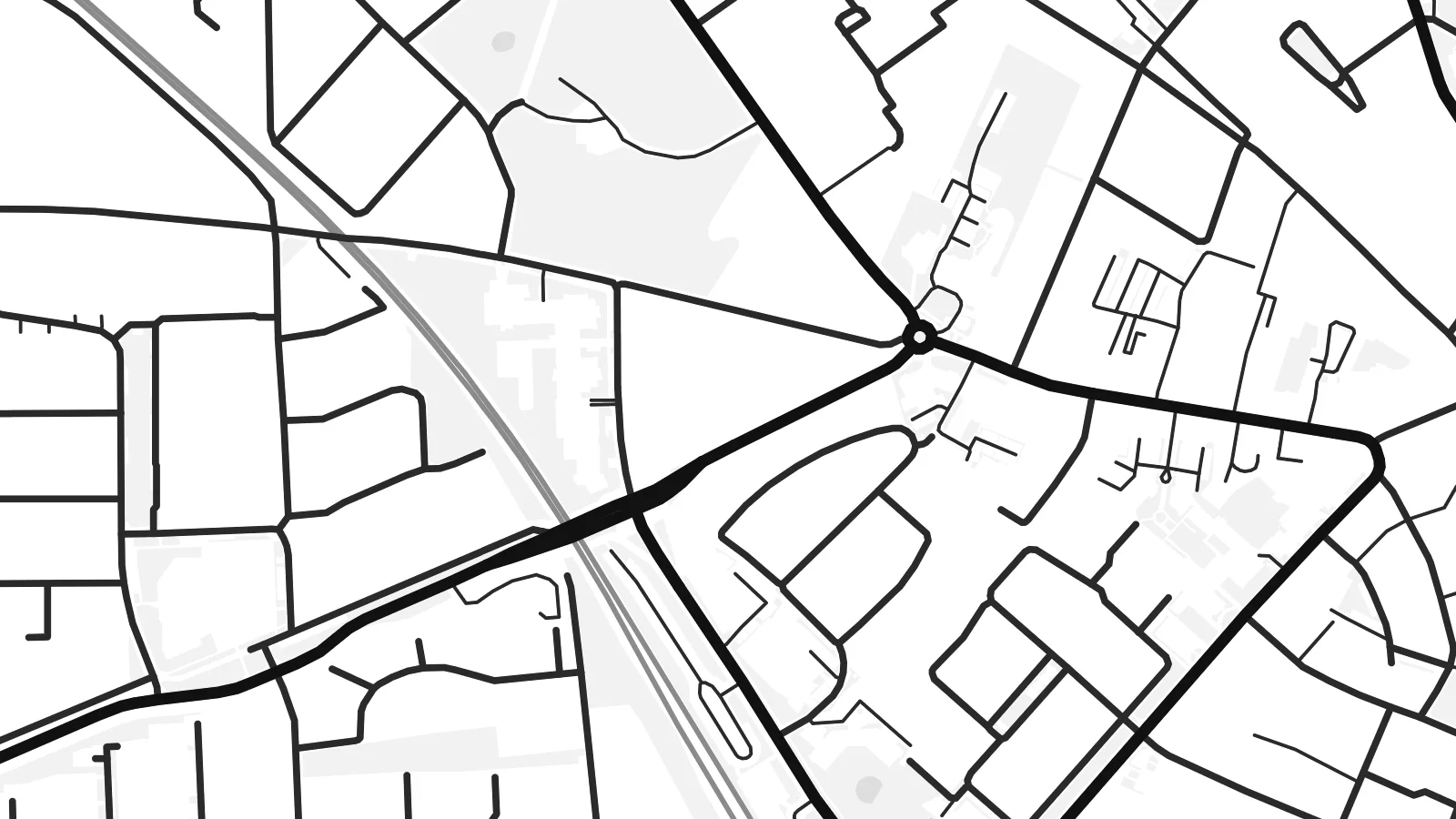 Veruligar pixlar · 24 × 36″ prentfíla
Prentskarpt
Hetta er ein 100% útskurður av teirri veruligu prentfíluni. Hvør plakat — prentað, í ramma ella niðurhalað — verður gjørd á okkara ambætarum við 300 DPI, upp til 7,200 × 10,800 pixlar, so eisini tær smæstu gøtur halda seg skarpar á einum 24 × 36″ prenti.
Á veggnum


Kortið
Borne is a town in the Twente region of Overijssel in the eastern Netherlands, set between the larger towns of Hengelo and Almelo. Like much of Twente, it grew with the textile industry in the nineteenth and twentieth centuries. Weaving mills shaped its economy and much of its growth.
Today the map shows a compact historic centre surrounded by the planned residential neighbourhoods typical of Dutch towns: orderly streets, cycle paths and green strips woven between the houses. Newer districts extend the town outward, and the flat surrounding countryside is divided into fields, wooded patches and farm lanes.
A Borne map poster gives the town a tidy, legible outline in which each district has its own rhythm, from the older centre to the more regular newer estates. Main roads and railway lines link it to its neighbours, adding strong straight lines across the composition.
The older heart of Borne has a looser, more irregular street pattern than the planned districts around it, a small knot of history in the middle of the map.
Residential areas built over the past decades follow neat, repeating layouts with green strips and cycle routes, giving the poster a calm, ordered texture.
Flat farmland, woodland and small lanes surround the town, a patchwork of open space that separates Borne from Hengelo and Almelo on either side.
Ger tað til títt
Legg ein dag, eitt navn ella egnan tekst afturat, skift stíl, stødd ella snið.
Ókeypis forskoðanin er í lágari upploysing og hevur vatnmerki. Prent og HD-fílur verða gjørdar við 300 DPI, upp til 7,200 × 10,800 px, uttan vatnmerki.
Hví Borne
Borne suits people who grew up in Twente, commute between its towns or settled here for its quieter pace. The map shows a familiar everyday place with clarity, and fits easily into a modern Dutch interior.
Personalise the title, subtitle and coordinates line, and choose from Classic black and white, Noir, Paper, Blueprint and Sand. Printed posters ship from partners in more than 30 countries, or download HD files for $9.
Panta Borne-plakatið| Prentstødd | Upploysn | Fílur |
|---|---|---|
| 30 × 40 cm (11.8 × 15.7″) | 3,543 × 4,724 px | PNG · PDF |
| 29.7 × 42 cm (A3, 11.7 × 16.5″) | 3,508 × 4,961 px | PNG · PDF |
| 42 × 59.4 cm (A2, 16.5 × 23.4″) | 4,961 × 7,016 px | PNG · PDF |
| 45.7 × 61 cm (18 × 24″) | 5,400 × 7,200 px | PNG · PDF |
| 50 × 70 cm (19.7 × 27.6″) | 5,906 × 8,268 px | PNG · PDF |
| 61 × 91.4 cm (24 × 36″) | 7,200 × 10,800 px | PNG · PDF |
Til samanberingar er ókeypis forsýningin 900 px breið, við vatnmerki og ætlað til skerm. HD-fílurnar hava upp til 8 ferðir so høga upploysn í hvørja átt og verða prentaðar reint í fullari plakatstødd.
Vel ein stíl ovast á síðuni, og vel síðani Prentað Plakat — eina stødd og, um tú vil, eina ramma — ella Digital HD-Fílur. Tað tekur bara eitt stig at ganga til kassa, og pantanarsíðan tín dagførist so skjótt sum gjaldið er gjøgnumført.
Tað verður prentað á 200 gsm matt kvalitetspappír í einari av seks støddum, frá 30 × 40 cm til 24 × 36″. Prentaðar plakatir byrja á {printFrom}, sending íroknað.
Ja. Vel eina ramma av massivum træi í svørtum, hvítum, natúrligum eik ella dekkum træi. Hon kemur við glassi, sum ikki brotnar, og er klár at hongja upp. Plakatir í ramma byrja á {framedFrom}, sending íroknað.
Sending er ókeypis um allan heimin. Hvør plakat verður prentað av tí næstu av okkara prentpartnarum í 30+ londum og kemur vanliga innan 3–7 arbeiðsdagar. Tú kanst fylgja við støðu og sporing undir Mínar Pantanir.
Send okkum eitt mynd innan 14 dagar eftir móttøku, og vit prenta tað umaftur ókeypis ella endurgjalda tær.
Ja. Í ritlinum á hesi síðu kanst tú broyta heitið, undirheitið og koordinatlinjuna til hvat sum helst, og velja stíl og stødd. Prentaðar, ramma- og digitalar pantanir brúka allar sama honnun, sum tú hevur gjørt.
Fyri $9 fært tú 300 DPI PNG- og prentklárar PDF-fílur í øllum seks støddum, uttan vatnmerki, so tú kanst prenta hvar sum helst. Ikki vís enn? Halda niður eina ókeypis forskoðan við vatnmerki fyrst.
