Medan Merdeka
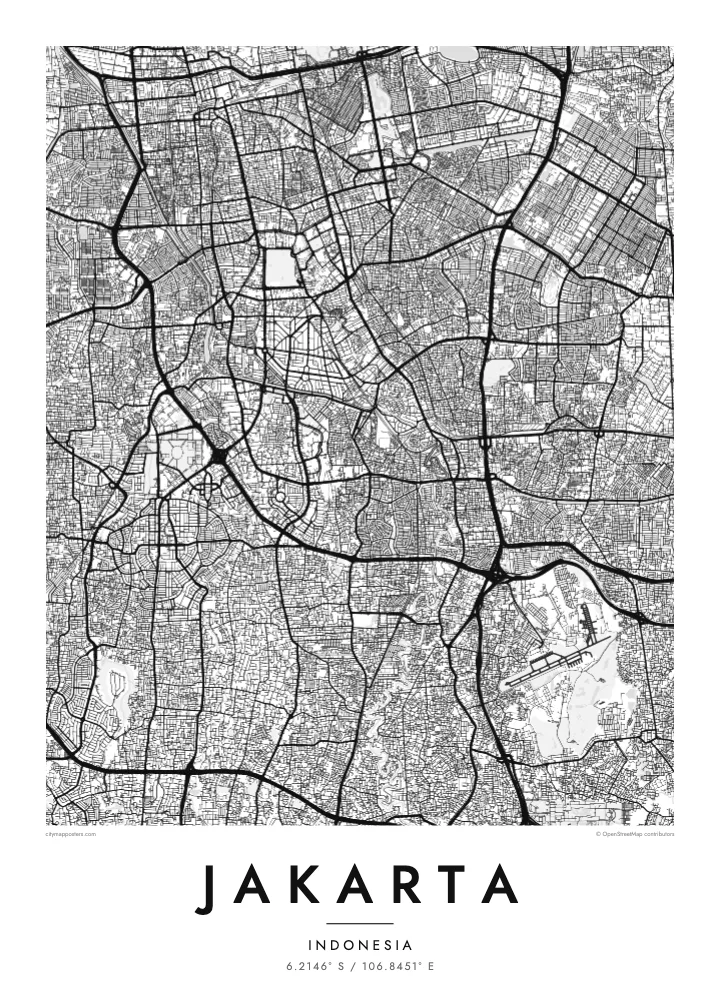
One of the largest city squares in the world, a near-square open field with the National Monument at its centre. On the map it forms a strong, blank anchor in the middle of the city.
Minimalistiskt kortplakat · Indonesia
6.2146° S / 106.8451° E
A flat coastal capital on Java's north shore, crossed by rivers and flood canals, with the old Batavia harbour at its edge.


Ein býur, fimm stemningar
Trýst á ein stíl fyri at síggja hann á veggnum. Allir stílar kosta tað sama — sum prent, í ramma ella sum HD-fílur.
 Veruligar pixlar · 24 × 36″ prentfíla
Prentskarpt
Hetta er ein 100% útskurður av teirri veruligu prentfíluni. Hvør plakat — prentað, í ramma ella niðurhalað — verður gjørd á okkara ambætarum við 300 DPI, upp til 7,200 × 10,800 pixlar, so eisini tær smæstu gøtur halda seg skarpar á einum 24 × 36″ prenti.
Á veggnum


Kortið
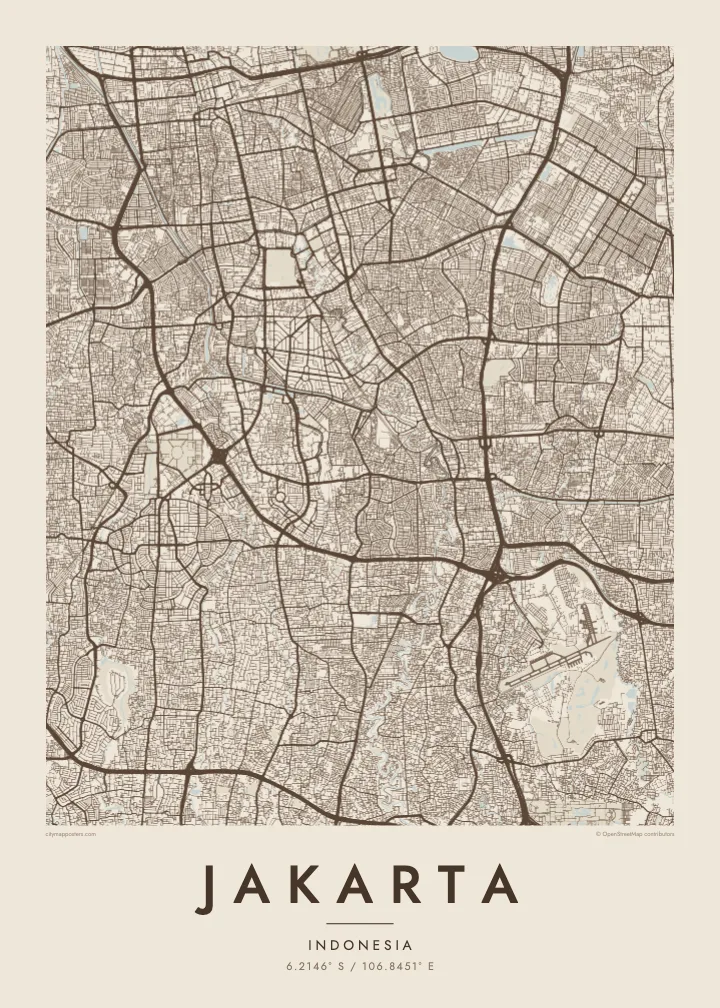
Jakarta spreads across a low, flat plain on the northern coast of Java, facing Jakarta Bay. Because the land is so level, water shapes much of the map. The Ciliwung and several other rivers flow north through the city to the sea, and two large flood canals, the West and East Banjir Kanal, cut across it to carry water past the centre.
The oldest part of the city is Kota Tua in the north, once the Dutch colonial settlement of Batavia. Its canals and warehouses sit beside Sunda Kelapa, the old harbour where wooden schooners still load cargo. To the south, the planned centre spreads around Medan Merdeka, a vast square with the National Monument at its middle, surrounded by ministries and wide avenues.
Beyond the centre, Jakarta becomes an enormous metropolitan region of toll roads and suburban grids. Parts of the north coast are subsiding, one reason the government decided to develop a new capital, Nusantara, in East Kalimantan. A Jakarta map poster records the city as it is now, from the bay and old port to the long avenues of Thamrin and Sudirman.
One of the largest city squares in the world, a near-square open field with the National Monument at its centre. On the map it forms a strong, blank anchor in the middle of the city.
Two long flood canals that bend around the core, the western one dating from the Dutch period and the eastern completed much later. Their clean curves stand apart from the winding natural rivers.
The old port at the mouth of the Ciliwung, with narrow basins and quays beside Kota Tua. It marks the point where the city began, on the shore of Jakarta Bay.
Ger tað til títt
Legg ein dag, eitt navn ella egnan tekst afturat, skift stíl, stødd ella snið.
Ókeypis forskoðanin er í lágari upploysing og hevur vatnmerki. Prent og HD-fílur verða gjørdar við 300 DPI, upp til 7,200 × 10,800 px, uttan vatnmerki.
Hví Jakarta
Jakarta is a city many people pass through for work and many more call home, often in one particular kampung or district. A map shows how that corner connects to the bay, the canals and the centre, which is rarely obvious from street level.
Write a title, add a date or subtitle, and adjust the coordinates line, then choose one of five styles. Classic black & white keeps the dense grid legible; Blueprint suits the canals. The $9 download includes a 300 DPI PNG and a print-ready PDF for each size.
Panta Jakarta-plakatið| Prentstødd | Upploysn | Fílur |
|---|---|---|
| 30 × 40 cm (11.8 × 15.7″) | 3,543 × 4,724 px | PNG · PDF |
| 29.7 × 42 cm (A3, 11.7 × 16.5″) | 3,508 × 4,961 px | PNG · PDF |
| 42 × 59.4 cm (A2, 16.5 × 23.4″) | 4,961 × 7,016 px | PNG · PDF |
| 45.7 × 61 cm (18 × 24″) | 5,400 × 7,200 px | PNG · PDF |
| 50 × 70 cm (19.7 × 27.6″) | 5,906 × 8,268 px | PNG · PDF |
| 61 × 91.4 cm (24 × 36″) | 7,200 × 10,800 px | PNG · PDF |
Til samanberingar er ókeypis forsýningin 900 px breið, við vatnmerki og ætlað til skerm. HD-fílurnar hava upp til 8 ferðir so høga upploysn í hvørja átt og verða prentaðar reint í fullari plakatstødd.
Vel ein stíl ovast á síðuni, og vel síðani Prentað Plakat — eina stødd og, um tú vil, eina ramma — ella Digital HD-Fílur. Tað tekur bara eitt stig at ganga til kassa, og pantanarsíðan tín dagførist so skjótt sum gjaldið er gjøgnumført.
Tað verður prentað á 200 gsm matt kvalitetspappír í einari av seks støddum, frá 30 × 40 cm til 24 × 36″. Prentaðar plakatir byrja á $39, sending íroknað.
Ja. Vel eina ramma av massivum træi í svørtum, hvítum, natúrligum eik ella dekkum træi. Hon kemur við glassi, sum ikki brotnar, og er klár at hongja upp. Plakatir í ramma byrja á $99, sending íroknað.
Sending er ókeypis um allan heim. Hvør plakat verður prentað hjá næsta prentsamstarvsfelaga okkara í 30+ londum og kemur vanliga fram innan 3–7 arbeiðsdagar. Tú kanst fylgja støðuni og sporing undir Mínar pantanir. Í nøkrum fáum londum tekur tað 2–5 vikur, og har sum vit ikki senda enn, sigur vevsíðan frá tí, áðrenn tú rindar.
Send okkum eitt mynd innan 14 dagar eftir móttøku, og vit prenta tað umaftur ókeypis ella endurgjalda tær.
Ja. Í ritlinum á hesi síðu kanst tú broyta heitið, undirheitið og koordinatlinjuna til hvat sum helst, og velja stíl og stødd. Prentaðar, ramma- og digitalar pantanir brúka allar sama honnun, sum tú hevur gjørt.
Fyri $9 fært tú 300 DPI PNG- og prentklárar PDF-fílur í øllum seks støddum, uttan vatnmerki, so tú kanst prenta hvar sum helst. Ikki vís enn? Halda niður eina ókeypis forskoðan við vatnmerki fyrst.
